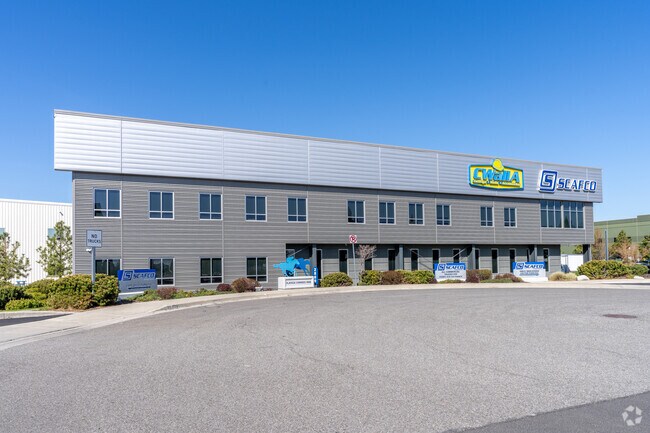
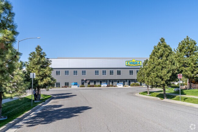
Property Record
2800 E Main Ave, Spokane, WA 99202

Property Detail
2800 E Main Ave
35166.0033
15 & 16-25-43 PTN OF SW1/4 DAF: PTN OF PARCEL B OF ROS (AFN#5639524) DAF: COMMENCING AT SW COR OF PARCEL B FROM WHICH NW COR THEREOF BEARS N000828E 1033.77FT SAID PT ALSO LYG ON NELY ROW LN OF UPRR TH S623800E 371.56FT TO BEG OF CURVE CONCAVE NELY TH
Heavyindustrial
Spokane
HI
Washington
B and X Area of moderate flood hazard, usually the area between the limits of the 100-year and 500-year floods.
8.44 AC
2025
SE North Metro
2025
Spokane
014500
Spokane-Spokane Valley, WA
138,078 SF
NEARBY LISTINGS FOR SALE OR LEASE
DEMOGRAPHICS near 2800 E Main Ave
1 mile
3 mile
5 mile
2025 Total Population
8,570
106,787
238,361
2030 Population
8,725
108,710
242,222
Pop Growth 2025-2030
+ 1.81%
+ 1.80%
+ 1.62%
Average Age
37
39
40
2025 Total Households
3,085
44,086
100,144
HH Growth 2025-2030
+ 1.91%
+ 2.09%
+ 1.76%
Median Household Inc
$60,609
$62,086
$64,857
Avg Household Size
2.50
2.20
2.20
2025 Avg HH Vehicles
2.00
2.00
2.00
Median Home Value
$275,483
$366,859
$374,322
Median Year Built
1949
1960
1965
Nearby Places
Map Layers
Map Styles
 Street
 Aerial
Transit
 Traffic
 Biking
Places
Listings with unknown addresses are not visible on the map
- Restaurants
- Banks
- Shops
- Fitness
- Groceries
PUBLIC TRANSPORTATION
COMMUTER RAIL
Spokane (Empire Builder - Amtrak)
Drive
Walk
Distance
Spokane (Empire Builder - Amtrak)
7 min
2.5 mi
AIRPORT
Spokane International
Drive
Walk
Distance
Spokane International
15 min
9.1 mi
Freight Ports
Port of Everett
Drive
Walk
Distance
Port of Everett
342 min
304.7 mi
Nearby Properties
Address
Land Use
TOTAL SIZE
Lot Size
Zoning
Address
Land Use
TOTAL SIZE
Lot Size
Zoning
763,627 SF
12.44 AC
OR
Address
Land Use
TOTAL SIZE
Lot Size
Zoning
481,348 SF
17.09 AC
DTU
Address
Land Use
TOTAL SIZE
Lot Size
Zoning
629,722 SF
26.28 AC
RHD
Address
Land Use
TOTAL SIZE
Lot Size
Zoning
917,113 SF
100.67 AC
LI
Address
Land Use
TOTAL SIZE
Lot Size
Zoning
157,882 SF
42.70 AC
DTG
Address
Land Use
TOTAL SIZE
Lot Size
Zoning
123,047 SF
3.95 AC
DTG
Address
Land Use
TOTAL SIZE
Lot Size
Zoning
241,106 SF
3.92 AC
CB
Address
Land Use
TOTAL SIZE
Lot Size
Zoning
536,438 SF
1.70 AC
DTC
Address
Land Use
TOTAL SIZE
Lot Size
Zoning
226,702 SF
49.25 AC
RSF
Address
Land Use
TOTAL SIZE
Lot Size
Zoning
365,804 SF
16.13 AC
RSF
Address
Land Use
TOTAL SIZE
Lot Size
Zoning
427,054 SF
16.60 AC
LI
Address
Land Use
TOTAL SIZE
Lot Size
Zoning
154,800 SF
20.06 AC
DTG
Address
Land Use
TOTAL SIZE
Lot Size
Zoning
386,885 SF
22.81 AC
RSF
Address
Land Use
TOTAL SIZE
Lot Size
Zoning
251,542 SF
5.78 AC
DTG
Address
Land Use
TOTAL SIZE
Lot Size
Zoning
310,606 SF
27.56 AC
RMF
Address
Land Use
TOTAL SIZE
Lot Size
Zoning
180,822 SF
16.11 AC
CC1
Address
Land Use
TOTAL SIZE
Lot Size
Zoning
107,800 SF
3.20 AC
CB
Address
Land Use
TOTAL SIZE
Lot Size
Zoning
379,678 SF
20.64 AC
LI
Address
Land Use
TOTAL SIZE
Lot Size
Zoning
91,882 SF
2.07 AC
OR
Address
Land Use
TOTAL SIZE
Lot Size
Zoning
124,234 SF
13.54 AC
RSF
Address
Land Use
TOTAL SIZE
Lot Size
Zoning
314,149 SF
1.07 AC
DTC
Address
Land Use
TOTAL SIZE
Lot Size
Zoning
151,667 SF
7.45 AC
DTG
Address
Land Use
TOTAL SIZE
Lot Size
Zoning
289,705 SF
3.36 AC
OR
Address
Land Use
TOTAL SIZE
Lot Size
Zoning
112,634 SF
3.87 AC
OR
Address
Land Use
TOTAL SIZE
Lot Size
Zoning
50,869 SF
0.61 AC
DTC
Address
Land Use
TOTAL SIZE
Lot Size
Zoning
137,503 SF
17.31 AC
GC
Address
Land Use
TOTAL SIZE
Lot Size
Zoning
290,380 SF
2.11 AC
CA3
Address
Land Use
TOTAL SIZE
Lot Size
Zoning
182,088 SF
0.37 AC
DTC
Address
Land Use
TOTAL SIZE
Lot Size
Zoning
107,240 SF
1.54 AC
CC1
Address
Land Use
TOTAL SIZE
Lot Size
Zoning
53,748 SF
1.26 AC
DTC
The World's #1 Commercial Real Estate Marketplace
Connect with us
© 2026 CoStar Group
The information above has been obtained from sources believed reliable. While we do not doubt its accuracy we have not verified it and make no guarantee, warranty or representation about it. It is your responsibility to independently confirm its accuracy and completeness. Any projections, opinions, assumptions, or estimates used are for example only and do not represent the current or future performance of the property. The value of this transaction to you depends on tax and other factors which should be evaluated by your tax, financial, and legal advisors. You and your advisors should conduct a careful, independent investigation of the property to determine to your satisfaction the suitability of the property for your needs.