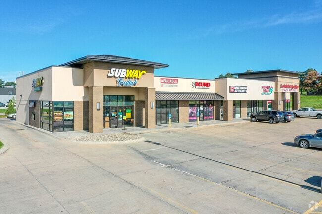
Property Record
2800 N 83Rd St, Lincoln, NE 68507


NEARBY LISTINGS FOR SALE OR LEASE
Property Detail
2800 N 83Rd St
Lincoln, NE
North Forty Plaza 2Nd Addition
17-15-243-001-000
NORTH FORTY PLAZA 2ND ADDITION, LOT 1
Storebuilding
Lancaster
X
Nebraska
31109C0328F
1
2024
1.75 AC
2025
Northeast
001101
Lincoln
9,858 SF
DEMOGRAPHICS near 2800 N 83Rd St
1 Mile
3 Mile
5 Mile
2024 Total Population
10,188
57,428
129,030
2029 Population
10,610
59,849
133,980
Pop Growth 2024-2029
+ 4.14%
+ 4.22%
+ 3.84%
Average Age
39
39
38
2024 Total Households
3,998
24,445
54,269
HH Growth 2024-2029
+ 4.33%
+ 4.32%
+ 4.00%
Median Household Inc
$79,032
$63,269
$59,482
Avg Household Size
2.50
2.20
2.20
2024 Avg HH Vehicles
2.00
2.00
2.00
Median Home Value
$243,187
$194,109
$196,343
Median Year Built
2001
1973
1974
Nearby Places
Map Layers
Map Styles
 Street
 Aerial
- Restaurants
- Banks
- Shops
- Fitness
- Groceries
PUBLIC TRANSPORTATION
COMMUTER RAIL
DRIVE
WALK
Distance
15 min
6.7 mi
AIRPORT
Lincoln
DRIVE
WALK
Distance
Lincoln
18 min
8.7 mi
SALE & LEASE HISTORY
LISTING DATE
SALE/LEASE

Nov 02, 2016
For Lease
Dec 01, 2023
For Lease
Nearby Properties
Address
Land Use
TOTAL SIZE
Lot Size
Zoning
Address
Land Use
TOTAL SIZE
Lot Size
Zoning
364,797 SF
25.06 AC
R1
Address
Land Use
TOTAL SIZE
Lot Size
Zoning
382,244 SF
44.25 AC
R6
Address
Land Use
TOTAL SIZE
Lot Size
Zoning
531,687 SF
32.18 AC
B5
Address
Land Use
TOTAL SIZE
Lot Size
Zoning
47,866 SF
10.39 AC
R3
Address
Land Use
TOTAL SIZE
Lot Size
Zoning
32,110 SF
14.60 AC
R5
Address
Land Use
TOTAL SIZE
Lot Size
Zoning
37,240 SF
17.06 AC
NULL
Address
Land Use
TOTAL SIZE
Lot Size
Zoning
36,751 SF
1.80 AC
B5
Address
Land Use
TOTAL SIZE
Lot Size
Zoning
430,949 SF
41.47 AC
P
Address
Land Use
TOTAL SIZE
Lot Size
Zoning
65,064 SF
1.39 AC
R6
Address
Land Use
TOTAL SIZE
Lot Size
Zoning
179,447 SF
7.85 AC
R6
Address
Land Use
TOTAL SIZE
Lot Size
Zoning
102,739 SF
4.24 AC
B2
Address
Land Use
TOTAL SIZE
Lot Size
Zoning
225,199 SF
31.18 AC
O3
Address
Land Use
TOTAL SIZE
Lot Size
Zoning
10,688 SF
237.77 AC
P
Address
Land Use
TOTAL SIZE
Lot Size
Zoning
192,751 SF
18.49 AC
B5
Address
Land Use
TOTAL SIZE
Lot Size
Zoning
46,906 SF
2.88 AC
Address
Land Use
TOTAL SIZE
Lot Size
Zoning
214,823 SF
19.37 AC
B5
Address
Land Use
TOTAL SIZE
Lot Size
Zoning
51,080 SF
12.42 AC
Address
Land Use
TOTAL SIZE
Lot Size
Zoning
73,737 SF
5.98 AC
B2
Address
Land Use
TOTAL SIZE
Lot Size
Zoning
92,054 SF
6.22 AC
R5
Address
Land Use
TOTAL SIZE
Lot Size
Zoning
69,760 SF
1.81 AC
Address
Land Use
TOTAL SIZE
Lot Size
Zoning
30,608 SF
25.92 AC
R4
Address
Land Use
TOTAL SIZE
Lot Size
Zoning
17,184 SF
15.39 AC
NULL
Address
Land Use
TOTAL SIZE
Lot Size
Zoning
69,652 SF
3.10 AC
B3
Address
Land Use
TOTAL SIZE
Lot Size
Zoning
36,041 SF
5.43 AC
R5
Address
Land Use
TOTAL SIZE
Lot Size
Zoning
17,312 SF
177.49 AC
AG
Address
Land Use
TOTAL SIZE
Lot Size
Zoning
59,073 SF
18.66 AC
R4
Address
Land Use
TOTAL SIZE
Lot Size
Zoning
154.12 AC
P
Address
Land Use
TOTAL SIZE
Lot Size
Zoning
759,282 SF
40.67 AC
I1
Address
Land Use
TOTAL SIZE
Lot Size
Zoning
72,176 SF
8.65 AC
Address
Land Use
TOTAL SIZE
Lot Size
Zoning
129,485 SF
22.71 AC
O3
The World's #1 Commercial Real Estate Marketplace
Connect with us
© 2026 CoStar Group
The information above has been obtained from sources believed reliable. While we do not doubt its accuracy we have not verified it and make no guarantee, warranty or representation about it. It is your responsibility to independently confirm its accuracy and completeness. Any projections, opinions, assumptions, or estimates used are for example only and do not represent the current or future performance of the property. The value of this transaction to you depends on tax and other factors which should be evaluated by your tax, financial, and legal advisors. You and your advisors should conduct a careful, independent investigation of the property to determine to your satisfaction the suitability of the property for your needs.