Property Record
2800 Nc Highway 68 S, High Point, NC 27265

NEARBY LISTINGS FOR SALE OR LEASE
Property Detail
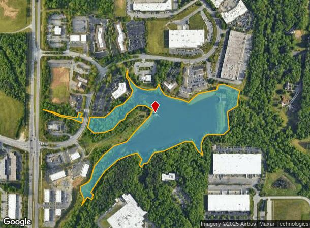
2800 Nc Highway 68 S
Greensboro-High Point, NC
South
0207826
PB151-75 24.27 AC 2800 NC 68 SOUTH
Federalproperty
Guilford
AE
North Carolina
3710781300J
6
0
24.27 AC
2025
Airport/W Guilford County
016205
Greensboro/Winston-Salem
DEMOGRAPHICS near 2800 Nc Highway 68 S
1 Mile
3 Mile
5 Mile
2024 Total Population
4,126
37,427
107,698
2029 Population
4,117
37,307
107,542
Pop Growth 2024-2029
(0.22%)
(0.32%)
(0.14%)
Average Age
38
40
40
2024 Total Households
1,961
15,619
46,291
HH Growth 2024-2029
(0.15%)
(0.42%)
(0.17%)
Median Household Inc
$79,254
$80,946
$67,471
Avg Household Size
2.10
2.40
2.30
2024 Avg HH Vehicles
2.00
2.00
2.00
Median Home Value
$199,175
$252,801
$213,250
Median Year Built
2002
1998
1992
Nearby Places
Map Layers
Map Styles
 Street
 Aerial
- Restaurants
- Banks
- Shops
- Fitness
- Groceries
PUBLIC TRANSPORTATION
COMMUTER RAIL
High Point Station (Piedmont - North Carolina by Train (NC Train))
DRIVE
WALK
Distance
High Point Station (Piedmont - North Carolina by Train (NC Train))
14 min
7.5 mi
AIRPORT
Piedmont Triad International
DRIVE
WALK
Distance
Piedmont Triad International
16 min
5.5 mi
Freight Ports
Port of Wilmington
DRIVE
WALK
Distance
Port of Wilmington
256 min
220.5 mi
Nearby Properties
Address
Land Use
TOTAL SIZE
Lot Size
Zoning
Address
Land Use
TOTAL SIZE
Lot Size
Zoning
37,237 SF
334.45 AC
HI
Address
Land Use
TOTAL SIZE
Lot Size
Zoning
256,051 SF
37.69 AC
LI
Address
Land Use
TOTAL SIZE
Lot Size
Zoning
691,408 SF
58.69 AC
LI
Address
Land Use
TOTAL SIZE
Lot Size
Zoning
186,200 SF
10.58 AC
LI
Address
Land Use
TOTAL SIZE
Lot Size
Zoning
552,314 SF
38.47 AC
PDR
Address
Land Use
TOTAL SIZE
Lot Size
Zoning
230,664 SF
13.69 AC
HI
Address
Land Use
TOTAL SIZE
Lot Size
Zoning
374,522 SF
56.55 AC
HI
Address
Land Use
TOTAL SIZE
Lot Size
Zoning
312,732 SF
14.27 AC
RM-18
Address
Land Use
TOTAL SIZE
Lot Size
Zoning
400,000 SF
46.72 AC
LI
Address
Land Use
TOTAL SIZE
Lot Size
Zoning
354,454 SF
20.65 AC
RM-18
Address
Land Use
TOTAL SIZE
Lot Size
Zoning
229,103 SF
18.76 AC
CZ-I
Address
Land Use
TOTAL SIZE
Lot Size
Zoning
291,895 SF
21.52 AC
RM-26
Address
Land Use
TOTAL SIZE
Lot Size
Zoning
363,308 SF
29.41 AC
RM-16
Address
Land Use
TOTAL SIZE
Lot Size
Zoning
145,105 SF
20.12 AC
C-M
Address
Land Use
TOTAL SIZE
Lot Size
Zoning
234,173 SF
22.14 AC
RM-12
Address
Land Use
TOTAL SIZE
Lot Size
Zoning
256,423 SF
20.64 AC
PUD
Address
Land Use
TOTAL SIZE
Lot Size
Zoning
309,749 SF
16.74 AC
CZ-PDM
Address
Land Use
TOTAL SIZE
Lot Size
Zoning
362,708 SF
56.81 AC
LI
Address
Land Use
TOTAL SIZE
Lot Size
Zoning
53,362 SF
0.51 AC
LAR3
Address
Land Use
TOTAL SIZE
Lot Size
Zoning
274,999 SF
21.57 AC
LI
Address
Land Use
TOTAL SIZE
Lot Size
Zoning
214,941 SF
13.29 AC
PDR
Address
Land Use
TOTAL SIZE
Lot Size
Zoning
293,851 SF
36.66 AC
PUD
Address
Land Use
TOTAL SIZE
Lot Size
Zoning
227,652 SF
21.64 AC
LI
Address
Land Use
TOTAL SIZE
Lot Size
Zoning
240,936 SF
12.02 AC
PDM
Address
Land Use
TOTAL SIZE
Lot Size
Zoning
269,956 SF
19.44 AC
OI
Address
Land Use
TOTAL SIZE
Lot Size
Zoning
209,184 SF
13.52 AC
OI
Address
Land Use
TOTAL SIZE
Lot Size
Zoning
193,705 SF
14.35 AC
PUD
Address
Land Use
TOTAL SIZE
Lot Size
Zoning
161,975 SF
20.66 AC
BP
Address
Land Use
TOTAL SIZE
Lot Size
Zoning
75,588 SF
6.49 AC
LI
Address
Land Use
TOTAL SIZE
Lot Size
Zoning
760,545 SF
69.50 AC
LI
The World's #1 Commercial Real Estate Marketplace
Connect with us
© 2025 CoStar Group
The information above has been obtained from sources believed reliable. While we do not doubt its accuracy we have not verified it and make no guarantee, warranty or representation about it. It is your responsibility to independently confirm its accuracy and completeness. Any projections, opinions, assumptions, or estimates used are for example only and do not represent the current or future performance of the property. The value of this transaction to you depends on tax and other factors which should be evaluated by your tax, financial, and legal advisors. You and your advisors should conduct a careful, independent investigation of the property to determine to your satisfaction the suitability of the property for your needs.