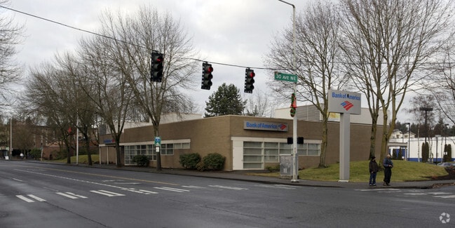
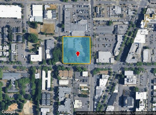
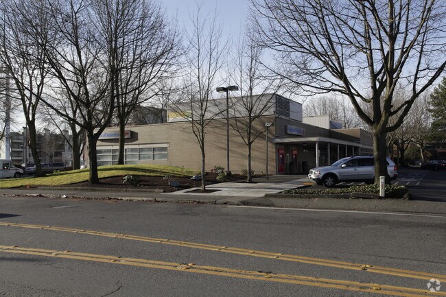
Property Record
2800 Ne 125Th St, Seattle, WA 98125
NEARBY LISTINGS FOR SALE OR LEASE
Property Detail
2800 Ne 125Th St
212604-9142
S 310 FT OF E 1/2 OF SE 1/4 OF SW 1/4 OF SE 1/4 SEC 21-26-4 LESS POR FOR STS
Commercialnec
King
X
Washington
53033C0331G
212604
2025
1.81 AC
2024
Northgate/N Seattle
000202
Seattle/Puget Sound
12,936 SF
Seattle-Tacoma-Bellevue, WA
DEMOGRAPHICS near 2800 Ne 125Th St
1 Mile
3 Mile
5 Mile
2024 Total Population
27,035
155,080
422,960
2029 Population
27,364
156,370
427,824
Pop Growth 2024-2029
+ 1.22%
+ 0.83%
+ 1.15%
Average Age
40
40
39
2024 Total Households
12,103
66,643
178,515
HH Growth 2024-2029
+ 1.21%
+ 0.82%
+ 1.19%
Median Household Inc
$85,639
$104,663
$111,621
Avg Household Size
2.10
2.20
2.20
2024 Avg HH Vehicles
2.00
2.00
2.00
Median Home Value
$786,867
$818,855
$845,418
Median Year Built
1974
1970
1973
Nearby Places
Map Layers
Map Styles
 Street
 Aerial
- Restaurants
- Banks
- Shops
- Fitness
- Groceries
PUBLIC TRANSPORTATION
COMMUTER RAIL
King Street (Seattle) Station (Sounder South Line - Central Puget Sound Regional Transit Authority Rail (Link Light Rail/Sounder))
DRIVE
WALK
Distance
King Street (Seattle) Station (Sounder South Line - Central Puget Sound Regional Transit Authority Rail (Link Light Rail/Sounder))
18 min
9.2 mi
AIRPORT
Seattle Paine Field International
DRIVE
WALK
Distance
Seattle Paine Field International
29 min
16.8 mi
Seattle-Tacoma International
DRIVE
WALK
Distance
Seattle-Tacoma International
36 min
22.4 mi
Freight Ports
Port of Seattle
DRIVE
WALK
Distance
Port of Seattle
23 min
12.9 mi
Nearby Properties
Address
Land Use
TOTAL SIZE
Lot Size
Zoning
Address
Land Use
TOTAL SIZE
Lot Size
Zoning
107.86 AC
NR2
Address
Land Use
TOTAL SIZE
Lot Size
Zoning
7,549 SF
59.34 AC
MIO-105-LR
Address
Land Use
TOTAL SIZE
Lot Size
Zoning
172,297 SF
4.21 AC
NC3-95 (M)
Address
Land Use
TOTAL SIZE
Lot Size
Zoning
10,090 SF
11.73 AC
NC3-95 (M)
Address
Land Use
TOTAL SIZE
Lot Size
Zoning
162,182 SF
9.10 AC
LR2 (M)
Address
Land Use
TOTAL SIZE
Lot Size
Zoning
205,000 SF
13.89 AC
NR3
Address
Land Use
TOTAL SIZE
Lot Size
Zoning
2,874 SF
21.94 AC
NR3
Address
Land Use
TOTAL SIZE
Lot Size
Zoning
207,576 SF
5.98 AC
MR (M)
Address
Land Use
TOTAL SIZE
Lot Size
Zoning
183,056 SF
1.95 AC
C1-55 (M)
Address
Land Use
TOTAL SIZE
Lot Size
Zoning
168,619 SF
7.79 AC
NC3-145 (M
Address
Land Use
TOTAL SIZE
Lot Size
Zoning
1,040 SF
18.74 AC
NR3
Address
Land Use
TOTAL SIZE
Lot Size
Zoning
17.65 AC
NR3
Address
Land Use
TOTAL SIZE
Lot Size
Zoning
119,405 SF
0.97 AC
NC3-95 (M)
Address
Land Use
TOTAL SIZE
Lot Size
Zoning
54,224 SF
2.22 AC
NC3-55 (M)
Address
Land Use
TOTAL SIZE
Lot Size
Zoning
170,408 SF
1.85 AC
NC3-75 (M)
Address
Land Use
TOTAL SIZE
Lot Size
Zoning
131,236 SF
19.14 AC
R6
Address
Land Use
TOTAL SIZE
Lot Size
Zoning
288,283 SF
3.94 AC
NC3-75 (M)
Address
Land Use
TOTAL SIZE
Lot Size
Zoning
184,576 SF
9.56 AC
RMA 1.8
Address
Land Use
TOTAL SIZE
Lot Size
Zoning
46,513 SF
5.90 AC
SM-NG 145
Address
Land Use
TOTAL SIZE
Lot Size
Zoning
188,597 SF
8.79 AC
NR3
Address
Land Use
TOTAL SIZE
Lot Size
Zoning
235,163 SF
18.39 AC
NR2
Address
Land Use
TOTAL SIZE
Lot Size
Zoning
14.11 AC
NR3
Address
Land Use
TOTAL SIZE
Lot Size
Zoning
234,128 SF
1.57 AC
NC3-145 (M
Address
Land Use
TOTAL SIZE
Lot Size
Zoning
179,340 SF
6.27 AC
LR2 (M)
Address
Land Use
TOTAL SIZE
Lot Size
Zoning
168,504 SF
6.34 AC
LR2 (M)
Address
Land Use
TOTAL SIZE
Lot Size
Zoning
97,381 SF
7.78 AC
NR3
Address
Land Use
TOTAL SIZE
Lot Size
Zoning
177,990 SF
50.72 AC
PUBLIC/SEM
Address
Land Use
TOTAL SIZE
Lot Size
Zoning
5,400 SF
0.09 AC
NC2P-75 (M
Address
Land Use
TOTAL SIZE
Lot Size
Zoning
156,743 SF
18.01 AC
NR2
Address
Land Use
TOTAL SIZE
Lot Size
Zoning
220,968 SF
16.46 AC
TC
The World's #1 Commercial Real Estate Marketplace
Connect with us
© 2025 CoStar Group
The information above has been obtained from sources believed reliable. While we do not doubt its accuracy we have not verified it and make no guarantee, warranty or representation about it. It is your responsibility to independently confirm its accuracy and completeness. Any projections, opinions, assumptions, or estimates used are for example only and do not represent the current or future performance of the property. The value of this transaction to you depends on tax and other factors which should be evaluated by your tax, financial, and legal advisors. You and your advisors should conduct a careful, independent investigation of the property to determine to your satisfaction the suitability of the property for your needs.