Property Record
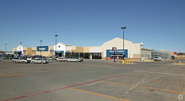
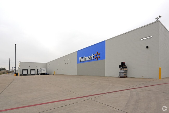
2801 E Interstate 20, Weatherford, TX 76087

Property Detail
2801 E Interstate 20
Dallas-Fort Worth-Arlington, TX
ACRES: 24.268 LOT: 1A BLK: 1 SUBD: OAK RIDGE CROSSING
R000086031
PARKER
Commercialnec
Texas
B and X Area of moderate flood hazard, usually the area between the limits of the 100-year and 500-year floods.
1a
2024
24.27 AC
2025
Parker County
140711
Dallas/Ft Worth
191,011 SF
NEARBY LISTINGS FOR SALE OR LEASE
DEMOGRAPHICS near 2801 E Interstate 20
1 mile
3 mile
5 mile
2025 Total Population
2,953
20,647
42,988
2030 Population
3,447
24,089
50,111
Pop Growth 2025-2030
+ 16.73%
+ 16.67%
+ 16.57%
Average Age
42
41
41
2025 Total Households
1,090
7,526
16,082
HH Growth 2025-2030
+ 15.96%
+ 15.96%
+ 15.92%
Median Household Inc
$105,856
$102,825
$85,040
Avg Household Size
2.70
2.70
2.60
2025 Avg HH Vehicles
2.00
2.00
2.00
Median Home Value
$395,917
$397,991
$373,255
Median Year Built
2004
2004
2001
Nearby Places
Map Layers
Map Styles
 Street
 Aerial
Layers
 Traffic
 Biking
Places
Listings with unknown addresses are not visible on the map
- Restaurants
- Banks
- Shops
- Fitness
- Groceries
Nearby Properties
Address
Land Use
TOTAL SIZE
Lot Size
Zoning
Address
Land Use
TOTAL SIZE
Lot Size
Zoning
341,996 SF
16.60 AC
Address
Land Use
TOTAL SIZE
Lot Size
Zoning
435,251 SF
17.27 AC
Address
Land Use
TOTAL SIZE
Lot Size
Zoning
2,403 SF
7.85 AC
Address
Land Use
TOTAL SIZE
Lot Size
Zoning
241,465 SF
23.67 AC
Address
Land Use
TOTAL SIZE
Lot Size
Zoning
5,314 SF
9.27 AC
Address
Land Use
TOTAL SIZE
Lot Size
Zoning
Address
Land Use
TOTAL SIZE
Lot Size
Zoning
18.62 AC
Address
Land Use
TOTAL SIZE
Lot Size
Zoning
59,579 SF
8 AC
Address
Land Use
TOTAL SIZE
Lot Size
Zoning
255,314 SF
14.27 AC
Address
Land Use
TOTAL SIZE
Lot Size
Zoning
93,124 SF
11.28 AC
Address
Land Use
TOTAL SIZE
Lot Size
Zoning
16,624 SF
9.53 AC
Address
Land Use
TOTAL SIZE
Lot Size
Zoning
105,344 SF
17.59 AC
Address
Land Use
TOTAL SIZE
Lot Size
Zoning
44,900 SF
4.49 AC
Address
Land Use
TOTAL SIZE
Lot Size
Zoning
47,038 SF
14.84 AC
Address
Land Use
TOTAL SIZE
Lot Size
Zoning
54,477 SF
5.94 AC
Address
Land Use
TOTAL SIZE
Lot Size
Zoning
14,070 SF
6.64 AC
Address
Land Use
TOTAL SIZE
Lot Size
Zoning
104,188 SF
12.73 AC
Address
Land Use
TOTAL SIZE
Lot Size
Zoning
50,112 SF
2.97 AC
Address
Land Use
TOTAL SIZE
Lot Size
Zoning
49,054 SF
2.76 AC
Address
Land Use
TOTAL SIZE
Lot Size
Zoning
6,926 SF
7.66 AC
Address
Land Use
TOTAL SIZE
Lot Size
Zoning
42,105 SF
3.38 AC
Address
Land Use
TOTAL SIZE
Lot Size
Zoning
64,428 SF
2.57 AC
Address
Land Use
TOTAL SIZE
Lot Size
Zoning
79,819 SF
5 AC
Address
Land Use
TOTAL SIZE
Lot Size
Zoning
43,184 SF
3.61 AC
Address
Land Use
TOTAL SIZE
Lot Size
Zoning
153,100 SF
7.50 AC
Address
Land Use
TOTAL SIZE
Lot Size
Zoning
1 SF
8.71 AC
Address
Land Use
TOTAL SIZE
Lot Size
Zoning
22,754 SF
2.68 AC
Address
Land Use
TOTAL SIZE
Lot Size
Zoning
35,605 SF
6.33 AC
Address
Land Use
TOTAL SIZE
Lot Size
Zoning
8,539 SF
9 AC
The World's #1 Commercial Real Estate Marketplace
Connect with us
© 2026 CoStar Group
The information above has been obtained from sources believed reliable. While we do not doubt its accuracy we have not verified it and make no guarantee, warranty or representation about it. It is your responsibility to independently confirm its accuracy and completeness. Any projections, opinions, assumptions, or estimates used are for example only and do not represent the current or future performance of the property. The value of this transaction to you depends on tax and other factors which should be evaluated by your tax, financial, and legal advisors. You and your advisors should conduct a careful, independent investigation of the property to determine to your satisfaction the suitability of the property for your needs.