Property Record
6130 S Homestead Rd, Pahrump, NV 89048


NEARBY LISTINGS FOR SALE OR LEASE
-
-
View all Pahrump listings for sale on LoopNet.com
Property Detail
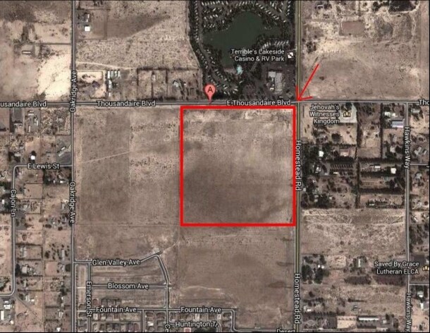
6130 S Homestead Rd
44-561-17
T21S R53E S13 F#480157 P.2 15.38AC P#1168280
Commercialnec
Nye
X
Nevada
32023C8840G
15.38 AC
2024
Carson City/Nevada Area
2025
Other Market Areas
960408
Pahrump, NV
DEMOGRAPHICS near 6130 S Homestead Rd
1 Mile
3 Mile
5 Mile
2024 Total Population
1,659
14,537
23,759
2029 Population
1,955
17,125
27,849
Pop Growth 2024-2029
+ 17.84%
+ 17.80%
+ 17.21%
Average Age
48
50
50
2024 Total Households
674
6,154
10,189
HH Growth 2024-2029
+ 17.80%
+ 17.94%
+ 17.33%
Median Household Inc
$67,736
$63,245
$61,426
Avg Household Size
2.40
2.30
2.30
2024 Avg HH Vehicles
2.00
2.00
2.00
Median Home Value
$273,195
$292,048
$293,005
Median Year Built
1996
2000
2000
Nearby Places
Map Layers
Map Styles
 Street
 Aerial
- Restaurants
- Banks
- Shops
- Fitness
- Groceries
SALE & LEASE HISTORY
LISTING DATE
SALE/LEASE

Dec 18, 2019
For Sale
Nearby Properties
Address
Land Use
TOTAL SIZE
Lot Size
Zoning
Address
Land Use
TOTAL SIZE
Lot Size
Zoning
16,945 SF
210.63 AC
Address
Land Use
TOTAL SIZE
Lot Size
Zoning
54,979 SF
11.54 AC
SP
Address
Land Use
TOTAL SIZE
Lot Size
Zoning
1,372.49 AC
R
Address
Land Use
TOTAL SIZE
Lot Size
Zoning
25,729 SF
32.26 AC
GC
Address
Land Use
TOTAL SIZE
Lot Size
Zoning
0.46 AC
VR-8
Address
Land Use
TOTAL SIZE
Lot Size
Zoning
20,398 SF
4.02 AC
SP
Address
Land Use
TOTAL SIZE
Lot Size
Zoning
12,806 SF
5.39 AC
SP
Address
Land Use
TOTAL SIZE
Lot Size
Zoning
9,590 SF
4.87 AC
GC
Address
Land Use
TOTAL SIZE
Lot Size
Zoning
0.46 AC
GC
Address
Land Use
TOTAL SIZE
Lot Size
Zoning
10 SF
1.08 AC
SP
Address
Land Use
TOTAL SIZE
Lot Size
Zoning
24.39 AC
VR-20
Address
Land Use
TOTAL SIZE
Lot Size
Zoning
31,890 SF
10.58 AC
VR-20
Address
Land Use
TOTAL SIZE
Lot Size
Zoning
9.54 AC
SP
Address
Land Use
TOTAL SIZE
Lot Size
Zoning
31,860 SF
3.32 AC
Address
Land Use
TOTAL SIZE
Lot Size
Zoning
41,448 SF
4.25 AC
GC
Address
Land Use
TOTAL SIZE
Lot Size
Zoning
6,433 SF
2.66 AC
Address
Land Use
TOTAL SIZE
Lot Size
Zoning
17,791 SF
3.78 AC
LI
Address
Land Use
TOTAL SIZE
Lot Size
Zoning
2.69 AC
Address
Land Use
TOTAL SIZE
Lot Size
Zoning
450.44 AC
R
Address
Land Use
TOTAL SIZE
Lot Size
Zoning
5,120 SF
2.15 AC
RE-1
Address
Land Use
TOTAL SIZE
Lot Size
Zoning
14,400 SF
2.17 AC
GC
Address
Land Use
TOTAL SIZE
Lot Size
Zoning
6,000 SF
5.81 AC
Address
Land Use
TOTAL SIZE
Lot Size
Zoning
25,500 SF
4.70 AC
RH-4.5
Address
Land Use
TOTAL SIZE
Lot Size
Zoning
0.17 AC
LCR15000*
Address
Land Use
TOTAL SIZE
Lot Size
Zoning
8,000 SF
2.06 AC
GC
Address
Land Use
TOTAL SIZE
Lot Size
Zoning
8,876 SF
1.25 AC
MU
Address
Land Use
TOTAL SIZE
Lot Size
Zoning
7,135 SF
2.20 AC
RE-2
Address
Land Use
TOTAL SIZE
Lot Size
Zoning
5,562 SF
4.10 AC
VR-20
Address
Land Use
TOTAL SIZE
Lot Size
Zoning
37.20 AC
CF
Address
Land Use
TOTAL SIZE
Lot Size
Zoning
5,563 SF
4.32 AC
RH-4.5
The World's #1 Commercial Real Estate Marketplace
Connect with us
© 2026 CoStar Group
The information above has been obtained from sources believed reliable. While we do not doubt its accuracy we have not verified it and make no guarantee, warranty or representation about it. It is your responsibility to independently confirm its accuracy and completeness. Any projections, opinions, assumptions, or estimates used are for example only and do not represent the current or future performance of the property. The value of this transaction to you depends on tax and other factors which should be evaluated by your tax, financial, and legal advisors. You and your advisors should conduct a careful, independent investigation of the property to determine to your satisfaction the suitability of the property for your needs.