Property Record
2801 Ne Adagio Way, Hillsboro, OR 97124
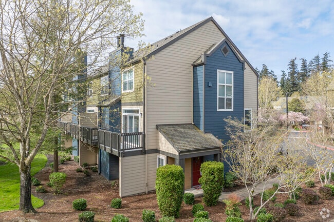

Property Detail
2801 Ne Adagio Way
Portland-Vancouver-Hillsboro, OR-WA
TANASBOURNE COMMUNITY, LOT PT 3, ACRES 8.49
R1390587
WASHINGTON
Apartment
Oregon
MFR-3
3
AE The base floodplain where base flood elevations are provided. AE Zones are now used on new format FIRMs instead of A1-A30 Zones.
8.49 AC
2025
Tanasbourne
2026
Portland
031617
NEARBY LISTINGS FOR SALE OR LEASE
DEMOGRAPHICS near 2801 Ne Adagio Way
1 mile
3 mile
5 mile
2025 Total Population
16,059
126,784
273,118
2030 Population
16,322
127,956
276,466
Pop Growth 2025-2030
+ 1.64%
+ 0.92%
+ 1.23%
Average Age
36
38
38
2025 Total Households
7,510
49,952
102,176
HH Growth 2025-2030
+ 1.84%
+ 1.05%
+ 1.35%
Median Household Inc
$94,614
$108,847
$107,382
Avg Household Size
2.10
2.50
2.60
2025 Avg HH Vehicles
2.00
2.00
2.00
Median Home Value
$603,239
$619,073
$612,239
Median Year Built
1996
1996
1993
Nearby Places
Map Layers
Map Styles
 Street
 Aerial
Layers
 Traffic
 Biking
Places
Listings with unknown addresses are not visible on the map
- Restaurants
- Banks
- Shops
- Fitness
- Groceries
PUBLIC TRANSPORTATION
COMMUTER RAIL
Beaverton Transit Center (West Side Express) (Westside Express Service - Tri-County Metropolitan Transportation District of Oregon Rail (TriMet Rail))
Drive
Walk
Distance
Beaverton Transit Center (West Side Express) (Westside Express Service - Tri-County Metropolitan Transportation District of Oregon Rail (TriMet Rail))
13 min
6.4 mi
Hall/Nimbus (Westside Express Service - Tri-County Metropolitan Transportation District of Oregon Rail (TriMet Rail))
Drive
Walk
Distance
Hall/Nimbus (Westside Express Service - Tri-County Metropolitan Transportation District of Oregon Rail (TriMet Rail))
15 min
10.0 mi
AIRPORT
Portland International
Drive
Walk
Distance
Portland International
38 min
24.7 mi
Freight Ports
Port of Portland
Drive
Walk
Distance
Port of Portland
21 min
13.7 mi
Nearby Properties
Address
Land Use
TOTAL SIZE
Lot Size
Zoning
Address
Land Use
TOTAL SIZE
Lot Size
Zoning
21.21 AC
I-P
Address
Land Use
TOTAL SIZE
Lot Size
Zoning
0.13 AC
I-P
Address
Land Use
TOTAL SIZE
Lot Size
Zoning
4,603 SF
90.28 AC
I-S
Address
Land Use
TOTAL SIZE
Lot Size
Zoning
337.91 AC
I-P
Address
Land Use
TOTAL SIZE
Lot Size
Zoning
562,350 SF
203.06 AC
INST
Address
Land Use
TOTAL SIZE
Lot Size
Zoning
14.02 AC
Address
Land Use
TOTAL SIZE
Lot Size
Zoning
35.87 AC
SSID
Address
Land Use
TOTAL SIZE
Lot Size
Zoning
37.93 AC
I-S
Address
Land Use
TOTAL SIZE
Lot Size
Zoning
373,884 SF
153.56 AC
UC-RP
Address
Land Use
TOTAL SIZE
Lot Size
Zoning
1,004,655 SF
24.55 AC
SCR-V
Address
Land Use
TOTAL SIZE
Lot Size
Zoning
47.85 AC
I-P
Address
Land Use
TOTAL SIZE
Lot Size
Zoning
Address
Land Use
TOTAL SIZE
Lot Size
Zoning
0.10 AC
IS
Address
Land Use
TOTAL SIZE
Lot Size
Zoning
2,016 SF
0.10 AC
I-S
Address
Land Use
TOTAL SIZE
Lot Size
Zoning
0.05 AC
I-S
Address
Land Use
TOTAL SIZE
Lot Size
Zoning
0.17 AC
I-P
Address
Land Use
TOTAL SIZE
Lot Size
Zoning
Address
Land Use
TOTAL SIZE
Lot Size
Zoning
292,000 SF
53.23 AC
I-G
Address
Land Use
TOTAL SIZE
Lot Size
Zoning
0.03 AC
I-P
Address
Land Use
TOTAL SIZE
Lot Size
Zoning
4,603 SF
0.09 AC
I-S
Address
Land Use
TOTAL SIZE
Lot Size
Zoning
316,321 SF
0.11 AC
I-P
Address
Land Use
TOTAL SIZE
Lot Size
Zoning
174,233 SF
14.74 AC
I-P
Address
Land Use
TOTAL SIZE
Lot Size
Zoning
791,581 SF
22.58 AC
MFR-3
Address
Land Use
TOTAL SIZE
Lot Size
Zoning
53.13 AC
SC-BP
Address
Land Use
TOTAL SIZE
Lot Size
Zoning
2,822 SF
13.23 AC
Address
Land Use
TOTAL SIZE
Lot Size
Zoning
281,695 SF
7.41 AC
SC-HDR
Address
Land Use
TOTAL SIZE
Lot Size
Zoning
482,173 SF
14.99 AC
C-G
Address
Land Use
TOTAL SIZE
Lot Size
Zoning
281,183 SF
44.96 AC
R-5
Address
Land Use
TOTAL SIZE
Lot Size
Zoning
38.36 AC
I-P
The World's #1 Commercial Real Estate Marketplace
Connect with us
© 2026 CoStar Group
The information above has been obtained from sources believed reliable. While we do not doubt its accuracy we have not verified it and make no guarantee, warranty or representation about it. It is your responsibility to independently confirm its accuracy and completeness. Any projections, opinions, assumptions, or estimates used are for example only and do not represent the current or future performance of the property. The value of this transaction to you depends on tax and other factors which should be evaluated by your tax, financial, and legal advisors. You and your advisors should conduct a careful, independent investigation of the property to determine to your satisfaction the suitability of the property for your needs.