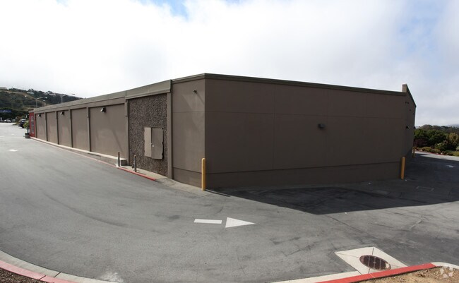
Property Record
2801 San Bruno Ave W, San Bruno, CA 94066


NEARBY LISTINGS FOR SALE OR LEASE
Property Detail
2801 San Bruno Ave W
San Francisco-Redwood City-South San Francisco, CA
Skycrest Sub
019-320-250
LOT 25 OF SKYCREST SUB RSM 135/11-14
Supermarket
San Mateo
X
California
06081C0127F
25
2024
3.03 AC
2025
San Bruno/Millbrae
603802
San Francisco
23,093 SF
DEMOGRAPHICS near 2801 San Bruno Ave W
1 Mile
3 Mile
5 Mile
2024 Total Population
12,277
118,015
223,036
2029 Population
11,649
112,145
211,980
Pop Growth 2024-2029
(5.12%)
(4.97%)
(4.96%)
Average Age
44
43
43
2024 Total Households
4,748
40,614
76,328
HH Growth 2024-2029
(5.35%)
(5.25%)
(5.19%)
Median Household Inc
$113,783
$123,197
$123,328
Avg Household Size
2.50
2.80
2.80
2024 Avg HH Vehicles
2.00
2.00
2.00
Median Home Value
$1,073,707
$1,082,268
$1,078,493
Median Year Built
1961
1963
1964
Nearby Places
Map Layers
Map Styles
 Street
 Aerial
- Restaurants
- Banks
- Shops
- Fitness
- Groceries
PUBLIC TRANSPORTATION
COMMUTER RAIL
San Bruno Caltrain Station (Local - Caltrain (Caltrain), Local Weekday - Caltrain (Caltrain), Local Weekend - Caltrain (Caltrain), LTD 4 - Caltrain (Caltrain))
DRIVE
WALK
Distance
San Bruno Caltrain Station (Local - Caltrain (Caltrain), Local Weekday - Caltrain (Caltrain), Local Weekend - Caltrain (Caltrain), LTD 4 - Caltrain (Caltrain))
3 min
1.9 mi
South San Francisco (Caltrain - Caltrain (Caltrain), Express - Caltrain (Caltrain), Limited - Caltrain (Caltrain), Local Weekday - Caltrain (Caltrain), Local Weekend - Caltrain (Caltrain))
DRIVE
WALK
Distance
South San Francisco (Caltrain - Caltrain (Caltrain), Express - Caltrain (Caltrain), Limited - Caltrain (Caltrain), Local Weekday - Caltrain (Caltrain), Local Weekend - Caltrain (Caltrain))
8 min
4.4 mi
AIRPORT
San Francisco International
DRIVE
WALK
Distance
San Francisco International
9 min
4.4 mi
Metro Oakland International
DRIVE
WALK
Distance
Metro Oakland International
45 min
34.6 mi
Freight Ports
Port of San Francisco
DRIVE
WALK
Distance
Port of San Francisco
23 min
15.1 mi
Nearby Properties
Address
Land Use
TOTAL SIZE
Lot Size
Zoning
Address
Land Use
TOTAL SIZE
Lot Size
Zoning
6.67 AC
PD0000
Address
Land Use
TOTAL SIZE
Lot Size
Zoning
198,375 SF
5.52 AC
PD0000
Address
Land Use
TOTAL SIZE
Lot Size
Zoning
403,363 SF
11.26 AC
PD0000
Address
Land Use
TOTAL SIZE
Lot Size
Zoning
Address
Land Use
TOTAL SIZE
Lot Size
Zoning
270,980 SF
3.33 AC
Address
Land Use
TOTAL SIZE
Lot Size
Zoning
453,076 SF
25.10 AC
Address
Land Use
TOTAL SIZE
Lot Size
Zoning
86,000 SF
4.90 AC
PD0000
Address
Land Use
TOTAL SIZE
Lot Size
Zoning
11.46 AC
Address
Land Use
TOTAL SIZE
Lot Size
Zoning
Address
Land Use
TOTAL SIZE
Lot Size
Zoning
144,591 SF
6.06 AC
CO0000
Address
Land Use
TOTAL SIZE
Lot Size
Zoning
105,710 SF
3.49 AC
Address
Land Use
TOTAL SIZE
Lot Size
Zoning
178,110 SF
1.67 AC
Address
Land Use
TOTAL SIZE
Lot Size
Zoning
165,936 SF
1.58 AC
CL00C1
Address
Land Use
TOTAL SIZE
Lot Size
Zoning
15.33 AC
Address
Land Use
TOTAL SIZE
Lot Size
Zoning
2,025 SF
2.28 AC
Address
Land Use
TOTAL SIZE
Lot Size
Zoning
338,057 SF
5.06 AC
Address
Land Use
TOTAL SIZE
Lot Size
Zoning
231,306 SF
3.68 AC
Address
Land Use
TOTAL SIZE
Lot Size
Zoning
220,000 SF
9.80 AC
PD0000
Address
Land Use
TOTAL SIZE
Lot Size
Zoning
40.92 AC
Address
Land Use
TOTAL SIZE
Lot Size
Zoning
11.98 AC
PD0000
Address
Land Use
TOTAL SIZE
Lot Size
Zoning
178,444 SF
3.29 AC
Address
Land Use
TOTAL SIZE
Lot Size
Zoning
Address
Land Use
TOTAL SIZE
Lot Size
Zoning
141,000 SF
8.21 AC
MH00M2
Address
Land Use
TOTAL SIZE
Lot Size
Zoning
215,640 SF
7.76 AC
M10000
Address
Land Use
TOTAL SIZE
Lot Size
Zoning
559,605 SF
19.80 AC
M1000H
Address
Land Use
TOTAL SIZE
Lot Size
Zoning
Address
Land Use
TOTAL SIZE
Lot Size
Zoning
101,123 SF
6.23 AC
Address
Land Use
TOTAL SIZE
Lot Size
Zoning
86,000 SF
4.13 AC
Address
Land Use
TOTAL SIZE
Lot Size
Zoning
209,692 SF
8.20 AC
R30000
The World's #1 Commercial Real Estate Marketplace
Connect with us
© 2026 CoStar Group
The information above has been obtained from sources believed reliable. While we do not doubt its accuracy we have not verified it and make no guarantee, warranty or representation about it. It is your responsibility to independently confirm its accuracy and completeness. Any projections, opinions, assumptions, or estimates used are for example only and do not represent the current or future performance of the property. The value of this transaction to you depends on tax and other factors which should be evaluated by your tax, financial, and legal advisors. You and your advisors should conduct a careful, independent investigation of the property to determine to your satisfaction the suitability of the property for your needs.