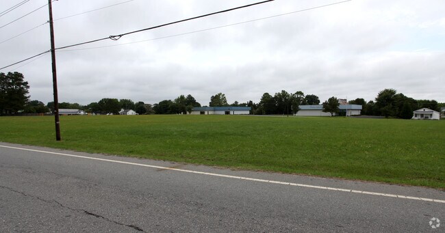
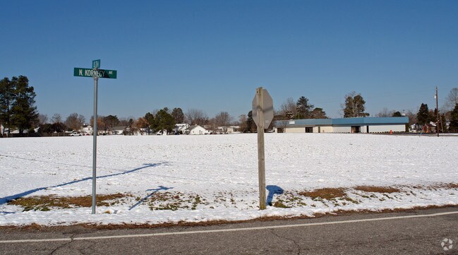
Property Record
2801 Us Highway 70A E, Selma, NC 27576

Property Detail
2801 Us Highway 70A E
12N10197I
METES AND BOUNDS KORNEGAY AVE AND US HWY 70A
Daycare
JOHNSTON
COM
North Carolina
B and X Area of moderate flood hazard, usually the area between the limits of the 100-year and 500-year floods.
4.52 AC
2025
Johnston County
2025
Raleigh/Durham
040301
Raleigh-Cary, NC
20,602 SF
NEARBY LISTINGS FOR SALE OR LEASE
DEMOGRAPHICS near 2801 Us Highway 70A E
1 mile
3 mile
5 mile
2025 Total Population
2,577
10,059
23,948
2030 Population
2,888
11,209
26,764
Pop Growth 2025-2030
+ 12.07%
+ 11.43%
+ 11.76%
Average Age
39
39
39
2025 Total Households
996
3,913
9,094
HH Growth 2025-2030
+ 12.05%
+ 11.45%
+ 11.81%
Median Household Inc
$71,596
$67,803
$60,478
Avg Household Size
2.60
2.50
2.60
2025 Avg HH Vehicles
2.00
2.00
2.00
Median Home Value
$249,662
$215,457
$197,939
Median Year Built
1995
1990
1989
Nearby Places
Map Layers
Map Styles
 Street
 Aerial
Transit
 Traffic
 Biking
Places
Listings with unknown addresses are not visible on the map
- Restaurants
- Banks
- Shops
- Fitness
- Groceries
PUBLIC TRANSPORTATION
COMMUTER RAIL
Drive
Walk
Distance
6 min
3.0 mi
AIRPORT
Raleigh-Durham International
Drive
Walk
Distance
Raleigh-Durham International
62 min
48.8 mi
Nearby Properties
Address
Land Use
TOTAL SIZE
Lot Size
Zoning
Address
Land Use
TOTAL SIZE
Lot Size
Zoning
45,000 SF
99.14 AC
IND
Address
Land Use
TOTAL SIZE
Lot Size
Zoning
134,742 SF
8.20 AC
IND
Address
Land Use
TOTAL SIZE
Lot Size
Zoning
54,009 SF
2.08 AC
COM
Address
Land Use
TOTAL SIZE
Lot Size
Zoning
63,415 SF
5.45 AC
COM
Address
Land Use
TOTAL SIZE
Lot Size
Zoning
30,370 SF
8.43 AC
COM
Address
Land Use
TOTAL SIZE
Lot Size
Zoning
57,774 SF
3.79 AC
COM
Address
Land Use
TOTAL SIZE
Lot Size
Zoning
3,600 SF
20.26 AC
RES
Address
Land Use
TOTAL SIZE
Lot Size
Zoning
41.27 AC
IND
Address
Land Use
TOTAL SIZE
Lot Size
Zoning
2,496 SF
11.10 AC
RES
Address
Land Use
TOTAL SIZE
Lot Size
Zoning
7,498 SF
3.22 AC
COM
Address
Land Use
TOTAL SIZE
Lot Size
Zoning
99.98 AC
RAG
Address
Land Use
TOTAL SIZE
Lot Size
Zoning
2,624 SF
21.77 AC
COM
Address
Land Use
TOTAL SIZE
Lot Size
Zoning
12,446 SF
2.83 AC
COM
Address
Land Use
TOTAL SIZE
Lot Size
Zoning
92,742 SF
20 AC
IND
Address
Land Use
TOTAL SIZE
Lot Size
Zoning
12.18 AC
COM
Address
Land Use
TOTAL SIZE
Lot Size
Zoning
25,000 SF
2.58 AC
COM
Address
Land Use
TOTAL SIZE
Lot Size
Zoning
3,982 SF
1.17 AC
COM
Address
Land Use
TOTAL SIZE
Lot Size
Zoning
5,090 SF
3 AC
RES
Address
Land Use
TOTAL SIZE
Lot Size
Zoning
34.19 AC
IND
Address
Land Use
TOTAL SIZE
Lot Size
Zoning
20,730 SF
7.77 AC
COM
Address
Land Use
TOTAL SIZE
Lot Size
Zoning
1,219 SF
9.91 AC
RES
Address
Land Use
TOTAL SIZE
Lot Size
Zoning
3,448 SF
0.96 AC
COM
Address
Land Use
TOTAL SIZE
Lot Size
Zoning
9.45 AC
COM
Address
Land Use
TOTAL SIZE
Lot Size
Zoning
10,640 SF
1.86 AC
RES
Address
Land Use
TOTAL SIZE
Lot Size
Zoning
46,830 SF
22.60 AC
IND
Address
Land Use
TOTAL SIZE
Lot Size
Zoning
37,320 SF
6.32 AC
IND
Address
Land Use
TOTAL SIZE
Lot Size
Zoning
2,800 SF
13.40 AC
COM
Address
Land Use
TOTAL SIZE
Lot Size
Zoning
2,200 SF
17.33 AC
MHP
The World's #1 Commercial Real Estate Marketplace
Connect with us
© 2026 CoStar Group
The information above has been obtained from sources believed reliable. While we do not doubt its accuracy we have not verified it and make no guarantee, warranty or representation about it. It is your responsibility to independently confirm its accuracy and completeness. Any projections, opinions, assumptions, or estimates used are for example only and do not represent the current or future performance of the property. The value of this transaction to you depends on tax and other factors which should be evaluated by your tax, financial, and legal advisors. You and your advisors should conduct a careful, independent investigation of the property to determine to your satisfaction the suitability of the property for your needs.