Property Record
2801 W Market St, Fairlawn, OH 44333


NEARBY LISTINGS FOR SALE OR LEASE
Property Detail
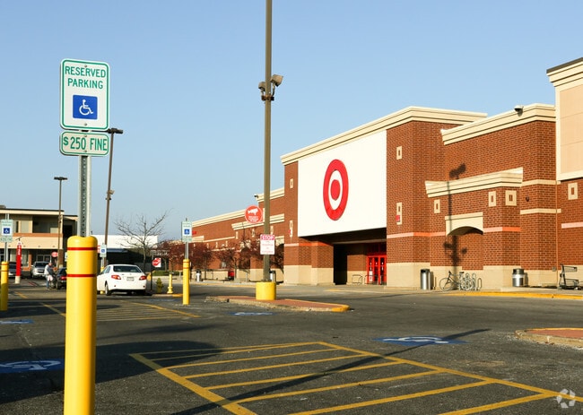
2801 W Market St
Akron, OH
Fairlawn
09-03158
LOT 6 N OF W MARKET ST 158 FT ON LOT LINE 3.29 AC
Departmentstore
Summit
X
Ohio
39153C0113F
6
2023
3.29 AC
2025
Fairlawn/Montrose
532202
Cleveland
99,402 SF
DEMOGRAPHICS near 2801 W Market St
1 Mile
3 Mile
5 Mile
2024 Total Population
6,697
41,835
104,343
2029 Population
6,585
41,251
103,345
Pop Growth 2024-2029
(1.67%)
(1.40%)
(0.96%)
Average Age
45
44
42
2024 Total Households
2,757
19,164
46,379
HH Growth 2024-2029
(1.78%)
(1.43%)
(0.99%)
Median Household Inc
$87,218
$77,826
$65,334
Avg Household Size
2.30
2.10
2.20
2024 Avg HH Vehicles
2.00
2.00
2.00
Median Home Value
$235,479
$219,050
$204,276
Median Year Built
1960
1967
1963
Nearby Places
Map Layers
Map Styles
 Street
 Aerial
- Restaurants
- Banks
- Shops
- Fitness
- Groceries
PUBLIC TRANSPORTATION
COMMUTER RAIL
Botzum (National Park Scenic Railway - Cuyahoga Valley Scenic Railroad)
DRIVE
WALK
Distance
Botzum (National Park Scenic Railway - Cuyahoga Valley Scenic Railroad)
11 min
4.5 mi
Big Bend (National Park Scenic Railway - Cuyahoga Valley Scenic Railroad)
DRIVE
WALK
Distance
Big Bend (National Park Scenic Railway - Cuyahoga Valley Scenic Railroad)
12 min
4.9 mi
AIRPORT
Akron-Canton Regional
DRIVE
WALK
Distance
Akron-Canton Regional
30 min
20.9 mi
Cleveland-Hopkins International
DRIVE
WALK
Distance
Cleveland-Hopkins International
47 min
31.9 mi
Freight Ports
Port of Toledo
DRIVE
WALK
Distance
Port of Toledo
150 min
126.4 mi
Nearby Properties
Address
Land Use
TOTAL SIZE
Lot Size
Zoning
Address
Land Use
TOTAL SIZE
Lot Size
Zoning
245,662 SF
866.66 AC
Address
Land Use
TOTAL SIZE
Lot Size
Zoning
Address
Land Use
TOTAL SIZE
Lot Size
Zoning
282,490 SF
20.76 AC
Address
Land Use
TOTAL SIZE
Lot Size
Zoning
12.92 AC
Address
Land Use
TOTAL SIZE
Lot Size
Zoning
676,403 SF
39.06 AC
Address
Land Use
TOTAL SIZE
Lot Size
Zoning
Address
Land Use
TOTAL SIZE
Lot Size
Zoning
324,548 SF
64.18 AC
Address
Land Use
TOTAL SIZE
Lot Size
Zoning
194,508 SF
30.87 AC
Address
Land Use
TOTAL SIZE
Lot Size
Zoning
91,104 SF
17.30 AC
Address
Land Use
TOTAL SIZE
Lot Size
Zoning
311,093 SF
32.53 AC
Address
Land Use
TOTAL SIZE
Lot Size
Zoning
72,026 SF
7.92 AC
Address
Land Use
TOTAL SIZE
Lot Size
Zoning
192,658 SF
15.34 AC
Address
Land Use
TOTAL SIZE
Lot Size
Zoning
Address
Land Use
TOTAL SIZE
Lot Size
Zoning
411,220 SF
54.72 AC
Address
Land Use
TOTAL SIZE
Lot Size
Zoning
439,456 SF
26.40 AC
Address
Land Use
TOTAL SIZE
Lot Size
Zoning
164,214 SF
12.92 AC
Address
Land Use
TOTAL SIZE
Lot Size
Zoning
214,600 SF
14.12 AC
Address
Land Use
TOTAL SIZE
Lot Size
Zoning
135,300 SF
6.75 AC
Address
Land Use
TOTAL SIZE
Lot Size
Zoning
226,341 SF
18.81 AC
Address
Land Use
TOTAL SIZE
Lot Size
Zoning
77,096 SF
6.21 AC
Address
Land Use
TOTAL SIZE
Lot Size
Zoning
Address
Land Use
TOTAL SIZE
Lot Size
Zoning
231,968 SF
29.14 AC
Address
Land Use
TOTAL SIZE
Lot Size
Zoning
10 AC
Address
Land Use
TOTAL SIZE
Lot Size
Zoning
87,071 SF
18.03 AC
Address
Land Use
TOTAL SIZE
Lot Size
Zoning
148,292 SF
18.43 AC
Address
Land Use
TOTAL SIZE
Lot Size
Zoning
Address
Land Use
TOTAL SIZE
Lot Size
Zoning
12.46 AC
Address
Land Use
TOTAL SIZE
Lot Size
Zoning
73,301 SF
5.55 AC
Address
Land Use
TOTAL SIZE
Lot Size
Zoning
147,635 SF
15.14 AC
Address
Land Use
TOTAL SIZE
Lot Size
Zoning
76,560 SF
6.07 AC
The World's #1 Commercial Real Estate Marketplace
Connect with us
© 2026 CoStar Group
The information above has been obtained from sources believed reliable. While we do not doubt its accuracy we have not verified it and make no guarantee, warranty or representation about it. It is your responsibility to independently confirm its accuracy and completeness. Any projections, opinions, assumptions, or estimates used are for example only and do not represent the current or future performance of the property. The value of this transaction to you depends on tax and other factors which should be evaluated by your tax, financial, and legal advisors. You and your advisors should conduct a careful, independent investigation of the property to determine to your satisfaction the suitability of the property for your needs.