Property Record
2801 Woodruff Rd, Simpsonville, SC 29681


NEARBY LISTINGS FOR SALE OR LEASE
Property Detail
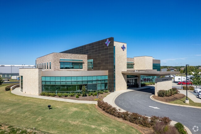
2801 Woodruff Rd
Greenville-Anderson-Mauldin, SC
MAP 0548.02; 4
0548.02-01-041.03
Greenville
Commercialnec
South Carolina
X
041.03
45045C0436E
2.97 AC
0
Mauldin/Fountain
2024
Greenville/Spartanburg
002814
DEMOGRAPHICS near 2801 Woodruff Rd
1 Mile
3 Mile
5 Mile
2024 Total Population
6,944
50,068
107,207
2029 Population
7,577
54,788
118,155
Pop Growth 2024-2029
+ 9.12%
+ 9.43%
+ 10.21%
Average Age
40
40
40
2024 Total Households
2,447
17,829
41,337
HH Growth 2024-2029
+ 9.19%
+ 9.54%
+ 10.32%
Median Household Inc
$127,250
$112,269
$95,035
Avg Household Size
2.80
2.80
2.60
2024 Avg HH Vehicles
2.00
2.00
2.00
Median Home Value
$346,832
$304,540
$289,650
Median Year Built
2003
2001
1999
Nearby Places
Map Layers
Map Styles
 Street
 Aerial
- Restaurants
- Banks
- Shops
- Fitness
- Groceries
PUBLIC TRANSPORTATION
AIRPORT
Greenville Spartanburg International
DRIVE
WALK
Distance
Greenville Spartanburg International
16 min
7.6 mi
Freight Ports
North Charleston Terminal
DRIVE
WALK
Distance
North Charleston Terminal
226 min
198.3 mi
Nearby Properties
Address
Land Use
TOTAL SIZE
Lot Size
Zoning
Address
Land Use
TOTAL SIZE
Lot Size
Zoning
2,355 SF
10.21 AC
RS
Address
Land Use
TOTAL SIZE
Lot Size
Zoning
38.86 AC
C2
Address
Land Use
TOTAL SIZE
Lot Size
Zoning
Address
Land Use
TOTAL SIZE
Lot Size
Zoning
5.19 AC
PD
Address
Land Use
TOTAL SIZE
Lot Size
Zoning
5.47 AC
C3
Address
Land Use
TOTAL SIZE
Lot Size
Zoning
24.12 AC
S1
Address
Land Use
TOTAL SIZE
Lot Size
Zoning
301 AC
RS
Address
Land Use
TOTAL SIZE
Lot Size
Zoning
2.73 AC
C3
Address
Land Use
TOTAL SIZE
Lot Size
Zoning
4,128 SF
25.54 AC
RS
Address
Land Use
TOTAL SIZE
Lot Size
Zoning
1,242 SF
26.57 AC
RS
Address
Land Use
TOTAL SIZE
Lot Size
Zoning
2.86 AC
S1
Address
Land Use
TOTAL SIZE
Lot Size
Zoning
26.29 AC
RS
Address
Land Use
TOTAL SIZE
Lot Size
Zoning
34.33 AC
RS
Address
Land Use
TOTAL SIZE
Lot Size
Zoning
16.05 AC
R12
Address
Land Use
TOTAL SIZE
Lot Size
Zoning
28.30 AC
RS
Address
Land Use
TOTAL SIZE
Lot Size
Zoning
25.26 AC
RS
Address
Land Use
TOTAL SIZE
Lot Size
Zoning
25.94 AC
RS
Address
Land Use
TOTAL SIZE
Lot Size
Zoning
1,758 SF
15.09 AC
RS
Address
Land Use
TOTAL SIZE
Lot Size
Zoning
13.74 AC
C1
Address
Land Use
TOTAL SIZE
Lot Size
Zoning
17.18 AC
R12
Address
Land Use
TOTAL SIZE
Lot Size
Zoning
48.26 AC
RS
Address
Land Use
TOTAL SIZE
Lot Size
Zoning
14,306 SF
3.64 AC
RS
Address
Land Use
TOTAL SIZE
Lot Size
Zoning
36.50 AC
RM
Address
Land Use
TOTAL SIZE
Lot Size
Zoning
4.21 AC
RS
Address
Land Use
TOTAL SIZE
Lot Size
Zoning
4.73 AC
C1
Address
Land Use
TOTAL SIZE
Lot Size
Zoning
1,080 SF
2.62 AC
R15
Address
Land Use
TOTAL SIZE
Lot Size
Zoning
3.09 AC
RS
Address
Land Use
TOTAL SIZE
Lot Size
Zoning
5,002 SF
10.16 AC
RS
Address
Land Use
TOTAL SIZE
Lot Size
Zoning
9.69 AC
C2
The World's #1 Commercial Real Estate Marketplace
Connect with us
© 2025 CoStar Group
The information above has been obtained from sources believed reliable. While we do not doubt its accuracy we have not verified it and make no guarantee, warranty or representation about it. It is your responsibility to independently confirm its accuracy and completeness. Any projections, opinions, assumptions, or estimates used are for example only and do not represent the current or future performance of the property. The value of this transaction to you depends on tax and other factors which should be evaluated by your tax, financial, and legal advisors. You and your advisors should conduct a careful, independent investigation of the property to determine to your satisfaction the suitability of the property for your needs.