Property Record
2803 E Kanesville Blvd, Council Bluffs, IA 51503


NEARBY LISTINGS FOR SALE OR LEASE
Property Detail
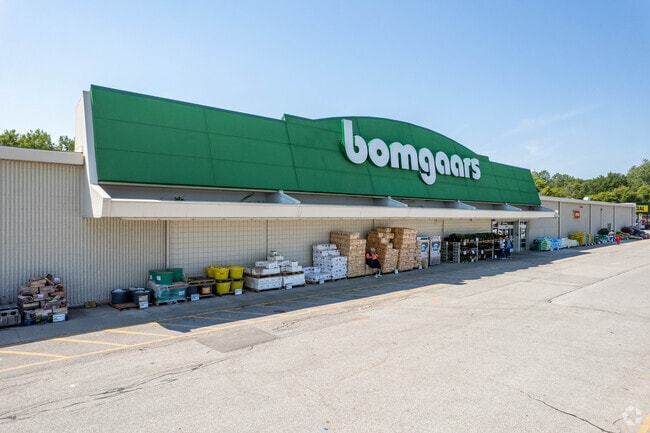
2803 E Kanesville Blvd
Omaha-Council Bluffs, NE-IA
Auditors Subdivision Of Tract 2 Sherwood
7543-20-476-002
SHERWOOD SUB A.S. TRACT 2 PARCEL C AND E3.67' S401.45' PARCEL B EXC 2.44 ACRES TO CITY
Storebuilding
Pottawattamie
AE
Iowa
19155C0418F
b,c
2025
7.99 AC
2025
Council Bluffs
031700
Omaha/Council Bluffs
90,790 SF
DEMOGRAPHICS near 2803 E Kanesville Blvd
1 Mile
3 Mile
5 Mile
2024 Total Population
3,000
32,133
60,622
2029 Population
2,990
31,978
60,216
Pop Growth 2024-2029
(0.33%)
(0.48%)
(0.67%)
Average Age
37
41
41
2024 Total Households
866
12,919
23,999
HH Growth 2024-2029
(0.35%)
(0.50%)
(0.70%)
Median Household Inc
$64,975
$69,865
$64,538
Avg Household Size
2.20
2.30
2.40
2024 Avg HH Vehicles
2.00
2.00
2.00
Median Home Value
$251,923
$205,275
$174,004
Median Year Built
1988
1968
1964
Nearby Places
Map Layers
Map Styles
 Street
 Aerial
- Restaurants
- Banks
- Shops
- Fitness
- Groceries
PUBLIC TRANSPORTATION
AIRPORT
Eppley Airfield
DRIVE
WALK
Distance
Eppley Airfield
25 min
10.5 mi
Freight Ports
Tulsa Port Of Catoosa
DRIVE
WALK
Distance
Tulsa Port Of Catoosa
460 min
418.0 mi
Nearby Properties
Address
Land Use
TOTAL SIZE
Lot Size
Zoning
Address
Land Use
TOTAL SIZE
Lot Size
Zoning
185.50 AC
A-2
Address
Land Use
TOTAL SIZE
Lot Size
Zoning
11.85 AC
R-3
Address
Land Use
TOTAL SIZE
Lot Size
Zoning
16.87 AC
P-C
Address
Land Use
TOTAL SIZE
Lot Size
Zoning
17.49 AC
R-3
Address
Land Use
TOTAL SIZE
Lot Size
Zoning
2.91 AC
A-P
Address
Land Use
TOTAL SIZE
Lot Size
Zoning
17.40 AC
A-P
Address
Land Use
TOTAL SIZE
Lot Size
Zoning
4,216 SF
17.29 AC
R-4
Address
Land Use
TOTAL SIZE
Lot Size
Zoning
14 AC
I-2
Address
Land Use
TOTAL SIZE
Lot Size
Zoning
30.64 AC
R-1
Address
Land Use
TOTAL SIZE
Lot Size
Zoning
8.34 AC
R-3
Address
Land Use
TOTAL SIZE
Lot Size
Zoning
1.99 AC
C-3
Address
Land Use
TOTAL SIZE
Lot Size
Zoning
21.72 AC
I-2
Address
Land Use
TOTAL SIZE
Lot Size
Zoning
582.98 AC
A-2
Address
Land Use
TOTAL SIZE
Lot Size
Zoning
18.68 AC
C-2
Address
Land Use
TOTAL SIZE
Lot Size
Zoning
18.41 AC
R-3
Address
Land Use
TOTAL SIZE
Lot Size
Zoning
9.06 AC
R-3
Address
Land Use
TOTAL SIZE
Lot Size
Zoning
4.48 AC
R-4
Address
Land Use
TOTAL SIZE
Lot Size
Zoning
7.72 AC
P-C
Address
Land Use
TOTAL SIZE
Lot Size
Zoning
7.17 AC
R-3
Address
Land Use
TOTAL SIZE
Lot Size
Zoning
8.42 AC
R-3
Address
Land Use
TOTAL SIZE
Lot Size
Zoning
4.87 AC
C-2
Address
Land Use
TOTAL SIZE
Lot Size
Zoning
864 SF
7.37 AC
C-2
Address
Land Use
TOTAL SIZE
Lot Size
Zoning
81.55 AC
A-2
Address
Land Use
TOTAL SIZE
Lot Size
Zoning
201,260 SF
10.65 AC
C-4
Address
Land Use
TOTAL SIZE
Lot Size
Zoning
5.66 AC
R-3
Address
Land Use
TOTAL SIZE
Lot Size
Zoning
15.91 AC
R-3
Address
Land Use
TOTAL SIZE
Lot Size
Zoning
1.57 AC
C-3
Address
Land Use
TOTAL SIZE
Lot Size
Zoning
6.98 AC
R-3
Address
Land Use
TOTAL SIZE
Lot Size
Zoning
9.10 AC
R-3
Address
Land Use
TOTAL SIZE
Lot Size
Zoning
6.53 AC
C-2
The World's #1 Commercial Real Estate Marketplace
Connect with us
© 2026 CoStar Group
The information above has been obtained from sources believed reliable. While we do not doubt its accuracy we have not verified it and make no guarantee, warranty or representation about it. It is your responsibility to independently confirm its accuracy and completeness. Any projections, opinions, assumptions, or estimates used are for example only and do not represent the current or future performance of the property. The value of this transaction to you depends on tax and other factors which should be evaluated by your tax, financial, and legal advisors. You and your advisors should conduct a careful, independent investigation of the property to determine to your satisfaction the suitability of the property for your needs.