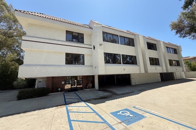
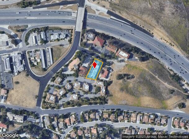
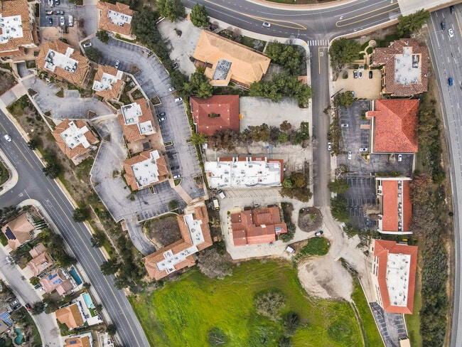
Property Record
28030 Dorothy Dr, Agoura Hills, CA 91301

Current Lease Availabilities
NEARBY LISTINGS FOR SALE OR LEASE
Property Detail
28030 Dorothy Dr
Los Angeles-Long Beach-Glendale, CA
8451
2061-013-037
*TR=8451*LOT COM AT MOST S COR OF LOT 24 TH NE TO A PT IN SW LINE OF DOROTHY DR NW THEREON 8 FT FROM MOST E COR OF SD LOT TH NW AND FOLLOWING BDRY LINE OF SD LOT TO BEG POR OF LOT 24 BLK 13
Officebuilding
Los Angeles
X
California
06111C1015E
24
2024
0.47 AC
2025
Calabasas/Westlake Vill
800336
Los Angeles
14,476 SF
DEMOGRAPHICS near 28030 Dorothy Dr
1 Mile
3 Mile
5 Mile
2024 Total Population
3,458
30,859
62,401
2029 Population
3,348
29,892
60,659
Pop Growth 2024-2029
(3.18%)
(3.13%)
(2.79%)
Average Age
43
43
43
2024 Total Households
1,360
11,639
23,607
HH Growth 2024-2029
(3.31%)
(3.35%)
(2.98%)
Median Household Inc
$138,026
$135,349
$146,269
Avg Household Size
2.50
2.60
2.60
2024 Avg HH Vehicles
2.00
2.00
2.00
Median Home Value
$944,863
$911,963
$1,015,176
Median Year Built
1979
1982
1983
Nearby Places
Map Layers
Map Styles
 Street
 Aerial
- Restaurants
- Banks
- Shops
- Fitness
- Groceries
PUBLIC TRANSPORTATION
AIRPORT
Bob Hope
DRIVE
WALK
Distance
Bob Hope
35 min
26.4 mi
Los Angeles International
DRIVE
WALK
Distance
Los Angeles International
45 min
34.5 mi
Freight Ports
The Port of Hueneme
DRIVE
WALK
Distance
The Port of Hueneme
42 min
30.7 mi
Nearby Properties
Address
Land Use
TOTAL SIZE
Lot Size
Zoning
Address
Land Use
TOTAL SIZE
Lot Size
Zoning
294,536 SF
16.70 AC
CS R-MF*
Address
Land Use
TOTAL SIZE
Lot Size
Zoning
210,268 SF
13.77 AC
CS R-MF*
Address
Land Use
TOTAL SIZE
Lot Size
Zoning
163,773 SF
5.80 AC
Address
Land Use
TOTAL SIZE
Lot Size
Zoning
142,738 SF
5.56 AC
AH BP-M-FC
Address
Land Use
TOTAL SIZE
Lot Size
Zoning
198,668 SF
17.98 AC
CSCB*
Address
Land Use
TOTAL SIZE
Lot Size
Zoning
142,578 SF
6.13 AC
Address
Land Use
TOTAL SIZE
Lot Size
Zoning
257,241 SF
29.19 AC
LCRPD15000
Address
Land Use
TOTAL SIZE
Lot Size
Zoning
237,492 SF
18.84 AC
LCRPD15000
Address
Land Use
TOTAL SIZE
Lot Size
Zoning
169,597 SF
7.19 AC
AH SP*
Address
Land Use
TOTAL SIZE
Lot Size
Zoning
110,229 SF
5.31 AC
CSCB
Address
Land Use
TOTAL SIZE
Lot Size
Zoning
230,800 SF
4.39 AC
LCMP
Address
Land Use
TOTAL SIZE
Lot Size
Zoning
98,127 SF
2.56 AC
AHRA20000*
Address
Land Use
TOTAL SIZE
Lot Size
Zoning
86,558 SF
8.83 AC
AHC3*
Address
Land Use
TOTAL SIZE
Lot Size
Zoning
117,968 SF
6.19 AC
AH BP-M-FC
Address
Land Use
TOTAL SIZE
Lot Size
Zoning
71,159 SF
5.74 AC
AH BP-OR-F
Address
Land Use
TOTAL SIZE
Lot Size
Zoning
65,706 SF
1.24 AC
LACRA 1-A2
Address
Land Use
TOTAL SIZE
Lot Size
Zoning
104,838 SF
2.41 AC
CSCR-SC*
Address
Land Use
TOTAL SIZE
Lot Size
Zoning
94,555 SF
3.28 AC
CRS
Address
Land Use
TOTAL SIZE
Lot Size
Zoning
157,896 SF
5.74 AC
AH
Address
Land Use
TOTAL SIZE
Lot Size
Zoning
58,092 SF
3.95 AC
AHCRS-FC-O
Address
Land Use
TOTAL SIZE
Lot Size
Zoning
120,006 SF
6.30 AC
AH BP-M-FC
Address
Land Use
TOTAL SIZE
Lot Size
Zoning
58,094 SF
4.51 AC
CSCR-SC*
Address
Land Use
TOTAL SIZE
Lot Size
Zoning
215,232 SF
18.99 AC
AH BP-M-FC
Address
Land Use
TOTAL SIZE
Lot Size
Zoning
94,826 SF
5.32 AC
AHC
Address
Land Use
TOTAL SIZE
Lot Size
Zoning
186,905 SF
3.94 AC
AH BP-OR-F
Address
Land Use
TOTAL SIZE
Lot Size
Zoning
229,843 SF
6.65 AC
AH CRS-FC-
Address
Land Use
TOTAL SIZE
Lot Size
Zoning
231,744 SF
5.20 AC
AH BP-M-FC
Address
Land Use
TOTAL SIZE
Lot Size
Zoning
78,847 SF
3.37 AC
CSCM
Address
Land Use
TOTAL SIZE
Lot Size
Zoning
120,092 SF
6.57 AC
AH BP-M-FC
Address
Land Use
TOTAL SIZE
Lot Size
Zoning
97,202 SF
3.77 AC
AHCRS-FC-O
The World's #1 Commercial Real Estate Marketplace
Connect with us
© 2025 CoStar Group
The information above has been obtained from sources believed reliable. While we do not doubt its accuracy we have not verified it and make no guarantee, warranty or representation about it. It is your responsibility to independently confirm its accuracy and completeness. Any projections, opinions, assumptions, or estimates used are for example only and do not represent the current or future performance of the property. The value of this transaction to you depends on tax and other factors which should be evaluated by your tax, financial, and legal advisors. You and your advisors should conduct a careful, independent investigation of the property to determine to your satisfaction the suitability of the property for your needs.