Property Record
2804 Wrightsboro Rd, Augusta, GA 30909


NEARBY LISTINGS FOR SALE OR LEASE
Property Detail
2804 Wrightsboro Rd
0434014000
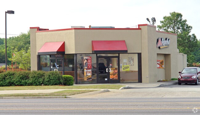
2804 WRIGHTSBORO RD
Governmentalpublicusegeneral
Richmond
X
Georgia
13245C0108G
1.84 AC
2025
South Richmond County
2025
Augusta/Richmond County
001604
Augusta-Richmond County, GA-SC
DEMOGRAPHICS near 2804 Wrightsboro Rd
1 Mile
3 Mile
5 Mile
2024 Total Population
6,918
64,753
144,682
2029 Population
6,869
64,790
145,571
Pop Growth 2024-2029
(0.71%)
+ 0.06%
+ 0.61%
Average Age
41
39
39
2024 Total Households
3,196
28,836
63,384
HH Growth 2024-2029
(0.63%)
+ 0.12%
+ 0.53%
Median Household Inc
$56,297
$42,958
$47,466
Avg Household Size
2.10
2.10
2.20
2024 Avg HH Vehicles
2.00
1.00
2.00
Median Home Value
$235,681
$168,716
$155,383
Median Year Built
1955
1966
1974
Nearby Places
Map Layers
Map Styles
 Street
 Aerial
- Restaurants
- Banks
- Shops
- Fitness
- Groceries
PUBLIC TRANSPORTATION
AIRPORT
Augusta Regional at Bush Field
DRIVE
WALK
Distance
Augusta Regional at Bush Field
22 min
9.9 mi
SALE & LEASE HISTORY
LISTING DATE
SALE/LEASE

Sep 24, 2016
For Sale
Nearby Properties
Address
Land Use
TOTAL SIZE
Lot Size
Zoning
Address
Land Use
TOTAL SIZE
Lot Size
Zoning
954,084 SF
18.30 AC
B-2
Address
Land Use
TOTAL SIZE
Lot Size
Zoning
8,993 SF
351.84 AC
R-1_B-2
Address
Land Use
TOTAL SIZE
Lot Size
Zoning
627,990 SF
20 AC
P-1
Address
Land Use
TOTAL SIZE
Lot Size
Zoning
1,100 SF
97.38 AC
R-1A
Address
Land Use
TOTAL SIZE
Lot Size
Zoning
292,232 SF
39.73 AC
B-2
Address
Land Use
TOTAL SIZE
Lot Size
Zoning
202,994 SF
19.25 AC
P-1
Address
Land Use
TOTAL SIZE
Lot Size
Zoning
179,743 SF
9.52 AC
007
Address
Land Use
TOTAL SIZE
Lot Size
Zoning
102,429 SF
7.31 AC
PUD
Address
Land Use
TOTAL SIZE
Lot Size
Zoning
255,834 SF
5.56 AC
B-1
Address
Land Use
TOTAL SIZE
Lot Size
Zoning
102,748 SF
22.60 AC
R-3B
Address
Land Use
TOTAL SIZE
Lot Size
Zoning
36,755 SF
12.09 AC
B-2
Address
Land Use
TOTAL SIZE
Lot Size
Zoning
4,800 SF
19.81 AC
B-2
Address
Land Use
TOTAL SIZE
Lot Size
Zoning
61,769 SF
12.06 AC
B-2
Address
Land Use
TOTAL SIZE
Lot Size
Zoning
38,080 SF
19.19 AC
R-3B
Address
Land Use
TOTAL SIZE
Lot Size
Zoning
1,782 SF
26.27 AC
R-3A
Address
Land Use
TOTAL SIZE
Lot Size
Zoning
6,323 SF
25.49 AC
R-3C
Address
Land Use
TOTAL SIZE
Lot Size
Zoning
8,640 SF
13.15 AC
R-3B
Address
Land Use
TOTAL SIZE
Lot Size
Zoning
102,060 SF
45.63 AC
R-3B
Address
Land Use
TOTAL SIZE
Lot Size
Zoning
42,617 SF
40.26 AC
R-1_B-1
Address
Land Use
TOTAL SIZE
Lot Size
Zoning
25,504 SF
9.87 AC
B-2
Address
Land Use
TOTAL SIZE
Lot Size
Zoning
68,600 SF
20.94 AC
R-3A
Address
Land Use
TOTAL SIZE
Lot Size
Zoning
21,615 SF
207.78 AC
R-1
Address
Land Use
TOTAL SIZE
Lot Size
Zoning
62,280 SF
22.83 AC
R-3A
Address
Land Use
TOTAL SIZE
Lot Size
Zoning
56,631 SF
11.62 AC
R-1A, B-2
Address
Land Use
TOTAL SIZE
Lot Size
Zoning
90,447 SF
1.28 AC
B-1
Address
Land Use
TOTAL SIZE
Lot Size
Zoning
431,971 SF
21.07 AC
007
Address
Land Use
TOTAL SIZE
Lot Size
Zoning
4,507 SF
56.06 AC
HI
Address
Land Use
TOTAL SIZE
Lot Size
Zoning
143,547 SF
9.88 AC
B-2
Address
Land Use
TOTAL SIZE
Lot Size
Zoning
4,947 SF
71.24 AC
R-3B
Address
Land Use
TOTAL SIZE
Lot Size
Zoning
68,704 SF
28.78 AC
B-1_R-3A
The World's #1 Commercial Real Estate Marketplace
Connect with us
© 2026 CoStar Group
The information above has been obtained from sources believed reliable. While we do not doubt its accuracy we have not verified it and make no guarantee, warranty or representation about it. It is your responsibility to independently confirm its accuracy and completeness. Any projections, opinions, assumptions, or estimates used are for example only and do not represent the current or future performance of the property. The value of this transaction to you depends on tax and other factors which should be evaluated by your tax, financial, and legal advisors. You and your advisors should conduct a careful, independent investigation of the property to determine to your satisfaction the suitability of the property for your needs.