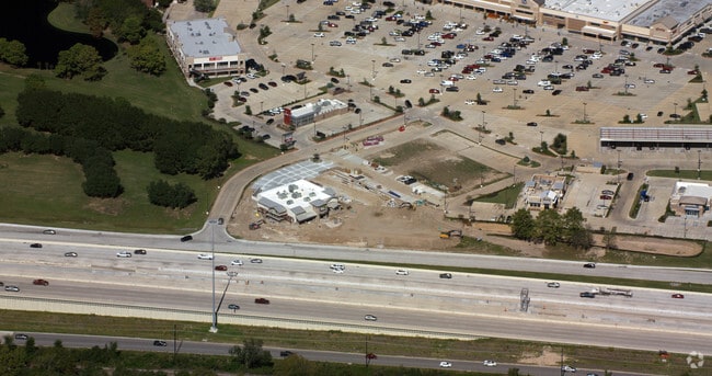
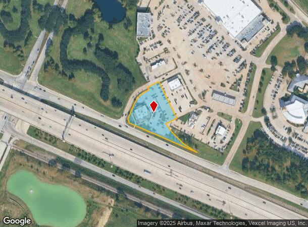
Property Record
28040 Highway 290, Cypress, TX 77433
NEARBY LISTINGS FOR SALE OR LEASE
Property Detail
28040 Highway 290
1172960030001
Fairfield Place Sec 2 Par R/P & Extn
Restaurantbuilding
RES A BLK 1 FAIRFIELD PLACE SEC 2 PAR R/P & EXTN
X
Harris
48201C0405M
Texas
2024
1.75 AC
2025
Fairfield
555701
Houston
8,397 SF
Houston-The Woodlands-Sugar Land, TX
DEMOGRAPHICS near 28040 Highway 290
1 Mile
3 Mile
5 Mile
2024 Total Population
8,333
52,720
114,356
2029 Population
8,587
53,843
117,272
Pop Growth 2024-2029
+ 3.05%
+ 2.13%
+ 2.55%
Average Age
35
35
35
2024 Total Households
2,683
16,337
35,558
HH Growth 2024-2029
+ 3.21%
+ 2.16%
+ 2.50%
Median Household Inc
$96,056
$119,254
$122,461
Avg Household Size
3.10
3.20
3.20
2024 Avg HH Vehicles
2.00
2.00
2.00
Median Home Value
$269,899
$319,348
$345,237
Median Year Built
2006
2008
2009
Nearby Places
Map Layers
Map Styles
 Street
 Aerial
- Restaurants
- Banks
- Shops
- Fitness
- Groceries
PUBLIC TRANSPORTATION
AIRPORT
George Bush Intcntl/Houston
DRIVE
WALK
Distance
George Bush Intcntl/Houston
43 min
30.2 mi
Freight Ports
Port of Houston
DRIVE
WALK
Distance
Port of Houston
53 min
39.0 mi
Nearby Properties
Address
Land Use
TOTAL SIZE
Lot Size
Zoning
Address
Land Use
TOTAL SIZE
Lot Size
Zoning
621,523 SF
66.99 AC
Address
Land Use
TOTAL SIZE
Lot Size
Zoning
270,794 SF
30.38 AC
Address
Land Use
TOTAL SIZE
Lot Size
Zoning
443,219 SF
24.05 AC
Address
Land Use
TOTAL SIZE
Lot Size
Zoning
297,044 SF
15 AC
Address
Land Use
TOTAL SIZE
Lot Size
Zoning
321,055 SF
13.58 AC
Address
Land Use
TOTAL SIZE
Lot Size
Zoning
300,268 SF
14.85 AC
Address
Land Use
TOTAL SIZE
Lot Size
Zoning
277,343 SF
12.79 AC
Address
Land Use
TOTAL SIZE
Lot Size
Zoning
290,379 SF
17.81 AC
Address
Land Use
TOTAL SIZE
Lot Size
Zoning
172,309 SF
Address
Land Use
TOTAL SIZE
Lot Size
Zoning
237,172 SF
35.93 AC
Address
Land Use
TOTAL SIZE
Lot Size
Zoning
235,555 SF
9.74 AC
Address
Land Use
TOTAL SIZE
Lot Size
Zoning
146,694 SF
6.45 AC
Address
Land Use
TOTAL SIZE
Lot Size
Zoning
119,152 SF
12.56 AC
Address
Land Use
TOTAL SIZE
Lot Size
Zoning
266,820 SF
4.46 AC
Address
Land Use
TOTAL SIZE
Lot Size
Zoning
119,810 SF
14.25 AC
Address
Land Use
TOTAL SIZE
Lot Size
Zoning
154,676 SF
17.13 AC
Address
Land Use
TOTAL SIZE
Lot Size
Zoning
81,933 SF
9.38 AC
Address
Land Use
TOTAL SIZE
Lot Size
Zoning
267,645 SF
14.20 AC
Address
Land Use
TOTAL SIZE
Lot Size
Zoning
209,305 SF
21.77 AC
Address
Land Use
TOTAL SIZE
Lot Size
Zoning
1,207.31 AC
Address
Land Use
TOTAL SIZE
Lot Size
Zoning
116,800 SF
9.99 AC
Address
Land Use
TOTAL SIZE
Lot Size
Zoning
159,182 SF
5.96 AC
Address
Land Use
TOTAL SIZE
Lot Size
Zoning
61,242 SF
30 AC
Address
Land Use
TOTAL SIZE
Lot Size
Zoning
24,111 SF
2.11 AC
Address
Land Use
TOTAL SIZE
Lot Size
Zoning
122,276 SF
11.53 AC
Address
Land Use
TOTAL SIZE
Lot Size
Zoning
137,533 SF
14.63 AC
Address
Land Use
TOTAL SIZE
Lot Size
Zoning
698.98 AC
Address
Land Use
TOTAL SIZE
Lot Size
Zoning
75,900 SF
2.95 AC
Address
Land Use
TOTAL SIZE
Lot Size
Zoning
40,058 SF
3.69 AC
Address
Land Use
TOTAL SIZE
Lot Size
Zoning
29,424 SF
2.99 AC
The World's #1 Commercial Real Estate Marketplace
Connect with us
© 2025 CoStar Group
The information above has been obtained from sources believed reliable. While we do not doubt its accuracy we have not verified it and make no guarantee, warranty or representation about it. It is your responsibility to independently confirm its accuracy and completeness. Any projections, opinions, assumptions, or estimates used are for example only and do not represent the current or future performance of the property. The value of this transaction to you depends on tax and other factors which should be evaluated by your tax, financial, and legal advisors. You and your advisors should conduct a careful, independent investigation of the property to determine to your satisfaction the suitability of the property for your needs.