Property Record
2805 A-P Riverside Dr, Danville, VA 24540
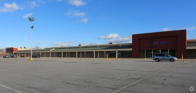
Property Detail
2805 A-P Riverside Dr
51668
.943 AC NO 1B RIVERSIDE D
Religious
DANVILLE CITY
PLANNED SH
Virginia
AE The base floodplain where base flood elevations are provided. AE Zones are now used on new format FIRMs instead of A1-A30 Zones.
13.79 AC
2025
Virginia South Central
2025
Other Market Areas
000800
Danville, VA
143,264 SF
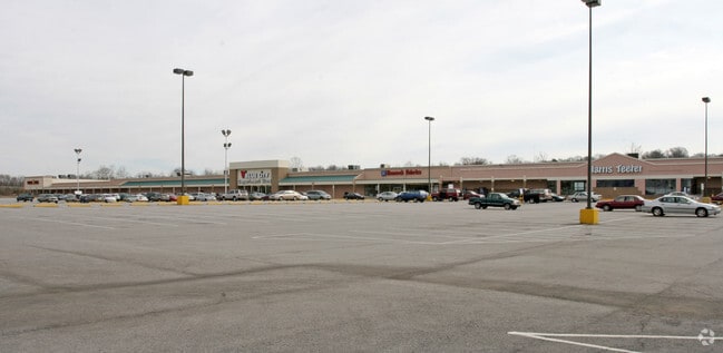
NEARBY LISTINGS FOR SALE OR LEASE
DEMOGRAPHICS near 2805 A-P Riverside Dr
1 mile
3 mile
5 mile
2025 Total Population
4,284
33,926
49,224
2030 Population
4,251
33,868
48,861
Pop Growth 2025-2030
(0.77%)
(0.17%)
(0.74%)
Average Age
41
43
43
2025 Total Households
1,794
15,075
21,746
HH Growth 2025-2030
(0.89%)
(0.17%)
(0.75%)
Median Household Inc
$44,520
$41,994
$45,178
Avg Household Size
2.00
2.10
2.20
2025 Avg HH Vehicles
2.00
2.00
2.00
Median Home Value
$162,678
$114,992
$134,542
Median Year Built
1952
1958
1965
Nearby Places
Map Layers
Map Styles
 Street
 Aerial
Layers
 Traffic
 Biking
Places
Listings with unknown addresses are not visible on the map
- Restaurants
- Banks
- Shops
- Fitness
- Groceries
PUBLIC TRANSPORTATION
COMMUTER RAIL
Danville Amtrak Station (Crescent - Amtrak)
Drive
Walk
Distance
Danville Amtrak Station (Crescent - Amtrak)
6 min
2.8 mi
Freight Ports
Virginia Port Authority - Richmond
Drive
Walk
Distance
Virginia Port Authority - Richmond
190 min
143.3 mi
Nearby Properties
Address
Land Use
TOTAL SIZE
Lot Size
Zoning
Address
Land Use
TOTAL SIZE
Lot Size
Zoning
789,481 SF
76.92 AC
MANUFACTUR
Address
Land Use
TOTAL SIZE
Lot Size
Zoning
10,373 SF
9.49 AC
TRANSITION
Address
Land Use
TOTAL SIZE
Lot Size
Zoning
508,832 SF
10.86 AC
TOBACCO WA
Address
Land Use
TOTAL SIZE
Lot Size
Zoning
93,230 SF
40.74 AC
TRANSITION
Address
Land Use
TOTAL SIZE
Lot Size
Zoning
54,169 SF
3.44 AC
CENTRAL BU
Address
Land Use
TOTAL SIZE
Lot Size
Zoning
157,977 SF
15.99 AC
TRANSITION
Address
Land Use
TOTAL SIZE
Lot Size
Zoning
77,952 SF
16.59 AC
TRANSITION
Address
Land Use
TOTAL SIZE
Lot Size
Zoning
48,285 SF
3.76 AC
TOBACCO WA
Address
Land Use
TOTAL SIZE
Lot Size
Zoning
159,055 SF
31.73 AC
OVERLAY PL
Address
Land Use
TOTAL SIZE
Lot Size
Zoning
25,436 SF
4.71 AC
TRANSITION
Address
Land Use
TOTAL SIZE
Lot Size
Zoning
225,611 SF
19.53 AC
PLANNED SH
Address
Land Use
TOTAL SIZE
Lot Size
Zoning
81,251 SF
70.22 AC
TRANSITION
Address
Land Use
TOTAL SIZE
Lot Size
Zoning
53,871 SF
6.89 AC
HIGHWAY RE
Address
Land Use
TOTAL SIZE
Lot Size
Zoning
1,000 SF
26.56 AC
TRANSITION
Address
Land Use
TOTAL SIZE
Lot Size
Zoning
21,476 SF
4.12 AC
TRANSITION
Address
Land Use
TOTAL SIZE
Lot Size
Zoning
136,211 SF
15.10 AC
PLANNED SH
Address
Land Use
TOTAL SIZE
Lot Size
Zoning
66,954 SF
17.70 AC
TOBACCO WA
Address
Land Use
TOTAL SIZE
Lot Size
Zoning
33,748 SF
3.73 AC
TOBACCO WA
Address
Land Use
TOTAL SIZE
Lot Size
Zoning
41,776 SF
2.60 AC
TRANSITION
Address
Land Use
TOTAL SIZE
Lot Size
Zoning
192,978 SF
15.17 AC
PLANNED SH
Address
Land Use
TOTAL SIZE
Lot Size
Zoning
162 SF
87 AC
HIGHWAY RE
Address
Land Use
TOTAL SIZE
Lot Size
Zoning
160,199 SF
15.90 AC
PLANNED SH
Address
Land Use
TOTAL SIZE
Lot Size
Zoning
59,791 SF
11.18 AC
HIGHWAY RE
Address
Land Use
TOTAL SIZE
Lot Size
Zoning
55,006 SF
4.49 AC
HIGHWAY RE
Address
Land Use
TOTAL SIZE
Lot Size
Zoning
81,326 SF
1.03 AC
TRANSITION
Address
Land Use
TOTAL SIZE
Lot Size
Zoning
43,352 SF
5.59 AC
TRANSITION
Address
Land Use
TOTAL SIZE
Lot Size
Zoning
625,362 SF
34.04 AC
PLANNED SH
Address
Land Use
TOTAL SIZE
Lot Size
Zoning
106,836 SF
11.67 AC
OVERLAY PL
Address
Land Use
TOTAL SIZE
Lot Size
Zoning
380,043 SF
9.40 AC
OVERLAY PL
Address
Land Use
TOTAL SIZE
Lot Size
Zoning
912 SF
16.33 AC
TRANSITION
The World's #1 Commercial Real Estate Marketplace
Connect with us
© 2026 CoStar Group
The information above has been obtained from sources believed reliable. While we do not doubt its accuracy we have not verified it and make no guarantee, warranty or representation about it. It is your responsibility to independently confirm its accuracy and completeness. Any projections, opinions, assumptions, or estimates used are for example only and do not represent the current or future performance of the property. The value of this transaction to you depends on tax and other factors which should be evaluated by your tax, financial, and legal advisors. You and your advisors should conduct a careful, independent investigation of the property to determine to your satisfaction the suitability of the property for your needs.