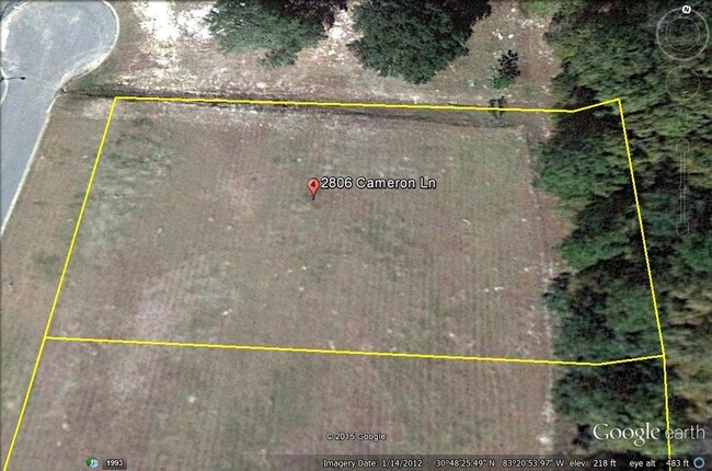
Property Record
2806 Cameron Ln, Valdosta, GA 31601

NEARBY LISTINGS FOR SALE OR LEASE
Property Detail
2806 Cameron Ln
Valdosta, GA
Dellwood Flood Major
0059-140A
LOT 5 WEST RIDGE BUSINESS PARK
Warehouse
Lowndes
X
Georgia
13185C0215E
5
2024
0.84 AC
2024
Valdosta/Lake Park
011402
Other Market Areas
9,000 SF
DEMOGRAPHICS near 2806 Cameron Ln
1 Mile
3 Mile
5 Mile
2024 Total Population
978
4,402
27,766
2029 Population
1,041
4,639
28,866
Pop Growth 2024-2029
+ 6.44%
+ 5.38%
+ 3.96%
Average Age
40
38
35
2024 Total Households
345
1,641
10,714
HH Growth 2024-2029
+ 6.38%
+ 5.55%
+ 4.20%
Median Household Inc
$58,703
$39,141
$30,405
Avg Household Size
2.80
2.60
2.30
2024 Avg HH Vehicles
2.00
2.00
2.00
Median Home Value
$323,863
$242,500
$152,165
Median Year Built
1997
1993
1982
Nearby Places
Map Layers
Map Styles
 Street
 Aerial
- Restaurants
- Banks
- Shops
- Fitness
- Groceries
PUBLIC TRANSPORTATION
AIRPORT
Valdosta Regional
DRIVE
WALK
Distance
Valdosta Regional
12 min
7.1 mi
Freight Ports
Jacksonville Port
DRIVE
WALK
Distance
Jacksonville Port
143 min
125.9 mi
SALE & LEASE HISTORY
LISTING DATE
SALE/LEASE

May 25, 2017
For Sale
Nearby Properties
Address
Land Use
TOTAL SIZE
Lot Size
Zoning
Address
Land Use
TOTAL SIZE
Lot Size
Zoning
1,200 SF
73.36 AC
M-2
Address
Land Use
TOTAL SIZE
Lot Size
Zoning
348,830 SF
80.94 AC
E-A, M-2
Address
Land Use
TOTAL SIZE
Lot Size
Zoning
1,686 SF
18.88 AC
R-M
Address
Land Use
TOTAL SIZE
Lot Size
Zoning
163,083 SF
17.16 AC
C-H
Address
Land Use
TOTAL SIZE
Lot Size
Zoning
150,802 SF
11.97 AC
M-1
Address
Land Use
TOTAL SIZE
Lot Size
Zoning
203,741 SF
22.55 AC
C-H
Address
Land Use
TOTAL SIZE
Lot Size
Zoning
120,720 SF
11.31 AC
C-H
Address
Land Use
TOTAL SIZE
Lot Size
Zoning
104,544 SF
20.31 AC
R-M
Address
Land Use
TOTAL SIZE
Lot Size
Zoning
104,423 SF
2.62 AC
C-H
Address
Land Use
TOTAL SIZE
Lot Size
Zoning
97,568 SF
3.63 AC
C-H
Address
Land Use
TOTAL SIZE
Lot Size
Zoning
89,977 SF
11.16 AC
C-H
Address
Land Use
TOTAL SIZE
Lot Size
Zoning
101,774 SF
3.55 AC
C-H
Address
Land Use
TOTAL SIZE
Lot Size
Zoning
120,400 SF
9.12 AC
M-1
Address
Land Use
TOTAL SIZE
Lot Size
Zoning
100,812 SF
6.43 AC
R-M
Address
Land Use
TOTAL SIZE
Lot Size
Zoning
80,062 SF
3 AC
C-H
Address
Land Use
TOTAL SIZE
Lot Size
Zoning
55,599 SF
4.14 AC
C-H
Address
Land Use
TOTAL SIZE
Lot Size
Zoning
76,250 SF
3.05 AC
C-H
Address
Land Use
TOTAL SIZE
Lot Size
Zoning
70,358 SF
8.41 AC
R-10
Address
Land Use
TOTAL SIZE
Lot Size
Zoning
50,340 SF
9.89 AC
C-H
Address
Land Use
TOTAL SIZE
Lot Size
Zoning
83,052 SF
6.81 AC
R-M
Address
Land Use
TOTAL SIZE
Lot Size
Zoning
140,398 SF
13.96 AC
C-H
Address
Land Use
TOTAL SIZE
Lot Size
Zoning
72,832 SF
114.10 AC
M-1
Address
Land Use
TOTAL SIZE
Lot Size
Zoning
55,180 SF
2.46 AC
M-2
Address
Land Use
TOTAL SIZE
Lot Size
Zoning
6,600 SF
404.44 AC
P-D,C-H
Address
Land Use
TOTAL SIZE
Lot Size
Zoning
3,284 SF
17.45 AC
R-M
Address
Land Use
TOTAL SIZE
Lot Size
Zoning
69.02 AC
C-H
Address
Land Use
TOTAL SIZE
Lot Size
Zoning
50,192 SF
2.48 AC
C-H
Address
Land Use
TOTAL SIZE
Lot Size
Zoning
53,360 SF
2.39 AC
C-H
Address
Land Use
TOTAL SIZE
Lot Size
Zoning
54,914 SF
2.16 AC
C-H
Address
Land Use
TOTAL SIZE
Lot Size
Zoning
37.28 AC
PMD
The World's #1 Commercial Real Estate Marketplace
Connect with us
© 2025 CoStar Group
The information above has been obtained from sources believed reliable. While we do not doubt its accuracy we have not verified it and make no guarantee, warranty or representation about it. It is your responsibility to independently confirm its accuracy and completeness. Any projections, opinions, assumptions, or estimates used are for example only and do not represent the current or future performance of the property. The value of this transaction to you depends on tax and other factors which should be evaluated by your tax, financial, and legal advisors. You and your advisors should conduct a careful, independent investigation of the property to determine to your satisfaction the suitability of the property for your needs.