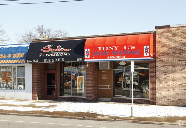
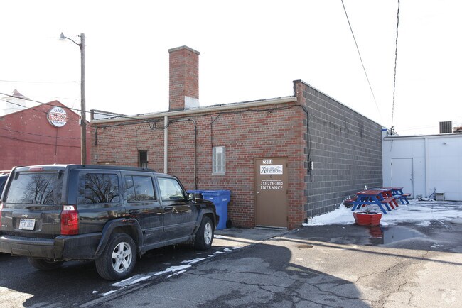
Property Record
2807 Monroe St, Dearborn, MI 48124
NEARBY LISTINGS FOR SALE OR LEASE
Property Detail
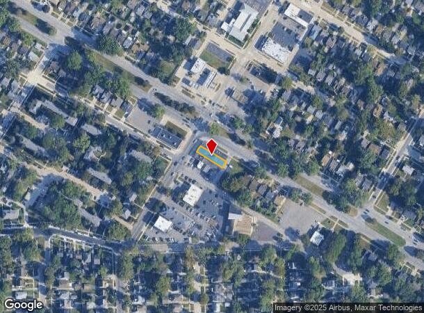
2807 Monroe St
Detroit-Warren-Dearborn, MI
Dearborn Ridge
82-09-271-18-002
LOT 26 & E 1/2 OF LOT 27 EXC NWLY 6 FT TAKEN FOR ST BERNS DEARBORN RIDGE SUB
Barberhairsalon
Wayne
X
Michigan
26163C0242E
26-27
2025
0.09 AC
2025
Dearborn
575401
Detroit
2,318 SF
DEMOGRAPHICS near 2807 Monroe St
1 Mile
3 Mile
5 Mile
2024 Total Population
14,968
99,029
314,565
2029 Population
14,337
95,268
303,547
Pop Growth 2024-2029
(4.22%)
(3.80%)
(3.50%)
Average Age
41
39
38
2024 Total Households
6,476
39,078
117,690
HH Growth 2024-2029
(4.23%)
(3.72%)
(3.52%)
Median Household Inc
$73,255
$65,294
$56,016
Avg Household Size
2.30
2.50
2.60
2024 Avg HH Vehicles
2.00
2.00
2.00
Median Home Value
$168,110
$161,802
$149,823
Median Year Built
1952
1954
1955
Nearby Places
Map Layers
Map Styles
 Street
 Aerial
- Restaurants
- Banks
- Shops
- Fitness
- Groceries
PUBLIC TRANSPORTATION
COMMUTER RAIL
DRIVE
WALK
Distance
5 min
1.6 mi
AIRPORT
Detroit Metro Wayne County
DRIVE
WALK
Distance
Detroit Metro Wayne County
22 min
12.4 mi
Windsor International
DRIVE
WALK
Distance
Windsor International
43 min
22.0 mi
Freight Ports
DRIVE
WALK
Distance
71 min
53.1 mi
Nearby Properties
Address
Land Use
TOTAL SIZE
Lot Size
Zoning
Address
Land Use
TOTAL SIZE
Lot Size
Zoning
5,597,761 SF
73.85 AC
IB
Address
Land Use
TOTAL SIZE
Lot Size
Zoning
830,075 SF
167.21 AC
BC
Address
Land Use
TOTAL SIZE
Lot Size
Zoning
373,209 SF
349 AC
IC
Address
Land Use
TOTAL SIZE
Lot Size
Zoning
675,440 SF
66.32 AC
IB
Address
Land Use
TOTAL SIZE
Lot Size
Zoning
1,209,711 SF
69.44 AC
IB
Address
Land Use
TOTAL SIZE
Lot Size
Zoning
590,893 SF
51.81 AC
IB
Address
Land Use
TOTAL SIZE
Lot Size
Zoning
229,368 SF
1 AC
C 6A
Address
Land Use
TOTAL SIZE
Lot Size
Zoning
324,414 SF
18.68 AC
RD
Address
Land Use
TOTAL SIZE
Lot Size
Zoning
854,358 SF
12.49 AC
BC
Address
Land Use
TOTAL SIZE
Lot Size
Zoning
357,640 SF
13.89 AC
C 6C
Address
Land Use
TOTAL SIZE
Lot Size
Zoning
Address
Land Use
TOTAL SIZE
Lot Size
Zoning
349,045 SF
40.28 AC
IB
Address
Land Use
TOTAL SIZE
Lot Size
Zoning
78,450 SF
12.03 AC
BC
Address
Land Use
TOTAL SIZE
Lot Size
Zoning
135,775 SF
18.39 AC
BC
Address
Land Use
TOTAL SIZE
Lot Size
Zoning
228,519 SF
6.16 AC
BC
Address
Land Use
TOTAL SIZE
Lot Size
Zoning
108,960 SF
5.23 AC
OS
Address
Land Use
TOTAL SIZE
Lot Size
Zoning
678,368 SF
48.99 AC
RD RESEARC
Address
Land Use
TOTAL SIZE
Lot Size
Zoning
219,434 SF
23.91 AC
BC
Address
Land Use
TOTAL SIZE
Lot Size
Zoning
Address
Land Use
TOTAL SIZE
Lot Size
Zoning
562,922 SF
30 AC
BC
Address
Land Use
TOTAL SIZE
Lot Size
Zoning
107,772 SF
8 AC
BC
Address
Land Use
TOTAL SIZE
Lot Size
Zoning
126,712 SF
4.52 AC
BC
Address
Land Use
TOTAL SIZE
Lot Size
Zoning
32,608 SF
46.51 AC
BC
Address
Land Use
TOTAL SIZE
Lot Size
Zoning
810,000 SF
23.15 AC
BC
Address
Land Use
TOTAL SIZE
Lot Size
Zoning
77,974 SF
1 AC
C 6A
Address
Land Use
TOTAL SIZE
Lot Size
Zoning
205,632 SF
1 AC
C 6A
Address
Land Use
TOTAL SIZE
Lot Size
Zoning
169,200 SF
19.92 AC
RD RESEARC
Address
Land Use
TOTAL SIZE
Lot Size
Zoning
637,176 SF
39.11 AC
C 6C
Address
Land Use
TOTAL SIZE
Lot Size
Zoning
463,642 SF
22.82 AC
Address
Land Use
TOTAL SIZE
Lot Size
Zoning
247,588 SF
4.12 AC
RE
The World's #1 Commercial Real Estate Marketplace
Connect with us
© 2026 CoStar Group
The information above has been obtained from sources believed reliable. While we do not doubt its accuracy we have not verified it and make no guarantee, warranty or representation about it. It is your responsibility to independently confirm its accuracy and completeness. Any projections, opinions, assumptions, or estimates used are for example only and do not represent the current or future performance of the property. The value of this transaction to you depends on tax and other factors which should be evaluated by your tax, financial, and legal advisors. You and your advisors should conduct a careful, independent investigation of the property to determine to your satisfaction the suitability of the property for your needs.