Property Record
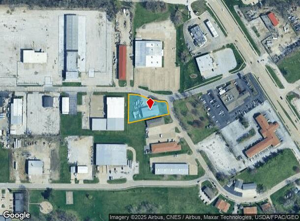
2807 W 73Rd St, Davenport, IA 52806

NEARBY LISTINGS FOR SALE OR LEASE
Property Detail
2807 W 73Rd St
Davenport-Moline-Rock Island, IA-IL
Green Tree Park 1St Add
W0405B01
GREEN TREE PARK 1ST ADD LOT: 11 GREEN TREE PARK 1STADD
Warehouse
Scott
X
Iowa
19163C0355H
11
2025
0.66 AC
2025
Greater Davenport
012601
Davenport/Moline/Rock Island
5,000 SF
DEMOGRAPHICS near 2807 W 73Rd St
1 Mile
3 Mile
5 Mile
2024 Total Population
4,943
27,439
83,555
2029 Population
4,877
27,349
82,953
Pop Growth 2024-2029
(1.34%)
(0.33%)
(0.72%)
Average Age
38
40
39
2024 Total Households
1,888
11,031
34,356
HH Growth 2024-2029
(1.38%)
(0.39%)
(0.80%)
Median Household Inc
$59,871
$59,126
$57,541
Avg Household Size
2.50
2.40
2.30
2024 Avg HH Vehicles
2.00
2.00
2.00
Median Home Value
$160,876
$166,871
$162,921
Median Year Built
1974
1977
1970
Nearby Places
Map Layers
Map Styles
 Street
 Aerial
- Restaurants
- Banks
- Shops
- Fitness
- Groceries
PUBLIC TRANSPORTATION
AIRPORT
Quad Cities International
DRIVE
WALK
Distance
Quad Cities International
30 min
22.2 mi
Freight Ports
Port Milwaukee
DRIVE
WALK
Distance
Port Milwaukee
239 min
212.9 mi
Nearby Properties
Address
Land Use
TOTAL SIZE
Lot Size
Zoning
Address
Land Use
TOTAL SIZE
Lot Size
Zoning
2,615,134 SF
120.68 AC
Address
Land Use
TOTAL SIZE
Lot Size
Zoning
2,545,300 SF
159.73 AC
Address
Land Use
TOTAL SIZE
Lot Size
Zoning
3,360 SF
42.55 AC
Address
Land Use
TOTAL SIZE
Lot Size
Zoning
300,100 SF
14.87 AC
Address
Land Use
TOTAL SIZE
Lot Size
Zoning
27,225 SF
40.34 AC
Address
Land Use
TOTAL SIZE
Lot Size
Zoning
688 SF
56.76 AC
Address
Land Use
TOTAL SIZE
Lot Size
Zoning
247,966 SF
14.14 AC
Address
Land Use
TOTAL SIZE
Lot Size
Zoning
300,718 SF
14.71 AC
Address
Land Use
TOTAL SIZE
Lot Size
Zoning
12,500 SF
578.76 AC
Address
Land Use
TOTAL SIZE
Lot Size
Zoning
4,804 SF
202 AC
Address
Land Use
TOTAL SIZE
Lot Size
Zoning
25,176 SF
13.85 AC
Address
Land Use
TOTAL SIZE
Lot Size
Zoning
197,946 SF
18.64 AC
Address
Land Use
TOTAL SIZE
Lot Size
Zoning
4,800 SF
18.86 AC
Address
Land Use
TOTAL SIZE
Lot Size
Zoning
86,976 SF
40 AC
Address
Land Use
TOTAL SIZE
Lot Size
Zoning
99,540 SF
10.95 AC
Address
Land Use
TOTAL SIZE
Lot Size
Zoning
111,452 SF
40 AC
Address
Land Use
TOTAL SIZE
Lot Size
Zoning
213,686 SF
23.29 AC
Address
Land Use
TOTAL SIZE
Lot Size
Zoning
348,893 SF
15.30 AC
Address
Land Use
TOTAL SIZE
Lot Size
Zoning
78,037 SF
17.06 AC
Address
Land Use
TOTAL SIZE
Lot Size
Zoning
25,200 SF
23.19 AC
Address
Land Use
TOTAL SIZE
Lot Size
Zoning
43,360 SF
2.92 AC
Address
Land Use
TOTAL SIZE
Lot Size
Zoning
98,297 SF
14.73 AC
Address
Land Use
TOTAL SIZE
Lot Size
Zoning
136,292 SF
30.02 AC
Address
Land Use
TOTAL SIZE
Lot Size
Zoning
20,000 SF
8.59 AC
Address
Land Use
TOTAL SIZE
Lot Size
Zoning
10,980 SF
42.84 AC
Address
Land Use
TOTAL SIZE
Lot Size
Zoning
175,578 SF
17.19 AC
Address
Land Use
TOTAL SIZE
Lot Size
Zoning
119,808 SF
38.22 AC
Address
Land Use
TOTAL SIZE
Lot Size
Zoning
4,000 SF
8.81 AC
Address
Land Use
TOTAL SIZE
Lot Size
Zoning
60,812 SF
1.92 AC
Address
Land Use
TOTAL SIZE
Lot Size
Zoning
52,032 SF
11.37 AC
The World's #1 Commercial Real Estate Marketplace
Connect with us
© 2025 CoStar Group
The information above has been obtained from sources believed reliable. While we do not doubt its accuracy we have not verified it and make no guarantee, warranty or representation about it. It is your responsibility to independently confirm its accuracy and completeness. Any projections, opinions, assumptions, or estimates used are for example only and do not represent the current or future performance of the property. The value of this transaction to you depends on tax and other factors which should be evaluated by your tax, financial, and legal advisors. You and your advisors should conduct a careful, independent investigation of the property to determine to your satisfaction the suitability of the property for your needs.