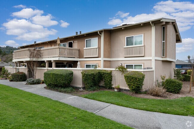
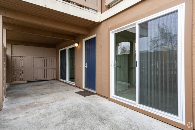
Property Record
2807 Yulupa Ave, Santa Rosa, CA 95405

Save to a Folder
{{folder.Name}}
{{folder.ListingIds.length}} Properties
{{folder.ListingIds.length}} Property
Create a New Folder
Property Detail
2807 Yulupa Ave
147-052-010
1971 FORM 147-052-07 PT FROM 01 C/H BY 2507-154
Apartment
Sonoma
CITYSR
California
B and X Area of moderate flood hazard, usually the area between the limits of the 100-year and 500-year floods.
1
2025
4.22 AC
2025
Outer Santa Rosa
151506
North Bay/Santa Rosa
12,762 SF
Santa Rosa-Petaluma, CA
NEARBY LISTINGS FOR SALE OR LEASE
DEMOGRAPHICS near 2807 Yulupa Ave
1 mile
3 mile
5 mile
2025 Total Population
9,024
66,130
172,744
2030 Population
8,923
66,348
173,436
Pop Growth 2025-2030
(1.12%)
+ 0.33%
+ 0.40%
Average Age
45
42
42
2025 Total Households
3,649
26,201
65,393
HH Growth 2025-2030
(1.15%)
+ 0.44%
+ 0.46%
Median Household Inc
$128,229
$93,767
$94,962
Avg Household Size
2.40
2.40
2.50
2025 Avg HH Vehicles
2.00
2.00
2.00
Median Home Value
$767,528
$756,904
$751,246
Median Year Built
1974
1976
1978
Nearby Places
Map Layers
Map Styles
 Street
 Aerial
Layers
 Traffic
 Biking
Places
Listings with unknown addresses are not visible on the map
- Restaurants
- Banks
- Shops
- Fitness
- Groceries
PUBLIC TRANSPORTATION
COMMUTER RAIL
Smart Santa Rosa Downtown (Main Line - Sonoma Marin Area Rail Transit)
Drive
Walk
Distance
Smart Santa Rosa Downtown (Main Line - Sonoma Marin Area Rail Transit)
9 min
4.2 mi
Smart Santa Rosa North (Main Line - Sonoma Marin Area Rail Transit)
Drive
Walk
Distance
Smart Santa Rosa North (Main Line - Sonoma Marin Area Rail Transit)
11 min
6.1 mi
AIRPORT
Charles M Schulz - Sonoma County
Drive
Walk
Distance
Charles M Schulz - Sonoma County
20 min
11.9 mi
Freight Ports
Port of Richmond
Drive
Walk
Distance
Port of Richmond
69 min
51.5 mi
Nearby Properties
Address
Land Use
TOTAL SIZE
Lot Size
Zoning
Address
Land Use
TOTAL SIZE
Lot Size
Zoning
142,169 SF
7.42 AC
CITYSR
Address
Land Use
TOTAL SIZE
Lot Size
Zoning
13,592 SF
30.22 AC
Address
Land Use
TOTAL SIZE
Lot Size
Zoning
22,841 SF
8.23 AC
Address
Land Use
TOTAL SIZE
Lot Size
Zoning
59,220 SF
22.98 AC
C-2
Address
Land Use
TOTAL SIZE
Lot Size
Zoning
41,815 SF
33.80 AC
Address
Land Use
TOTAL SIZE
Lot Size
Zoning
191,385 SF
13.77 AC
C2P
Address
Land Use
TOTAL SIZE
Lot Size
Zoning
28,750 SF
9.35 AC
Address
Land Use
TOTAL SIZE
Lot Size
Zoning
167,485 SF
7.81 AC
Address
Land Use
TOTAL SIZE
Lot Size
Zoning
178,704 SF
10.76 AC
CITYSR
Address
Land Use
TOTAL SIZE
Lot Size
Zoning
90,079 SF
3.09 AC
Address
Land Use
TOTAL SIZE
Lot Size
Zoning
9,450 SF
0.76 AC
Address
Land Use
TOTAL SIZE
Lot Size
Zoning
22,869 SF
4.65 AC
Address
Land Use
TOTAL SIZE
Lot Size
Zoning
107,765 SF
5.70 AC
CITYSR
Address
Land Use
TOTAL SIZE
Lot Size
Zoning
85,034 SF
5.43 AC
Address
Land Use
TOTAL SIZE
Lot Size
Zoning
19,444 SF
7.91 AC
C2
Address
Land Use
TOTAL SIZE
Lot Size
Zoning
145,976 SF
7.09 AC
R210
Address
Land Use
TOTAL SIZE
Lot Size
Zoning
19,013 SF
9.46 AC
CITYSR
Address
Land Use
TOTAL SIZE
Lot Size
Zoning
181,593 SF
0.80 AC
R3PD
Address
Land Use
TOTAL SIZE
Lot Size
Zoning
53,600 SF
7.37 AC
C4
Address
Land Use
TOTAL SIZE
Lot Size
Zoning
142,272 SF
0.25 AC
C2
Address
Land Use
TOTAL SIZE
Lot Size
Zoning
978 SF
150.82 AC
Address
Land Use
TOTAL SIZE
Lot Size
Zoning
28,384 SF
2.94 AC
CITYSR
Address
Land Use
TOTAL SIZE
Lot Size
Zoning
86,889 SF
6.36 AC
Address
Land Use
TOTAL SIZE
Lot Size
Zoning
2,507 SF
4.19 AC
CITYSR
Address
Land Use
TOTAL SIZE
Lot Size
Zoning
38,567 SF
3.80 AC
PC
Address
Land Use
TOTAL SIZE
Lot Size
Zoning
26,320 SF
1.94 AC
CITYSR
Address
Land Use
TOTAL SIZE
Lot Size
Zoning
6,150 SF
6.57 AC
CITYSR
Address
Land Use
TOTAL SIZE
Lot Size
Zoning
Address
Land Use
TOTAL SIZE
Lot Size
Zoning
76,529 SF
6.10 AC
C2
Address
Land Use
TOTAL SIZE
Lot Size
Zoning
99,362 SF
0.77 AC
CITYSR
The World's #1 Commercial Real Estate Marketplace
Connect with us
© 2026 CoStar Group
The information above has been obtained from sources believed reliable. While we do not doubt its accuracy we have not verified it and make no guarantee, warranty or representation about it. It is your responsibility to independently confirm its accuracy and completeness. Any projections, opinions, assumptions, or estimates used are for example only and do not represent the current or future performance of the property. The value of this transaction to you depends on tax and other factors which should be evaluated by your tax, financial, and legal advisors. You and your advisors should conduct a careful, independent investigation of the property to determine to your satisfaction the suitability of the property for your needs.