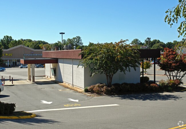
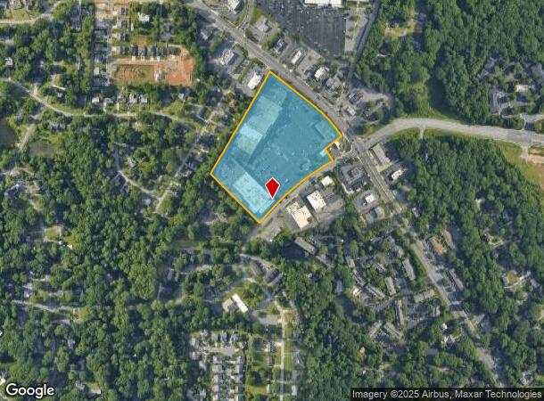
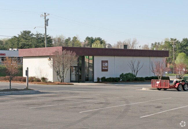
Property Record
2808 Reynolda Rd, Winston Salem, NC 27106
NEARBY LISTINGS FOR SALE OR LEASE
Property Detail
2808 Reynolda Rd
Winston-Salem, NC
Reynolda Manor Shopping Center
6817-63-0479
REYNOLDA MANOR SHOPPING CENTER LO:204D BL:3463 PL:70-196 BU:1
Storebuilding
Forsyth
X
North Carolina
3710681700J
204d
2024
11.49 AC
2025
NW Forsyth County
002606
Greensboro/Winston-Salem
4,777 SF
DEMOGRAPHICS near 2808 Reynolda Rd
1 Mile
3 Mile
5 Mile
2024 Total Population
8,812
57,413
144,887
2029 Population
9,180
59,592
151,314
Pop Growth 2024-2029
+ 4.18%
+ 3.80%
+ 4.44%
Average Age
39
38
39
2024 Total Households
4,068
22,796
61,126
HH Growth 2024-2029
+ 4.28%
+ 3.96%
+ 4.56%
Median Household Inc
$52,547
$60,167
$56,670
Avg Household Size
1.90
2.20
2.20
2024 Avg HH Vehicles
2.00
2.00
2.00
Median Home Value
$215,302
$265,224
$240,368
Median Year Built
1983
1978
1976
Nearby Places
Map Layers
Map Styles
 Street
 Aerial
- Restaurants
- Banks
- Shops
- Fitness
- Groceries
PUBLIC TRANSPORTATION
AIRPORT
Piedmont Triad International
DRIVE
WALK
Distance
Piedmont Triad International
43 min
26.1 mi
Freight Ports
Virginia Port Authority - Richmond
DRIVE
WALK
Distance
Virginia Port Authority - Richmond
269 min
229.8 mi
Nearby Properties
Address
Land Use
TOTAL SIZE
Lot Size
Zoning
Address
Land Use
TOTAL SIZE
Lot Size
Zoning
100 SF
213.71 AC
C
Address
Land Use
TOTAL SIZE
Lot Size
Zoning
436,579 SF
72.65 AC
RM8-S
Address
Land Use
TOTAL SIZE
Lot Size
Zoning
329,963 SF
58.84 AC
RM18-S
Address
Land Use
TOTAL SIZE
Lot Size
Zoning
122,900 SF
49.54 AC
GB
Address
Land Use
TOTAL SIZE
Lot Size
Zoning
153,937 SF
34.63 AC
RM12-S
Address
Land Use
TOTAL SIZE
Lot Size
Zoning
264,904 SF
21.63 AC
GB
Address
Land Use
TOTAL SIZE
Lot Size
Zoning
169,443 SF
33.02 AC
GB
Address
Land Use
TOTAL SIZE
Lot Size
Zoning
245,828 SF
28.02 AC
GB
Address
Land Use
TOTAL SIZE
Lot Size
Zoning
449,945 SF
20.96 AC
LI
Address
Land Use
TOTAL SIZE
Lot Size
Zoning
188,135 SF
8.65 AC
GO-S
Address
Land Use
TOTAL SIZE
Lot Size
Zoning
152,968 SF
32.40 AC
RM18
Address
Land Use
TOTAL SIZE
Lot Size
Zoning
127,566 SF
35.86 AC
C-L
Address
Land Use
TOTAL SIZE
Lot Size
Zoning
119,130 SF
5.84 AC
GB-L
Address
Land Use
TOTAL SIZE
Lot Size
Zoning
85,354 SF
29.13 AC
RM18-S
Address
Land Use
TOTAL SIZE
Lot Size
Zoning
178,192 SF
28.15 AC
RM18
Address
Land Use
TOTAL SIZE
Lot Size
Zoning
185,506 SF
57.30 AC
GB
Address
Land Use
TOTAL SIZE
Lot Size
Zoning
91,905 SF
21.18 AC
RM18-S
Address
Land Use
TOTAL SIZE
Lot Size
Zoning
106,821 SF
14.95 AC
RM12-S
Address
Land Use
TOTAL SIZE
Lot Size
Zoning
111,133 SF
10.09 AC
RM8-S
Address
Land Use
TOTAL SIZE
Lot Size
Zoning
12,132 SF
57.50 AC
RM18
Address
Land Use
TOTAL SIZE
Lot Size
Zoning
711,274 SF
38.24 AC
LI
Address
Land Use
TOTAL SIZE
Lot Size
Zoning
139,775 SF
11.57 AC
HB,RS9
Address
Land Use
TOTAL SIZE
Lot Size
Zoning
120,256 SF
43.62 AC
GB-S,IP
Address
Land Use
TOTAL SIZE
Lot Size
Zoning
90,740 SF
17.28 AC
RM18
Address
Land Use
TOTAL SIZE
Lot Size
Zoning
106,941 SF
10.91 AC
RM12-S
Address
Land Use
TOTAL SIZE
Lot Size
Zoning
82,843 SF
16.06 AC
RM18
Address
Land Use
TOTAL SIZE
Lot Size
Zoning
120,118 SF
15.71 AC
RM18
Address
Land Use
TOTAL SIZE
Lot Size
Zoning
141,377 SF
37.07 AC
IP
Address
Land Use
TOTAL SIZE
Lot Size
Zoning
99,460 SF
17.17 AC
RM18
Address
Land Use
TOTAL SIZE
Lot Size
Zoning
72,782 SF
15.72 AC
RM12-S,RS9
The World's #1 Commercial Real Estate Marketplace
Connect with us
© 2025 CoStar Group
The information above has been obtained from sources believed reliable. While we do not doubt its accuracy we have not verified it and make no guarantee, warranty or representation about it. It is your responsibility to independently confirm its accuracy and completeness. Any projections, opinions, assumptions, or estimates used are for example only and do not represent the current or future performance of the property. The value of this transaction to you depends on tax and other factors which should be evaluated by your tax, financial, and legal advisors. You and your advisors should conduct a careful, independent investigation of the property to determine to your satisfaction the suitability of the property for your needs.