Property Record
2808 W Expressway 83, Mcallen, TX 78501

NEARBY LISTINGS FOR SALE OR LEASE
Property Detail
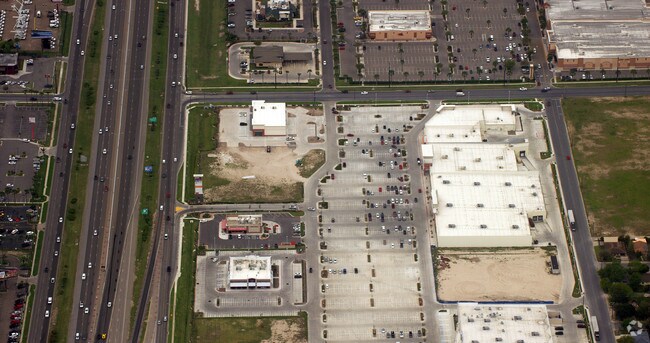
2808 W Expressway 83
McAllen/Edinburg/Pharr
Shops At 29 - Sml
McAllen-Edinburg-Mission, TX
SHOPS AT 29 LOT 2A
S3280-00-000-002A-00
Hidalgo
Commercialnec
Texas
2024
2a
2025
1.17 AC
020506
Greater McAllen
9,120 SF
DEMOGRAPHICS near 2808 W Expressway 83
1 Mile
3 Mile
5 Mile
2024 Total Population
11,135
86,227
209,520
2029 Population
11,621
91,501
222,426
Pop Growth 2024-2029
+ 4.36%
+ 6.12%
+ 6.16%
Average Age
38
37
37
2024 Total Households
3,686
29,180
70,909
HH Growth 2024-2029
+ 4.04%
+ 6.03%
+ 6.17%
Median Household Inc
$26,133
$42,242
$49,235
Avg Household Size
2.90
2.80
2.80
2024 Avg HH Vehicles
2.00
2.00
2.00
Median Home Value
$69,250
$144,505
$149,979
Median Year Built
1984
1992
1995
Nearby Places
Map Layers
Map Styles
 Street
 Aerial
- Restaurants
- Banks
- Shops
- Fitness
- Groceries
PUBLIC TRANSPORTATION
AIRPORT
McAllen International
DRIVE
WALK
Distance
McAllen International
7 min
2.3 mi
Freight Ports
Port of Brownsville
DRIVE
WALK
Distance
Port of Brownsville
71 min
62.3 mi
SALE & LEASE HISTORY
LISTING DATE
SALE/LEASE

Nov 04, 2024
For Lease
Nearby Properties
Address
Land Use
TOTAL SIZE
Lot Size
Zoning
Address
Land Use
TOTAL SIZE
Lot Size
Zoning
1,199,590 SF
47.93 AC
Address
Land Use
TOTAL SIZE
Lot Size
Zoning
430,216 SF
18.66 AC
CO
Address
Land Use
TOTAL SIZE
Lot Size
Zoning
347,628 SF
13.03 AC
CO
Address
Land Use
TOTAL SIZE
Lot Size
Zoning
291,859 SF
10.11 AC
CO
Address
Land Use
TOTAL SIZE
Lot Size
Zoning
165,620 SF
24.44 AC
Address
Land Use
TOTAL SIZE
Lot Size
Zoning
93,471 SF
12.66 AC
Address
Land Use
TOTAL SIZE
Lot Size
Zoning
18 SF
82.24 AC
Address
Land Use
TOTAL SIZE
Lot Size
Zoning
354,558 SF
26.79 AC
Address
Land Use
TOTAL SIZE
Lot Size
Zoning
263,388 SF
37.48 AC
Address
Land Use
TOTAL SIZE
Lot Size
Zoning
235,545 SF
40.51 AC
Address
Land Use
TOTAL SIZE
Lot Size
Zoning
191,978 SF
2.22 AC
Address
Land Use
TOTAL SIZE
Lot Size
Zoning
252,435 SF
9.09 AC
Address
Land Use
TOTAL SIZE
Lot Size
Zoning
216,315 SF
3.19 AC
CO
Address
Land Use
TOTAL SIZE
Lot Size
Zoning
208,941 SF
18.57 AC
Address
Land Use
TOTAL SIZE
Lot Size
Zoning
159,617 SF
5.38 AC
Address
Land Use
TOTAL SIZE
Lot Size
Zoning
105,440 SF
19.84 AC
Address
Land Use
TOTAL SIZE
Lot Size
Zoning
236,124 SF
14.03 AC
Address
Land Use
TOTAL SIZE
Lot Size
Zoning
287,691 SF
33.57 AC
Address
Land Use
TOTAL SIZE
Lot Size
Zoning
39,603 SF
3.95 AC
Address
Land Use
TOTAL SIZE
Lot Size
Zoning
115,998 SF
6.73 AC
Address
Land Use
TOTAL SIZE
Lot Size
Zoning
254,477 SF
51.88 AC
Address
Land Use
TOTAL SIZE
Lot Size
Zoning
79,150 SF
10.24 AC
Address
Land Use
TOTAL SIZE
Lot Size
Zoning
135,948 SF
2.87 AC
Address
Land Use
TOTAL SIZE
Lot Size
Zoning
84,335 SF
5.79 AC
CO
Address
Land Use
TOTAL SIZE
Lot Size
Zoning
3,000 SF
16 AC
Address
Land Use
TOTAL SIZE
Lot Size
Zoning
115,360 SF
4.70 AC
Address
Land Use
TOTAL SIZE
Lot Size
Zoning
73,507 SF
23.84 AC
Address
Land Use
TOTAL SIZE
Lot Size
Zoning
208,104 SF
15.65 AC
Address
Land Use
TOTAL SIZE
Lot Size
Zoning
156,516 SF
13.65 AC
Address
Land Use
TOTAL SIZE
Lot Size
Zoning
108,527 SF
1.49 AC
The World's #1 Commercial Real Estate Marketplace
Connect with us
© 2026 CoStar Group
The information above has been obtained from sources believed reliable. While we do not doubt its accuracy we have not verified it and make no guarantee, warranty or representation about it. It is your responsibility to independently confirm its accuracy and completeness. Any projections, opinions, assumptions, or estimates used are for example only and do not represent the current or future performance of the property. The value of this transaction to you depends on tax and other factors which should be evaluated by your tax, financial, and legal advisors. You and your advisors should conduct a careful, independent investigation of the property to determine to your satisfaction the suitability of the property for your needs.