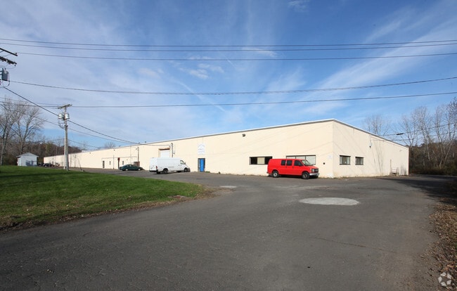
Property Record
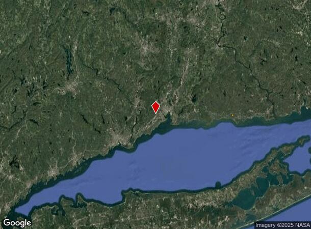
281 Dogburn Rd, West Haven, CT 06516
Current Lease Availabilities
NEARBY LISTINGS FOR SALE OR LEASE
Property Detail
281 Dogburn Rd
Commercialbuilding
New Haven
AE
Connecticut
09009C0436H
16.86 AC
2025
West Haven
2025
Westchester/So Connecticut
154102
New Haven-Milford, CT
190,085 SF
WHAV-000051-000001
DEMOGRAPHICS near 281 Dogburn Rd
1 Mile
3 Mile
5 Mile
2024 Total Population
8,308
90,348
214,139
2029 Population
8,254
89,223
212,172
Pop Growth 2024-2029
(0.65%)
(1.25%)
(0.92%)
Average Age
38
38
38
2024 Total Households
2,979
34,084
82,394
HH Growth 2024-2029
(0.84%)
(1.35%)
(0.92%)
Median Household Inc
$68,444
$65,859
$66,413
Avg Household Size
2.60
2.40
2.30
2024 Avg HH Vehicles
2.00
2.00
1.00
Median Home Value
$267,131
$253,941
$276,354
Median Year Built
1969
1955
1956
Nearby Places
- Restaurants
- Banks
- Shops
- Fitness
- Groceries
PUBLIC TRANSPORTATION
COMMUTER RAIL
West Haven (New Haven - Metro-North Railroad)
DRIVE
WALK
Distance
West Haven (New Haven - Metro-North Railroad)
5 min
2.2 mi
New Haven (New Haven - Metro-North Railroad)
DRIVE
WALK
Distance
New Haven (New Haven - Metro-North Railroad)
8 min
4.2 mi
AIRPORT
Tweed/New Haven
DRIVE
WALK
Distance
Tweed/New Haven
18 min
9.0 mi
Freight Ports
Port of New Haven
DRIVE
WALK
Distance
Port of New Haven
13 min
6.1 mi
Nearby Properties
Address
Land Use
TOTAL SIZE
Lot Size
Zoning
Address
Land Use
TOTAL SIZE
Lot Size
Zoning
289,886 SF
2.21 AC
BD2
Address
Land Use
TOTAL SIZE
Lot Size
Zoning
56,359 SF
17.09 AC
RCPD
Address
Land Use
TOTAL SIZE
Lot Size
Zoning
50.14 AC
PRD
Address
Land Use
TOTAL SIZE
Lot Size
Zoning
81,870 SF
3.86 AC
RM2
Address
Land Use
TOTAL SIZE
Lot Size
Zoning
302,262 SF
10.40 AC
RM1
Address
Land Use
TOTAL SIZE
Lot Size
Zoning
133,767 SF
1.25 AC
BD2
Address
Land Use
TOTAL SIZE
Lot Size
Zoning
72,708 SF
1.91 AC
PDU 87
Address
Land Use
TOTAL SIZE
Lot Size
Zoning
57,339 SF
3.46 AC
RM2
Address
Land Use
TOTAL SIZE
Lot Size
Zoning
75,139 SF
3.54 AC
RM1
Address
Land Use
TOTAL SIZE
Lot Size
Zoning
42.52 AC
PF
Address
Land Use
TOTAL SIZE
Lot Size
Zoning
287,844 SF
2.11 AC
IL
Address
Land Use
TOTAL SIZE
Lot Size
Zoning
158,622 SF
2.09 AC
BA/RM2
Address
Land Use
TOTAL SIZE
Lot Size
Zoning
29.78 AC
PRD
Address
Land Use
TOTAL SIZE
Lot Size
Zoning
76,945 SF
8.52 AC
RM2
Address
Land Use
TOTAL SIZE
Lot Size
Zoning
35.05 AC
LI-2
Address
Land Use
TOTAL SIZE
Lot Size
Zoning
840,277 SF
4.28 AC
BD2
Address
Land Use
TOTAL SIZE
Lot Size
Zoning
576 SF
RS2
Address
Land Use
TOTAL SIZE
Lot Size
Zoning
119,187 SF
1.38 AC
RO
Address
Land Use
TOTAL SIZE
Lot Size
Zoning
54,372 SF
2.42 AC
BD2
Address
Land Use
TOTAL SIZE
Lot Size
Zoning
125,676 SF
22.12 AC
BOP
Address
Land Use
TOTAL SIZE
Lot Size
Zoning
228,347 SF
0.66 AC
BA
Address
Land Use
TOTAL SIZE
Lot Size
Zoning
253,181 SF
1.86 AC
RH2
Address
Land Use
TOTAL SIZE
Lot Size
Zoning
26,560 SF
4.22 AC
RM2
Address
Land Use
TOTAL SIZE
Lot Size
Zoning
46,962 SF
1.48 AC
RM1/RS
Address
Land Use
TOTAL SIZE
Lot Size
Zoning
56,509 SF
1.07 AC
BA
Address
Land Use
TOTAL SIZE
Lot Size
Zoning
141,861 SF
1.62 AC
BD2
Address
Land Use
TOTAL SIZE
Lot Size
Zoning
63,304 SF
4.62 AC
RCPD
Address
Land Use
TOTAL SIZE
Lot Size
Zoning
140,931 SF
1.86 AC
RM2
Address
Land Use
TOTAL SIZE
Lot Size
Zoning
161,426 SF
4.79 AC
EFD
Address
Land Use
TOTAL SIZE
Lot Size
Zoning
93,849 SF
3.16 AC
RM1
The World's #1 Commercial Real Estate Marketplace
Connect with us
© 2025 CoStar Group
The information above has been obtained from sources believed reliable. While we do not doubt its accuracy we have not verified it and make no guarantee, warranty or representation about it. It is your responsibility to independently confirm its accuracy and completeness. Any projections, opinions, assumptions, or estimates used are for example only and do not represent the current or future performance of the property. The value of this transaction to you depends on tax and other factors which should be evaluated by your tax, financial, and legal advisors. You and your advisors should conduct a careful, independent investigation of the property to determine to your satisfaction the suitability of the property for your needs.