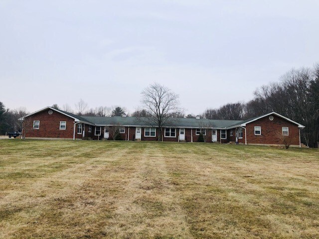
Property Record
281 Beaumont Hwy, Lebanon, CT 06249


NEARBY LISTINGS FOR SALE OR LEASE
-
-
View all Lebanon listings for sale on LoopNet.com
Property Detail
281 Beaumont Hwy
LEBA-000209-000000-000018
New London
Apartmenthouse5plusunits
Connecticut
X
18
09015C0325F
8.40 AC
2024
Northwest New London/Colchester
2025
Hartford
870100
Norwich-New London, CT
DEMOGRAPHICS near 281 Beaumont Hwy
1 Mile
3 Mile
5 Mile
2024 Total Population
402
19,898
35,905
2029 Population
396
19,886
35,856
Pop Growth 2024-2029
(1.49%)
(0.06%)
(0.14%)
Average Age
42
36
39
2024 Total Households
147
6,794
13,296
HH Growth 2024-2029
(1.36%)
(0.28%)
(0.26%)
Median Household Inc
$84,239
$51,888
$56,459
Avg Household Size
2.70
2.40
2.40
2024 Avg HH Vehicles
2.00
2.00
2.00
Median Home Value
$342,452
$189,378
$226,275
Median Year Built
1983
1955
1967
Nearby Places
Map Layers
Map Styles
 Street
 Aerial
- Restaurants
- Banks
- Shops
- Fitness
- Groceries
PUBLIC TRANSPORTATION
AIRPORT
Bradley International
DRIVE
WALK
Distance
Bradley International
70 min
44.5 mi
Freight Ports
Port of Davisville, RI
DRIVE
WALK
Distance
Port of Davisville, RI
89 min
63.8 mi
SALE & LEASE HISTORY
LISTING DATE
SALE/LEASE

Jan 18, 2021
For Sale
Nearby Properties
Address
Land Use
TOTAL SIZE
Lot Size
Zoning
Address
Land Use
TOTAL SIZE
Lot Size
Zoning
14.62 AC
B4
Address
Land Use
TOTAL SIZE
Lot Size
Zoning
33,366 SF
R6
Address
Land Use
TOTAL SIZE
Lot Size
Zoning
145,144 SF
R6
Address
Land Use
TOTAL SIZE
Lot Size
Zoning
111,757 SF
6.74 AC
RL
Address
Land Use
TOTAL SIZE
Lot Size
Zoning
90,450 SF
R6
Address
Land Use
TOTAL SIZE
Lot Size
Zoning
73,691 SF
R6
Address
Land Use
TOTAL SIZE
Lot Size
Zoning
99,139 SF
R6
Address
Land Use
TOTAL SIZE
Lot Size
Zoning
68,508 SF
R6
Address
Land Use
TOTAL SIZE
Lot Size
Zoning
316,812 SF
39.88 AC
R4
Address
Land Use
TOTAL SIZE
Lot Size
Zoning
57,648 SF
R6
Address
Land Use
TOTAL SIZE
Lot Size
Zoning
22.30 AC
RL
Address
Land Use
TOTAL SIZE
Lot Size
Zoning
28,231 SF
R6
Address
Land Use
TOTAL SIZE
Lot Size
Zoning
158,766 SF
3.91 AC
R6
Address
Land Use
TOTAL SIZE
Lot Size
Zoning
24,313 SF
R6
Address
Land Use
TOTAL SIZE
Lot Size
Zoning
63,224 SF
2.68 AC
R6
Address
Land Use
TOTAL SIZE
Lot Size
Zoning
300,483 SF
R6
Address
Land Use
TOTAL SIZE
Lot Size
Zoning
44,000 SF
R6
Address
Land Use
TOTAL SIZE
Lot Size
Zoning
3.50 AC
R6
Address
Land Use
TOTAL SIZE
Lot Size
Zoning
64,490 SF
R6
Address
Land Use
TOTAL SIZE
Lot Size
Zoning
14.12 AC
B2A
Address
Land Use
TOTAL SIZE
Lot Size
Zoning
58,264 SF
5.97 AC
B2A
Address
Land Use
TOTAL SIZE
Lot Size
Zoning
142 AC
R5 - 1
Address
Land Use
TOTAL SIZE
Lot Size
Zoning
40,897 SF
0.62 AC
R6
Address
Land Use
TOTAL SIZE
Lot Size
Zoning
37,665 SF
0.42 AC
B1
Address
Land Use
TOTAL SIZE
Lot Size
Zoning
34,087 SF
0.68 AC
B1
Address
Land Use
TOTAL SIZE
Lot Size
Zoning
71,976 SF
3.15 AC
R6
Address
Land Use
TOTAL SIZE
Lot Size
Zoning
223,296 SF
R6
Address
Land Use
TOTAL SIZE
Lot Size
Zoning
53.16 AC
M4
Address
Land Use
TOTAL SIZE
Lot Size
Zoning
36,560 SF
R6
Address
Land Use
TOTAL SIZE
Lot Size
Zoning
14.59 AC
R5
The World's #1 Commercial Real Estate Marketplace
Connect with us
© 2026 CoStar Group
The information above has been obtained from sources believed reliable. While we do not doubt its accuracy we have not verified it and make no guarantee, warranty or representation about it. It is your responsibility to independently confirm its accuracy and completeness. Any projections, opinions, assumptions, or estimates used are for example only and do not represent the current or future performance of the property. The value of this transaction to you depends on tax and other factors which should be evaluated by your tax, financial, and legal advisors. You and your advisors should conduct a careful, independent investigation of the property to determine to your satisfaction the suitability of the property for your needs.