Property Record
281 E Randolph Rd, Coolidge, AZ 85128

Property Detail
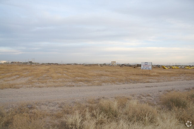
281 E Randolph Rd
401-30-002C
THE NW NW OF SEC 10-06S-08E EXC THE FOLLOWING: THE W-70.00 THEREO F AND THE N-40.00 OF THE E-1255.82 OF SAID SECTION LYING WESTERLY OF THE WEST LINE OF THE SPRR AND EXC APPROX THE S-382.32 OF THE E-100.00 LYING WEST OF THE SPRR, 33.83 AC
Lightindustrial
PINAL
B and X Area of moderate flood hazard, usually the area between the limits of the 100-year and 500-year floods.
Arizona
2024
33.83 AC
2025
Pinal County
001100
Phoenix
73,320 SF
Phoenix-Mesa-Chandler, AZ
NEARBY LISTINGS FOR SALE OR LEASE
-
-
View all Coolidge listings for sale on LoopNet.com
DEMOGRAPHICS near 281 E Randolph Rd
1 mile
3 mile
5 mile
2025 Total Population
171
2,713
18,921
2030 Population
205
3,234
22,544
Pop Growth 2025-2030
+ 19.88%
+ 19.20%
+ 19.15%
Average Age
47
42
38
2025 Total Households
70
1,035
6,412
HH Growth 2025-2030
+ 18.57%
+ 19.13%
+ 18.86%
Median Household Inc
$49,999
$52,241
$58,034
Avg Household Size
2.40
2.60
2.90
2025 Avg HH Vehicles
2.00
2.00
2.00
Median Home Value
$172,222
$128,000
$241,529
Median Year Built
1995
1992
1999
Nearby Places
Map Layers
Map Styles
 Street
 Aerial
Layers
 Traffic
 Biking
Places
Listings with unknown addresses are not visible on the map
- Restaurants
- Banks
- Shops
- Fitness
- Groceries
PUBLIC TRANSPORTATION
AIRPORT
Phoenix-Mesa Gateway
Drive
Walk
Distance
Phoenix-Mesa Gateway
59 min
35.2 mi
Freight Ports
Port of San Diego
Drive
Walk
Distance
Port of San Diego
395 min
365.8 mi
Nearby Properties
Address
Land Use
TOTAL SIZE
Lot Size
Zoning
Address
Land Use
TOTAL SIZE
Lot Size
Zoning
8,594 SF
37.10 AC
UNDESIGNAT
Address
Land Use
TOTAL SIZE
Lot Size
Zoning
41,042 SF
77.11 AC
UNDESIGNAT
Address
Land Use
TOTAL SIZE
Lot Size
Zoning
16,190 SF
4.81 AC
Address
Land Use
TOTAL SIZE
Lot Size
Zoning
1,690 SF
186.46 AC
UNDESIGNAT
Address
Land Use
TOTAL SIZE
Lot Size
Zoning
171.17 AC
UNDESIGNAT
Address
Land Use
TOTAL SIZE
Lot Size
Zoning
202 SF
20 AC
UNDESIGNAT
Address
Land Use
TOTAL SIZE
Lot Size
Zoning
9,231 SF
1.02 AC
Address
Land Use
TOTAL SIZE
Lot Size
Zoning
1,460 SF
79.76 AC
UNDESIGNAT
Address
Land Use
TOTAL SIZE
Lot Size
Zoning
120.50 AC
UNDESIGNAT
Address
Land Use
TOTAL SIZE
Lot Size
Zoning
14,650 SF
2.21 AC
UNDESIGNAT
Address
Land Use
TOTAL SIZE
Lot Size
Zoning
100.87 AC
UNDESIGNAT
Address
Land Use
TOTAL SIZE
Lot Size
Zoning
8,872 SF
105 AC
GR
Address
Land Use
TOTAL SIZE
Lot Size
Zoning
237.29 AC
UNDESIGNAT
Address
Land Use
TOTAL SIZE
Lot Size
Zoning
17,032 SF
1.62 AC
UNDESIGNAT
Address
Land Use
TOTAL SIZE
Lot Size
Zoning
28,300 SF
4.18 AC
CI1
Address
Land Use
TOTAL SIZE
Lot Size
Zoning
5,544 SF
0.87 AC
UNDESIGNAT
The World's #1 Commercial Real Estate Marketplace
Connect with us
© 2026 CoStar Group
The information above has been obtained from sources believed reliable. While we do not doubt its accuracy we have not verified it and make no guarantee, warranty or representation about it. It is your responsibility to independently confirm its accuracy and completeness. Any projections, opinions, assumptions, or estimates used are for example only and do not represent the current or future performance of the property. The value of this transaction to you depends on tax and other factors which should be evaluated by your tax, financial, and legal advisors. You and your advisors should conduct a careful, independent investigation of the property to determine to your satisfaction the suitability of the property for your needs.