Property Record
2810 Gause Blvd E, Slidell, LA 70461
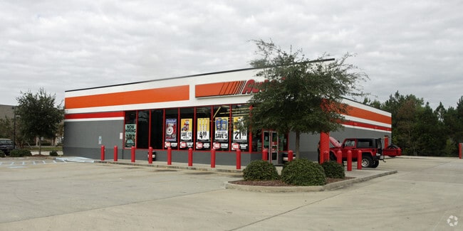

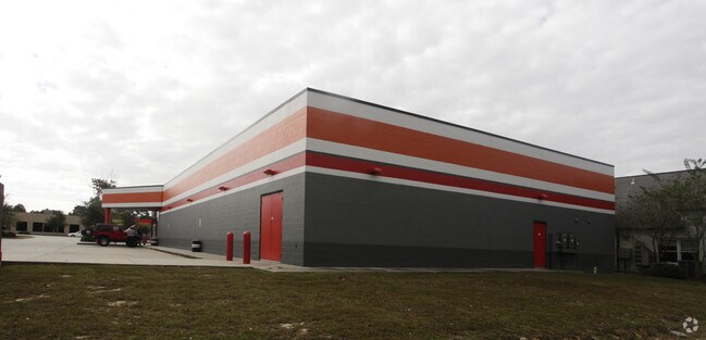
Property Detail
2810 Gause Blvd E
Slidell-Mandeville-Covington, LA
1.033 ACS SEC 38 9 15 INST NO 1001629 INST NO 1001666 INST NO 1548559 INST NO 1621917 INST NO 1864126
37901
Saint Tammany
Commercialnec
Louisiana
2025
1.03 AC
2025
Slidell
040709
New Orleans/Metairie/Kenner
7,360 SF
NEARBY LISTINGS FOR SALE OR LEASE
DEMOGRAPHICS near 2810 Gause Blvd E
1 mile
3 mile
5 mile
2025 Total Population
9,172
40,306
70,176
2030 Population
9,384
41,347
72,365
Pop Growth 2025-2030
+ 2.31%
+ 2.58%
+ 3.12%
Average Age
41
41
40
2025 Total Households
3,442
14,882
26,557
HH Growth 2025-2030
+ 2.30%
+ 2.59%
+ 3.17%
Median Household Inc
$95,274
$84,458
$70,651
Avg Household Size
2.60
2.60
2.60
2025 Avg HH Vehicles
2.00
2.00
2.00
Median Home Value
$273,990
$246,126
$236,009
Median Year Built
1991
1987
1988
Nearby Places
Map Layers
Map Styles
 Street
 Aerial
Transit
 Traffic
 Biking
Places
Listings with unknown addresses are not visible on the map
- Restaurants
- Banks
- Shops
- Fitness
- Groceries
SALE & LEASE HISTORY
LISTING DATE
SALE/LEASE

Aug 25, 2017
For Sale
Nearby Properties
Address
Land Use
TOTAL SIZE
Lot Size
Zoning
Address
Land Use
TOTAL SIZE
Lot Size
Zoning
318,479 SF
34.24 AC
Address
Land Use
TOTAL SIZE
Lot Size
Zoning
120,000 SF
6.75 AC
Address
Land Use
TOTAL SIZE
Lot Size
Zoning
104,000 SF
12.89 AC
Address
Land Use
TOTAL SIZE
Lot Size
Zoning
205,496 SF
27.47 AC
Address
Land Use
TOTAL SIZE
Lot Size
Zoning
151,281 SF
19.39 AC
Address
Land Use
TOTAL SIZE
Lot Size
Zoning
222,530 SF
40 AC
Address
Land Use
TOTAL SIZE
Lot Size
Zoning
85,000 SF
12.23 AC
Address
Land Use
TOTAL SIZE
Lot Size
Zoning
125,000 SF
10.84 AC
Address
Land Use
TOTAL SIZE
Lot Size
Zoning
197,221 SF
1.60 AC
Address
Land Use
TOTAL SIZE
Lot Size
Zoning
62,506 SF
Address
Land Use
TOTAL SIZE
Lot Size
Zoning
132,961 SF
12.06 AC
Address
Land Use
TOTAL SIZE
Lot Size
Zoning
123,155 SF
15 AC
Address
Land Use
TOTAL SIZE
Lot Size
Zoning
59,987 SF
4.29 AC
Address
Land Use
TOTAL SIZE
Lot Size
Zoning
116,081 SF
19.63 AC
Address
Land Use
TOTAL SIZE
Lot Size
Zoning
105,633 SF
11 AC
Address
Land Use
TOTAL SIZE
Lot Size
Zoning
104,821 SF
10.09 AC
Address
Land Use
TOTAL SIZE
Lot Size
Zoning
84,000 SF
10.84 AC
Address
Land Use
TOTAL SIZE
Lot Size
Zoning
115,568 SF
0.21 AC
Address
Land Use
TOTAL SIZE
Lot Size
Zoning
118,344 SF
Address
Land Use
TOTAL SIZE
Lot Size
Zoning
53,331 SF
1.75 AC
Address
Land Use
TOTAL SIZE
Lot Size
Zoning
104,702 SF
11.69 AC
Address
Land Use
TOTAL SIZE
Lot Size
Zoning
78,248 SF
4.78 AC
Address
Land Use
TOTAL SIZE
Lot Size
Zoning
144,674 SF
13.10 AC
Address
Land Use
TOTAL SIZE
Lot Size
Zoning
86,514 SF
10 AC
Address
Land Use
TOTAL SIZE
Lot Size
Zoning
49,091 SF
3.35 AC
Address
Land Use
TOTAL SIZE
Lot Size
Zoning
44,390 SF
1.69 AC
Address
Land Use
TOTAL SIZE
Lot Size
Zoning
91,149 SF
4.26 AC
Address
Land Use
TOTAL SIZE
Lot Size
Zoning
80,668 SF
7.65 AC
Address
Land Use
TOTAL SIZE
Lot Size
Zoning
41,588 SF
6.20 AC
Address
Land Use
TOTAL SIZE
Lot Size
Zoning
66,634 SF
14 AC
The World's #1 Commercial Real Estate Marketplace
Connect with us
© 2026 CoStar Group
The information above has been obtained from sources believed reliable. While we do not doubt its accuracy we have not verified it and make no guarantee, warranty or representation about it. It is your responsibility to independently confirm its accuracy and completeness. Any projections, opinions, assumptions, or estimates used are for example only and do not represent the current or future performance of the property. The value of this transaction to you depends on tax and other factors which should be evaluated by your tax, financial, and legal advisors. You and your advisors should conduct a careful, independent investigation of the property to determine to your satisfaction the suitability of the property for your needs.