Property Record
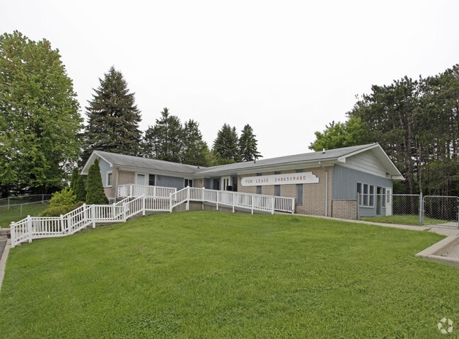
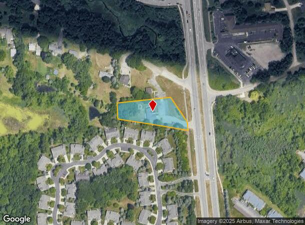
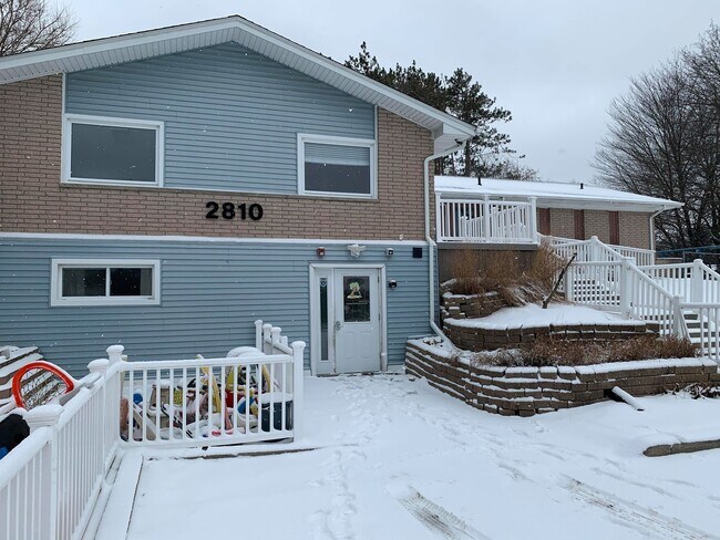
2810 S Lapeer Rd, Orion, MI 48360
Current Lease Availabilities
NEARBY LISTINGS FOR SALE OR LEASE
Property Detail
2810 S Lapeer Rd
09-23-351-009
T4N, R10E, SEC 23 PART OF E 1/2 OF SW 1/4 BEG AT PT DIST S 03-28-20 E 2190.55 FT & N 64-00-00 W 335.43 FT & S 31-58-00 E 194.96 FT FROM CEN OF SEC, TH S 85-04-30 W 311.95 FT, TH S 01-39-00 E 91.90 FT, TH S 79-51-00 E 408.70 FT, TH N 03-49-00 W 44.60
Daycare
Oakland
X
Michigan
26125C0376F
1.17 AC
2024
St Clair & Lapeer Counties
2024
Detroit
128400
Detroit-Warren-Dearborn, MI
2,314 SF
DEMOGRAPHICS near 2810 S Lapeer Rd
1 Mile
3 Mile
5 Mile
2024 Total Population
5,129
30,749
92,185
2029 Population
5,269
30,762
91,823
Pop Growth 2024-2029
+ 2.73%
+ 0.04%
(0.39%)
Average Age
38
40
40
2024 Total Households
1,956
11,682
34,768
HH Growth 2024-2029
+ 2.91%
+ 0.10%
(0.40%)
Median Household Inc
$96,153
$108,128
$102,169
Avg Household Size
2.60
2.60
2.50
2024 Avg HH Vehicles
2.00
2.00
2.00
Median Home Value
$367,516
$376,518
$370,982
Median Year Built
1998
1992
1988
Nearby Places
Map Layers
Map Styles
 Street
 Aerial
- Restaurants
- Banks
- Shops
- Fitness
- Groceries
PUBLIC TRANSPORTATION
COMMUTER RAIL
Pontiac Amtrak Station (Wolverine - Amtrak)
DRIVE
WALK
Distance
Pontiac Amtrak Station (Wolverine - Amtrak)
15 min
8.7 mi
AIRPORT
Bishop International
DRIVE
WALK
Distance
Bishop International
56 min
39.5 mi
Freight Ports
Port of Toledo
DRIVE
WALK
Distance
Port of Toledo
115 min
94.7 mi
Nearby Properties
Address
Land Use
TOTAL SIZE
Lot Size
Zoning
Address
Land Use
TOTAL SIZE
Lot Size
Zoning
6,255,758 SF
Address
Land Use
TOTAL SIZE
Lot Size
Zoning
527,000 SF
36.03 AC
Address
Land Use
TOTAL SIZE
Lot Size
Zoning
891,314 SF
60.90 AC
II
Address
Land Use
TOTAL SIZE
Lot Size
Zoning
6,255,758 SF
Address
Land Use
TOTAL SIZE
Lot Size
Zoning
6,255,758 SF
223.95 AC
Address
Land Use
TOTAL SIZE
Lot Size
Zoning
6,255,758 SF
233.05 AC
II
Address
Land Use
TOTAL SIZE
Lot Size
Zoning
246,150 SF
26.64 AC
TR
Address
Land Use
TOTAL SIZE
Lot Size
Zoning
247,500 SF
Address
Land Use
TOTAL SIZE
Lot Size
Zoning
179,510 SF
8.80 AC
Address
Land Use
TOTAL SIZE
Lot Size
Zoning
347,979 SF
58.38 AC
AI
Address
Land Use
TOTAL SIZE
Lot Size
Zoning
213,112 SF
12.17 AC
I1
Address
Land Use
TOTAL SIZE
Lot Size
Zoning
329,335 SF
17.40 AC
Address
Land Use
TOTAL SIZE
Lot Size
Zoning
455,045 SF
23.47 AC
I1
Address
Land Use
TOTAL SIZE
Lot Size
Zoning
173,974 SF
31.37 AC
TR
Address
Land Use
TOTAL SIZE
Lot Size
Zoning
158,978 SF
13.81 AC
Address
Land Use
TOTAL SIZE
Lot Size
Zoning
124,104 SF
Address
Land Use
TOTAL SIZE
Lot Size
Zoning
245,436 SF
39.08 AC
Address
Land Use
TOTAL SIZE
Lot Size
Zoning
133,546 SF
3.09 AC
BI
Address
Land Use
TOTAL SIZE
Lot Size
Zoning
172,412 SF
9.68 AC
I1
Address
Land Use
TOTAL SIZE
Lot Size
Zoning
104,020 SF
6.48 AC
I2
Address
Land Use
TOTAL SIZE
Lot Size
Zoning
125,108 SF
27.93 AC
I1
Address
Land Use
TOTAL SIZE
Lot Size
Zoning
245,436 SF
29.85 AC
Address
Land Use
TOTAL SIZE
Lot Size
Zoning
175,822 SF
8.08 AC
II
Address
Land Use
TOTAL SIZE
Lot Size
Zoning
183,920 SF
12.06 AC
I1
Address
Land Use
TOTAL SIZE
Lot Size
Zoning
144,889 SF
8.09 AC
Address
Land Use
TOTAL SIZE
Lot Size
Zoning
280,000 SF
40.08 AC
R1
Address
Land Use
TOTAL SIZE
Lot Size
Zoning
72,591 SF
21.60 AC
TR
Address
Land Use
TOTAL SIZE
Lot Size
Zoning
166,200 SF
10.35 AC
I1
Address
Land Use
TOTAL SIZE
Lot Size
Zoning
272,879 SF
Address
Land Use
TOTAL SIZE
Lot Size
Zoning
121,830 SF
9 AC
II
The World's #1 Commercial Real Estate Marketplace
Connect with us
© 2025 CoStar Group
The information above has been obtained from sources believed reliable. While we do not doubt its accuracy we have not verified it and make no guarantee, warranty or representation about it. It is your responsibility to independently confirm its accuracy and completeness. Any projections, opinions, assumptions, or estimates used are for example only and do not represent the current or future performance of the property. The value of this transaction to you depends on tax and other factors which should be evaluated by your tax, financial, and legal advisors. You and your advisors should conduct a careful, independent investigation of the property to determine to your satisfaction the suitability of the property for your needs.