Property Record
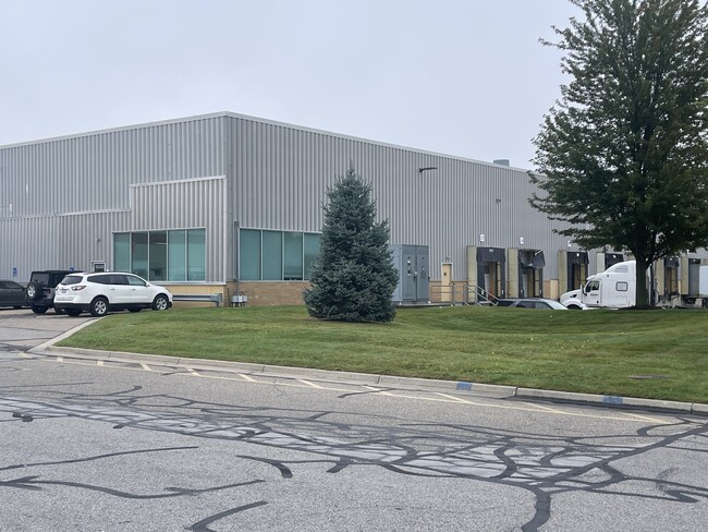
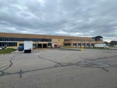
28450 Plymouth Rd, Livonia, MI 48150
Current Lease Availabilities
NEARBY LISTINGS FOR SALE OR LEASE
Property Detail
28450 Plymouth Rd
Detroit-Warren-Dearborn, MI
PT OF THE S 1/2 SEC 25 T1S R9E DESC AS BEG AT A PT DIST S 89D 41M 00S E 2017.95 FT AND N 00D 21M 50S E 2362.05 FT FROM SW COR
46-099-99-0151-002
Wayne
Industrialgeneral
Michigan
X
0151
26163C0227E
2.31 AC
2024
Livonia
2025
Detroit
558301
DEMOGRAPHICS near 28450 Plymouth Rd
1 Mile
3 Mile
5 Mile
2024 Total Population
7,879
96,898
291,092
2029 Population
7,521
92,850
280,528
Pop Growth 2024-2029
(4.54%)
(4.18%)
(3.63%)
Average Age
40
41
40
2024 Total Households
3,156
39,295
117,055
HH Growth 2024-2029
(4.56%)
(4.22%)
(3.71%)
Median Household Inc
$79,820
$70,756
$61,690
Avg Household Size
2.40
2.40
2.40
2024 Avg HH Vehicles
2.00
2.00
2.00
Median Home Value
$152,029
$166,423
$167,205
Median Year Built
1954
1956
1957
Nearby Places
- Restaurants
- Banks
- Shops
- Fitness
- Groceries
PUBLIC TRANSPORTATION
AIRPORT
Detroit Metro Wayne County
DRIVE
WALK
Distance
Detroit Metro Wayne County
33 min
15.3 mi
Windsor International
DRIVE
WALK
Distance
Windsor International
45 min
27.1 mi
Freight Ports
Port of Toledo
DRIVE
WALK
Distance
Port of Toledo
84 min
67.6 mi
Nearby Properties
Address
Land Use
TOTAL SIZE
Lot Size
Zoning
Address
Land Use
TOTAL SIZE
Lot Size
Zoning
1,316,911 SF
72.87 AC
M-1
Address
Land Use
TOTAL SIZE
Lot Size
Zoning
1,071,675 SF
59.61 AC
M-2
Address
Land Use
TOTAL SIZE
Lot Size
Zoning
335,133 SF
22.08 AC
Address
Land Use
TOTAL SIZE
Lot Size
Zoning
909,159 SF
55.33 AC
M-2
Address
Land Use
TOTAL SIZE
Lot Size
Zoning
199,485 SF
10.31 AC
R-9
Address
Land Use
TOTAL SIZE
Lot Size
Zoning
1,156,275 SF
75.88 AC
M-2
Address
Land Use
TOTAL SIZE
Lot Size
Zoning
85.45 AC
Address
Land Use
TOTAL SIZE
Lot Size
Zoning
1,013,885 SF
36.48 AC
M-1
Address
Land Use
TOTAL SIZE
Lot Size
Zoning
176,396 SF
11.76 AC
Address
Land Use
TOTAL SIZE
Lot Size
Zoning
188,958 SF
7.71 AC
Address
Land Use
TOTAL SIZE
Lot Size
Zoning
206,130 SF
14.12 AC
Address
Land Use
TOTAL SIZE
Lot Size
Zoning
399,770 SF
34.90 AC
M-2
Address
Land Use
TOTAL SIZE
Lot Size
Zoning
Address
Land Use
TOTAL SIZE
Lot Size
Zoning
121,420 SF
16.01 AC
C-2
Address
Land Use
TOTAL SIZE
Lot Size
Zoning
197,774 SF
11.72 AC
Address
Land Use
TOTAL SIZE
Lot Size
Zoning
835,383 SF
36.85 AC
Address
Land Use
TOTAL SIZE
Lot Size
Zoning
137,490 SF
12.16 AC
C-2
Address
Land Use
TOTAL SIZE
Lot Size
Zoning
1,529,287 SF
76.96 AC
M-1
Address
Land Use
TOTAL SIZE
Lot Size
Zoning
205,368 SF
20.22 AC
C-2
Address
Land Use
TOTAL SIZE
Lot Size
Zoning
216,268 SF
23.58 AC
C-2
Address
Land Use
TOTAL SIZE
Lot Size
Zoning
282,088 SF
14.34 AC
M-2
Address
Land Use
TOTAL SIZE
Lot Size
Zoning
102,089 SF
10.94 AC
C-2
Address
Land Use
TOTAL SIZE
Lot Size
Zoning
167,562 SF
9.25 AC
R5
Address
Land Use
TOTAL SIZE
Lot Size
Zoning
151,605 SF
14.66 AC
C-2
Address
Land Use
TOTAL SIZE
Lot Size
Zoning
286,524 SF
16.58 AC
Address
Land Use
TOTAL SIZE
Lot Size
Zoning
244,838 SF
8.93 AC
M-1
Address
Land Use
TOTAL SIZE
Lot Size
Zoning
182,700 SF
20.45 AC
C-2
Address
Land Use
TOTAL SIZE
Lot Size
Zoning
129,975 SF
6.89 AC
R5
Address
Land Use
TOTAL SIZE
Lot Size
Zoning
57,739 SF
1.71 AC
Address
Land Use
TOTAL SIZE
Lot Size
Zoning
115,215 SF
8.83 AC
C-2
The World's #1 Commercial Real Estate Marketplace
Connect with us
© 2025 CoStar Group
The information above has been obtained from sources believed reliable. While we do not doubt its accuracy we have not verified it and make no guarantee, warranty or representation about it. It is your responsibility to independently confirm its accuracy and completeness. Any projections, opinions, assumptions, or estimates used are for example only and do not represent the current or future performance of the property. The value of this transaction to you depends on tax and other factors which should be evaluated by your tax, financial, and legal advisors. You and your advisors should conduct a careful, independent investigation of the property to determine to your satisfaction the suitability of the property for your needs.