Property Record
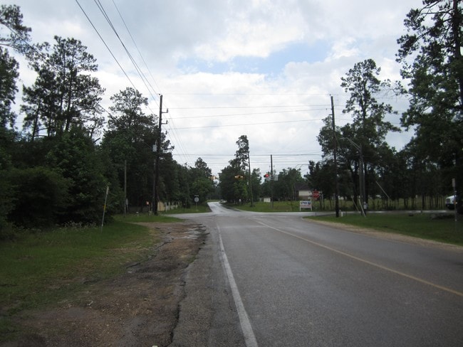
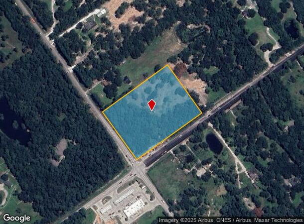
28105 Hardin Store Rd, Magnolia, TX 77354
NEARBY LISTINGS FOR SALE OR LEASE
Property Detail
28105 Hardin Store Rd
Houston-Pasadena-The Woodlands, TX
Ascot Farms 01
2195-01-03400
S219501 - ASCOT FARMS 01, BLOCK RESERVE A, ACRES 5
Commercialnec
Montgomery
X
Texas
48339C0515G
5 AC
2024
Outlying Montgomery Cnty
2025
Houston
690407
DEMOGRAPHICS near 28105 Hardin Store Rd
1 Mile
3 Mile
5 Mile
2024 Total Population
2,559
29,226
97,126
2029 Population
3,227
35,811
113,182
Pop Growth 2024-2029
+ 26.10%
+ 22.53%
+ 16.53%
Average Age
38
37
37
2024 Total Households
825
9,837
32,370
HH Growth 2024-2029
+ 26.42%
+ 22.58%
+ 16.51%
Median Household Inc
$88,602
$110,504
$127,620
Avg Household Size
2.90
2.90
2.90
2024 Avg HH Vehicles
2.00
2.00
2.00
Median Home Value
$274,385
$378,354
$411,164
Median Year Built
2007
2007
2007
Nearby Places
Map Layers
Map Styles
 Street
 Aerial
- Restaurants
- Banks
- Shops
- Fitness
- Groceries
PUBLIC TRANSPORTATION
AIRPORT
George Bush Intcntl/Houston
DRIVE
WALK
Distance
George Bush Intcntl/Houston
43 min
33.3 mi
Freight Ports
Port of Houston
DRIVE
WALK
Distance
Port of Houston
66 min
44.7 mi
SALE & LEASE HISTORY
LISTING DATE
SALE/LEASE

Feb 10, 2017
For Sale
Nearby Properties
Address
Land Use
TOTAL SIZE
Lot Size
Zoning
Address
Land Use
TOTAL SIZE
Lot Size
Zoning
461,345 SF
28.36 AC
Address
Land Use
TOTAL SIZE
Lot Size
Zoning
370,029 SF
16.12 AC
Address
Land Use
TOTAL SIZE
Lot Size
Zoning
361,747 SF
16.71 AC
Address
Land Use
TOTAL SIZE
Lot Size
Zoning
194,272 SF
11.06 AC
Address
Land Use
TOTAL SIZE
Lot Size
Zoning
211,965 SF
25.17 AC
Address
Land Use
TOTAL SIZE
Lot Size
Zoning
1,440 SF
126.83 AC
2
Address
Land Use
TOTAL SIZE
Lot Size
Zoning
105,005 SF
2.84 AC
Address
Land Use
TOTAL SIZE
Lot Size
Zoning
116,619 SF
14 AC
Address
Land Use
TOTAL SIZE
Lot Size
Zoning
118,359 SF
14.15 AC
Address
Land Use
TOTAL SIZE
Lot Size
Zoning
43,510 SF
5.63 AC
Address
Land Use
TOTAL SIZE
Lot Size
Zoning
31,689 SF
5.24 AC
Address
Land Use
TOTAL SIZE
Lot Size
Zoning
112,014 SF
9.56 AC
Address
Land Use
TOTAL SIZE
Lot Size
Zoning
43,105 SF
51.54 AC
2
Address
Land Use
TOTAL SIZE
Lot Size
Zoning
87,278 SF
2.65 AC
I2
Address
Land Use
TOTAL SIZE
Lot Size
Zoning
96,968 SF
10.05 AC
2
Address
Land Use
TOTAL SIZE
Lot Size
Zoning
90,222 SF
15 AC
Address
Land Use
TOTAL SIZE
Lot Size
Zoning
66,252 SF
12.28 AC
2
Address
Land Use
TOTAL SIZE
Lot Size
Zoning
16,260 SF
3.24 AC
2
Address
Land Use
TOTAL SIZE
Lot Size
Zoning
18,800 SF
2.28 AC
Address
Land Use
TOTAL SIZE
Lot Size
Zoning
24,080 SF
5.09 AC
2
Address
Land Use
TOTAL SIZE
Lot Size
Zoning
14,605 SF
2.35 AC
Address
Land Use
TOTAL SIZE
Lot Size
Zoning
16,463 SF
2.45 AC
Address
Land Use
TOTAL SIZE
Lot Size
Zoning
25,438 SF
3.09 AC
Address
Land Use
TOTAL SIZE
Lot Size
Zoning
8,086 SF
1.30 AC
Address
Land Use
TOTAL SIZE
Lot Size
Zoning
33,510 SF
5.16 AC
Address
Land Use
TOTAL SIZE
Lot Size
Zoning
50,402 SF
13.57 AC
2
Address
Land Use
TOTAL SIZE
Lot Size
Zoning
5,612 SF
1.48 AC
Address
Land Use
TOTAL SIZE
Lot Size
Zoning
6,700 SF
2.06 AC
Address
Land Use
TOTAL SIZE
Lot Size
Zoning
13,280 SF
4 AC
Address
Land Use
TOTAL SIZE
Lot Size
Zoning
8,976 SF
5.03 AC
The World's #1 Commercial Real Estate Marketplace
Connect with us
© 2026 CoStar Group
The information above has been obtained from sources believed reliable. While we do not doubt its accuracy we have not verified it and make no guarantee, warranty or representation about it. It is your responsibility to independently confirm its accuracy and completeness. Any projections, opinions, assumptions, or estimates used are for example only and do not represent the current or future performance of the property. The value of this transaction to you depends on tax and other factors which should be evaluated by your tax, financial, and legal advisors. You and your advisors should conduct a careful, independent investigation of the property to determine to your satisfaction the suitability of the property for your needs.