Property Record
2811 E Central Ave, Bentonville, AR 72712
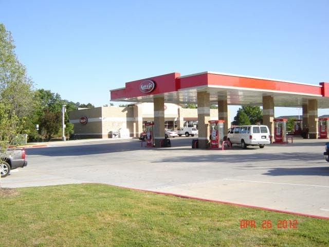

Property Detail
2811 E Central Ave
Fayetteville-Springdale-Rogers, AR
REPLAT 2010-364 & 365 8/30/2010
01-05119-000
Benton
Storebuilding
Arkansas
B and X Area of moderate flood hazard, usually the area between the limits of the 100-year and 500-year floods.
3
2025
2.07 AC
2025
Bentonville
020501
Fayetteville/Springdale/Rogers
5,106 SF
NEARBY LISTINGS FOR SALE OR LEASE
DEMOGRAPHICS near 2811 E Central Ave
1 mile
3 mile
5 mile
2025 Total Population
4,837
38,702
101,803
2030 Population
5,429
42,742
112,405
Pop Growth 2025-2030
+ 12.24%
+ 10.44%
+ 10.41%
Average Age
37
37
37
2025 Total Households
1,815
15,224
38,943
HH Growth 2025-2030
+ 12.56%
+ 10.81%
+ 10.82%
Median Household Inc
$94,428
$89,845
$92,349
Avg Household Size
2.60
2.50
2.50
2025 Avg HH Vehicles
2.00
2.00
2.00
Median Home Value
$440,113
$413,392
$370,672
Median Year Built
2005
1995
1998
Nearby Places
Map Layers
Map Styles
 Street
 Aerial
Layers
 Traffic
 Biking
Places
Listings with unknown addresses are not visible on the map
- Restaurants
- Banks
- Shops
- Fitness
- Groceries
PUBLIC TRANSPORTATION
AIRPORT
Northwest Arkansas Ntl
Drive
Walk
Distance
Northwest Arkansas Ntl
29 min
14.9 mi
Nearby Properties
Address
Land Use
TOTAL SIZE
Lot Size
Zoning
Address
Land Use
TOTAL SIZE
Lot Size
Zoning
552,541 SF
26.92 AC
Address
Land Use
TOTAL SIZE
Lot Size
Zoning
147,199 SF
16.11 AC
Address
Land Use
TOTAL SIZE
Lot Size
Zoning
344,315 SF
12.74 AC
Address
Land Use
TOTAL SIZE
Lot Size
Zoning
216,538 SF
22.14 AC
Address
Land Use
TOTAL SIZE
Lot Size
Zoning
149,727 SF
1.32 AC
Address
Land Use
TOTAL SIZE
Lot Size
Zoning
675,465 SF
37.34 AC
Address
Land Use
TOTAL SIZE
Lot Size
Zoning
381,924 SF
10.23 AC
Address
Land Use
TOTAL SIZE
Lot Size
Zoning
546,195 SF
15.80 AC
Address
Land Use
TOTAL SIZE
Lot Size
Zoning
187,529 SF
37.78 AC
Address
Land Use
TOTAL SIZE
Lot Size
Zoning
247,292 SF
1.57 AC
Address
Land Use
TOTAL SIZE
Lot Size
Zoning
746,783 SF
77.03 AC
Address
Land Use
TOTAL SIZE
Lot Size
Zoning
208,865 SF
7.73 AC
Address
Land Use
TOTAL SIZE
Lot Size
Zoning
418,411 SF
26.88 AC
Address
Land Use
TOTAL SIZE
Lot Size
Zoning
256,469 SF
3.18 AC
Address
Land Use
TOTAL SIZE
Lot Size
Zoning
6,545 SF
29.19 AC
Address
Land Use
TOTAL SIZE
Lot Size
Zoning
97,660 SF
5.35 AC
Address
Land Use
TOTAL SIZE
Lot Size
Zoning
543,020 SF
9.15 AC
Address
Land Use
TOTAL SIZE
Lot Size
Zoning
39,047 SF
1.43 AC
Address
Land Use
TOTAL SIZE
Lot Size
Zoning
264,824 SF
17.24 AC
Address
Land Use
TOTAL SIZE
Lot Size
Zoning
64,098 SF
2.17 AC
Address
Land Use
TOTAL SIZE
Lot Size
Zoning
213,552 SF
20.20 AC
Address
Land Use
TOTAL SIZE
Lot Size
Zoning
18,413 SF
0.68 AC
Address
Land Use
TOTAL SIZE
Lot Size
Zoning
176,035 SF
1.48 AC
Address
Land Use
TOTAL SIZE
Lot Size
Zoning
118,875 SF
5.06 AC
Address
Land Use
TOTAL SIZE
Lot Size
Zoning
249,843 SF
19.21 AC
Address
Land Use
TOTAL SIZE
Lot Size
Zoning
239,145 SF
32.91 AC
Address
Land Use
TOTAL SIZE
Lot Size
Zoning
170,184 SF
10.51 AC
Address
Land Use
TOTAL SIZE
Lot Size
Zoning
161,358 SF
12.23 AC
Address
Land Use
TOTAL SIZE
Lot Size
Zoning
31.21 AC
Address
Land Use
TOTAL SIZE
Lot Size
Zoning
152,197 SF
9.99 AC
The World's #1 Commercial Real Estate Marketplace
Connect with us
© 2026 CoStar Group
The information above has been obtained from sources believed reliable. While we do not doubt its accuracy we have not verified it and make no guarantee, warranty or representation about it. It is your responsibility to independently confirm its accuracy and completeness. Any projections, opinions, assumptions, or estimates used are for example only and do not represent the current or future performance of the property. The value of this transaction to you depends on tax and other factors which should be evaluated by your tax, financial, and legal advisors. You and your advisors should conduct a careful, independent investigation of the property to determine to your satisfaction the suitability of the property for your needs.