Property Record
2811 Hamby Cir, Chattanooga, TN 37421


Property Detail
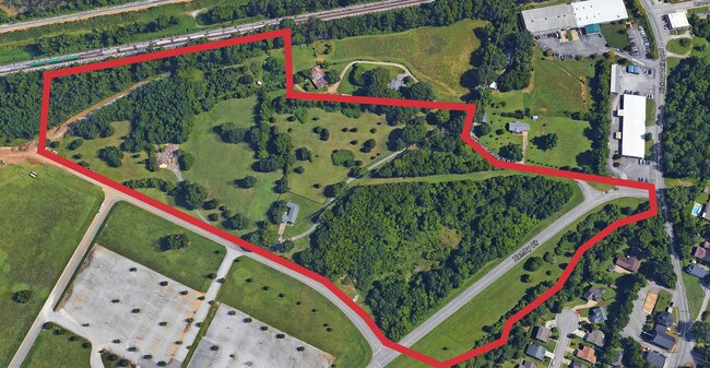
2811 Hamby Cir
138E-A-001.05
THOROUGHBRED RUN OFF HICKORY VALLEY ROAD WELLINGTON DOWNS 366 TOTAL UNITS INCLUDES THE 14 CARRIAGE UNITS ABOVE THE GARAGES (4
Multifamilydwelling
Hamilton
R1
Tennessee
B and X Area of moderate flood hazard, usually the area between the limits of the 100-year and 500-year floods.
26.14 AC
2025
Outlying Chattanooga
2025
Chattanooga
011449
Chattanooga, TN-GA
402,862 SF
NEARBY LISTINGS FOR SALE OR LEASE
DEMOGRAPHICS near 2811 Hamby Cir
1 mile
3 mile
5 mile
2025 Total Population
3,302
35,076
99,788
2030 Population
3,426
36,806
104,606
Pop Growth 2025-2030
+ 3.76%
+ 4.93%
+ 4.83%
Average Age
43
42
42
2025 Total Households
1,406
15,024
41,382
HH Growth 2025-2030
+ 4.05%
+ 5.19%
+ 5.03%
Median Household Inc
$69,797
$69,314
$73,350
Avg Household Size
2.20
2.20
2.30
2025 Avg HH Vehicles
2.00
2.00
2.00
Median Home Value
$292,651
$288,433
$305,007
Median Year Built
1981
1986
1984
Nearby Places
Map Layers
Map Styles
 Street
 Aerial
Layers
 Traffic
 Biking
Places
Listings with unknown addresses are not visible on the map
- Restaurants
- Banks
- Shops
- Fitness
- Groceries
PUBLIC TRANSPORTATION
AIRPORT
Lovell Field
Drive
Walk
Distance
Lovell Field
15 min
6.1 mi
SALE & LEASE HISTORY
LISTING DATE
SALE/LEASE

Aug 31, 2017
For Sale
Nearby Properties
Address
Land Use
TOTAL SIZE
Lot Size
Zoning
Address
Land Use
TOTAL SIZE
Lot Size
Zoning
2,025,141 SF
1,096 AC
M1
Address
Land Use
TOTAL SIZE
Lot Size
Zoning
831.19 AC
M1
Address
Land Use
TOTAL SIZE
Lot Size
Zoning
0.06 AC
M1
Address
Land Use
TOTAL SIZE
Lot Size
Zoning
523,520 SF
12.03 AC
M1
Address
Land Use
TOTAL SIZE
Lot Size
Zoning
213,416 SF
56.75 AC
Address
Land Use
TOTAL SIZE
Lot Size
Zoning
440,611 SF
27.46 AC
C2
Address
Land Use
TOTAL SIZE
Lot Size
Zoning
292,309 SF
45.28 AC
M1
Address
Land Use
TOTAL SIZE
Lot Size
Zoning
1,015,740 SF
83.82 AC
M1
Address
Land Use
TOTAL SIZE
Lot Size
Zoning
117,007 SF
23.87 AC
R4
Address
Land Use
TOTAL SIZE
Lot Size
Zoning
333,801 SF
15.44 AC
C2
Address
Land Use
TOTAL SIZE
Lot Size
Zoning
242,788 SF
27 AC
Address
Land Use
TOTAL SIZE
Lot Size
Zoning
4,418 SF
18.01 AC
R3
Address
Land Use
TOTAL SIZE
Lot Size
Zoning
320,068 SF
42.83 AC
R4
Address
Land Use
TOTAL SIZE
Lot Size
Zoning
23,078 SF
14.41 AC
R4
Address
Land Use
TOTAL SIZE
Lot Size
Zoning
333,768 SF
15.38 AC
C4
Address
Land Use
TOTAL SIZE
Lot Size
Zoning
43,576 SF
6.66 AC
C2
Address
Land Use
TOTAL SIZE
Lot Size
Zoning
25,462 SF
16.20 AC
R1
Address
Land Use
TOTAL SIZE
Lot Size
Zoning
3,472 SF
14.01 AC
Address
Land Use
TOTAL SIZE
Lot Size
Zoning
97,000 SF
18.78 AC
Address
Land Use
TOTAL SIZE
Lot Size
Zoning
23,124 SF
27.23 AC
A
Address
Land Use
TOTAL SIZE
Lot Size
Zoning
25,165 SF
21.90 AC
Address
Land Use
TOTAL SIZE
Lot Size
Zoning
102,382 SF
29.80 AC
M2
Address
Land Use
TOTAL SIZE
Lot Size
Zoning
99,202 SF
17.32 AC
Address
Land Use
TOTAL SIZE
Lot Size
Zoning
129,710 SF
4.55 AC
R1
Address
Land Use
TOTAL SIZE
Lot Size
Zoning
291,314 SF
29.69 AC
M1
Address
Land Use
TOTAL SIZE
Lot Size
Zoning
82,000 SF
22.45 AC
M1
Address
Land Use
TOTAL SIZE
Lot Size
Zoning
201,276 SF
15.30 AC
R3
Address
Land Use
TOTAL SIZE
Lot Size
Zoning
49,857 SF
1.93 AC
R1
Address
Land Use
TOTAL SIZE
Lot Size
Zoning
50,506 SF
5.14 AC
MD
The World's #1 Commercial Real Estate Marketplace
Connect with us
© 2026 CoStar Group
The information above has been obtained from sources believed reliable. While we do not doubt its accuracy we have not verified it and make no guarantee, warranty or representation about it. It is your responsibility to independently confirm its accuracy and completeness. Any projections, opinions, assumptions, or estimates used are for example only and do not represent the current or future performance of the property. The value of this transaction to you depends on tax and other factors which should be evaluated by your tax, financial, and legal advisors. You and your advisors should conduct a careful, independent investigation of the property to determine to your satisfaction the suitability of the property for your needs.