Property Record
2811 Hebron Ave, Glastonbury, CT 06033


NEARBY LISTINGS FOR SALE OR LEASE
-
-
View all Glastonbury listings for sale on LoopNet.com
Property Detail
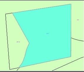
2811 Hebron Ave
GLAS-000005M-002920-N000086B
Hartford
Commercialnec
Connecticut
X
n0086b
09003C0553F
6.07 AC
2025
Glastonbury
2025
Hartford
520201
Hartford-West Hartford-East Hartford, CT
DEMOGRAPHICS near 2811 Hebron Ave
1 Mile
3 Mile
5 Mile
2024 Total Population
552
10,325
58,844
2029 Population
549
10,266
58,519
Pop Growth 2024-2029
(0.54%)
(0.57%)
(0.55%)
Average Age
40
42
42
2024 Total Households
180
3,635
22,892
HH Growth 2024-2029
(0.56%)
(0.61%)
(0.65%)
Median Household Inc
$195,832
$151,085
$105,732
Avg Household Size
3.00
2.80
2.50
2024 Avg HH Vehicles
3.00
2.00
2.00
Median Home Value
$497,221
$400,470
$317,137
Median Year Built
1986
1977
1967
Nearby Places
Map Layers
Map Styles
 Street
 Aerial
- Restaurants
- Banks
- Shops
- Fitness
- Groceries
PUBLIC TRANSPORTATION
AIRPORT
Bradley International
DRIVE
WALK
Distance
Bradley International
49 min
28.1 mi
Freight Ports
Port of New Haven
DRIVE
WALK
Distance
Port of New Haven
62 min
44.1 mi
Nearby Properties
Address
Land Use
TOTAL SIZE
Lot Size
Zoning
Address
Land Use
TOTAL SIZE
Lot Size
Zoning
110,628 SF
28.81 AC
RR
Address
Land Use
TOTAL SIZE
Lot Size
Zoning
32,137 SF
11.95 AC
RR
Address
Land Use
TOTAL SIZE
Lot Size
Zoning
Address
Land Use
TOTAL SIZE
Lot Size
Zoning
6.73 AC
Address
Land Use
TOTAL SIZE
Lot Size
Zoning
42,622 SF
11.50 AC
Address
Land Use
TOTAL SIZE
Lot Size
Zoning
263.89 AC
RR
Address
Land Use
TOTAL SIZE
Lot Size
Zoning
268.71 AC
RR
Address
Land Use
TOTAL SIZE
Lot Size
Zoning
1,104.50 AC
RL
Address
Land Use
TOTAL SIZE
Lot Size
Zoning
924 SF
9.08 AC
RR
Address
Land Use
TOTAL SIZE
Lot Size
Zoning
8,400 SF
75.48 AC
Address
Land Use
TOTAL SIZE
Lot Size
Zoning
6.85 AC
PBD
Address
Land Use
TOTAL SIZE
Lot Size
Zoning
156.99 AC
RR
Address
Land Use
TOTAL SIZE
Lot Size
Zoning
6.41 AC
RR
Address
Land Use
TOTAL SIZE
Lot Size
Zoning
75 AC
RR
Address
Land Use
TOTAL SIZE
Lot Size
Zoning
131.14 AC
RR
Address
Land Use
TOTAL SIZE
Lot Size
Zoning
2,168 SF
1.02 AC
PBD
Address
Land Use
TOTAL SIZE
Lot Size
Zoning
11,484 SF
13.20 AC
NB
Address
Land Use
TOTAL SIZE
Lot Size
Zoning
4,436 SF
4.66 AC
R
Address
Land Use
TOTAL SIZE
Lot Size
Zoning
108.76 AC
RR
Address
Land Use
TOTAL SIZE
Lot Size
Zoning
2,200 SF
44.15 AC
PAD
Address
Land Use
TOTAL SIZE
Lot Size
Zoning
217.83 AC
R
Address
Land Use
TOTAL SIZE
Lot Size
Zoning
11.54 AC
RR
Address
Land Use
TOTAL SIZE
Lot Size
Zoning
64.25 AC
CR
Address
Land Use
TOTAL SIZE
Lot Size
Zoning
Address
Land Use
TOTAL SIZE
Lot Size
Zoning
Address
Land Use
TOTAL SIZE
Lot Size
Zoning
57,951 SF
6.70 AC
Address
Land Use
TOTAL SIZE
Lot Size
Zoning
49.22 AC
Address
Land Use
TOTAL SIZE
Lot Size
Zoning
29.49 AC
RR
Address
Land Use
TOTAL SIZE
Lot Size
Zoning
77.37 AC
CR
The World's #1 Commercial Real Estate Marketplace
Connect with us
© 2025 CoStar Group
The information above has been obtained from sources believed reliable. While we do not doubt its accuracy we have not verified it and make no guarantee, warranty or representation about it. It is your responsibility to independently confirm its accuracy and completeness. Any projections, opinions, assumptions, or estimates used are for example only and do not represent the current or future performance of the property. The value of this transaction to you depends on tax and other factors which should be evaluated by your tax, financial, and legal advisors. You and your advisors should conduct a careful, independent investigation of the property to determine to your satisfaction the suitability of the property for your needs.