Property Record
2811 Observation Dr, San Antonio, TX 78227


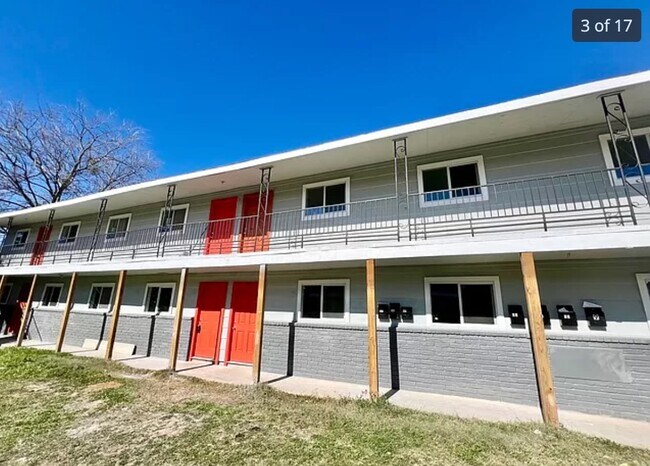
Property Detail
2811 Observation Dr
San Antonio-New Braunfels, TX
NCB 15509 BLK 7 LOT N 60 FT OF 2
15509-007-0021
Bexar
Multifamilydwelling
Texas
B and X Area of moderate flood hazard, usually the area between the limits of the 100-year and 500-year floods.
21
2025
0.22 AC
2025
Lackland Terrace
171802
San Antonio
5,800 SF
NEARBY LISTINGS FOR SALE OR LEASE
DEMOGRAPHICS near 2811 Observation Dr
1 mile
3 mile
5 mile
2025 Total Population
16,886
119,028
272,082
2030 Population
17,849
126,957
287,921
Pop Growth 2025-2030
+ 5.70%
+ 6.66%
+ 5.82%
Average Age
37
33
34
2025 Total Households
5,679
36,387
86,536
HH Growth 2025-2030
+ 5.85%
+ 6.82%
+ 5.88%
Median Household Inc
$46,077
$60,191
$65,082
Avg Household Size
2.90
3.00
3.00
2025 Avg HH Vehicles
2.00
2.00
2.00
Median Home Value
$153,859
$194,060
$223,506
Median Year Built
1969
1991
1997
Nearby Places
Map Layers
Map Styles
 Street
 Aerial
Layers
 Traffic
 Biking
Places
Listings with unknown addresses are not visible on the map
- Restaurants
- Banks
- Shops
- Fitness
- Groceries
PUBLIC TRANSPORTATION
AIRPORT
San Antonio International
Drive
Walk
Distance
San Antonio International
20 min
15.6 mi
Freight Ports
Port of Corpus Christi
Drive
Walk
Distance
Port of Corpus Christi
158 min
153.1 mi
SALE & LEASE HISTORY
LISTING DATE
SALE/LEASE

Nov 30, 2022
For Sale
Nearby Properties
Address
Land Use
TOTAL SIZE
Lot Size
Zoning
Address
Land Use
TOTAL SIZE
Lot Size
Zoning
341,212 SF
15 AC
Address
Land Use
TOTAL SIZE
Lot Size
Zoning
369,951 SF
21.42 AC
Address
Land Use
TOTAL SIZE
Lot Size
Zoning
331,109 SF
14.44 AC
Address
Land Use
TOTAL SIZE
Lot Size
Zoning
336,383 SF
18.71 AC
Address
Land Use
TOTAL SIZE
Lot Size
Zoning
286,006 SF
13.43 AC
Address
Land Use
TOTAL SIZE
Lot Size
Zoning
337,360 SF
13.33 AC
Address
Land Use
TOTAL SIZE
Lot Size
Zoning
328,060 SF
16.19 AC
Address
Land Use
TOTAL SIZE
Lot Size
Zoning
505,914 SF
41.01 AC
Address
Land Use
TOTAL SIZE
Lot Size
Zoning
228,494 SF
12.74 AC
Address
Land Use
TOTAL SIZE
Lot Size
Zoning
269,610 SF
15.64 AC
Address
Land Use
TOTAL SIZE
Lot Size
Zoning
253,856 SF
5.84 AC
Address
Land Use
TOTAL SIZE
Lot Size
Zoning
267,972 SF
13.26 AC
Address
Land Use
TOTAL SIZE
Lot Size
Zoning
199,954 SF
10.29 AC
Address
Land Use
TOTAL SIZE
Lot Size
Zoning
256,992 SF
10.87 AC
Address
Land Use
TOTAL SIZE
Lot Size
Zoning
286,881 SF
37.13 AC
Address
Land Use
TOTAL SIZE
Lot Size
Zoning
165,612 SF
5.49 AC
Address
Land Use
TOTAL SIZE
Lot Size
Zoning
103,012 SF
10.24 AC
Address
Land Use
TOTAL SIZE
Lot Size
Zoning
248,405 SF
14.04 AC
Address
Land Use
TOTAL SIZE
Lot Size
Zoning
240,775 SF
13.63 AC
Address
Land Use
TOTAL SIZE
Lot Size
Zoning
163,800 SF
6.16 AC
Address
Land Use
TOTAL SIZE
Lot Size
Zoning
2,457 SF
60.19 AC
Address
Land Use
TOTAL SIZE
Lot Size
Zoning
114,125 SF
12.05 AC
Address
Land Use
TOTAL SIZE
Lot Size
Zoning
147,130 SF
20.28 AC
Address
Land Use
TOTAL SIZE
Lot Size
Zoning
240,976 SF
9.99 AC
Address
Land Use
TOTAL SIZE
Lot Size
Zoning
168,273 SF
23.13 AC
Address
Land Use
TOTAL SIZE
Lot Size
Zoning
62,146 SF
6.13 AC
Address
Land Use
TOTAL SIZE
Lot Size
Zoning
216,948 SF
23.77 AC
Address
Land Use
TOTAL SIZE
Lot Size
Zoning
149,184 SF
7.42 AC
Address
Land Use
TOTAL SIZE
Lot Size
Zoning
47,471 SF
11.33 AC
Address
Land Use
TOTAL SIZE
Lot Size
Zoning
229,416 SF
12 AC
The World's #1 Commercial Real Estate Marketplace
Connect with us
© 2026 CoStar Group
The information above has been obtained from sources believed reliable. While we do not doubt its accuracy we have not verified it and make no guarantee, warranty or representation about it. It is your responsibility to independently confirm its accuracy and completeness. Any projections, opinions, assumptions, or estimates used are for example only and do not represent the current or future performance of the property. The value of this transaction to you depends on tax and other factors which should be evaluated by your tax, financial, and legal advisors. You and your advisors should conduct a careful, independent investigation of the property to determine to your satisfaction the suitability of the property for your needs.