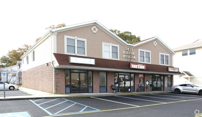
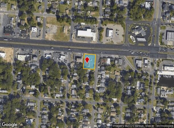
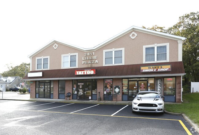
Property Record
2811 Route 37 E, Toms River, NJ 08753
Current Lease Availabilities
NEARBY LISTINGS FOR SALE OR LEASE
Property Detail
2811 Route 37 E
New York-Jersey City-White Plains, NY-NJ
Bay Shore Sec A
08-00794-05-00004
120X153
Commercialnec
Ocean
X
New Jersey
34029C0309F
4
2024
0.42 AC
2025
Ocean County
723500
Northern New Jersey
7,192 SF
DEMOGRAPHICS near 2811 Route 37 E
1 Mile
3 Mile
5 Mile
2024 Total Population
9,032
56,696
128,710
2029 Population
9,744
61,505
139,909
Pop Growth 2024-2029
+ 7.88%
+ 8.48%
+ 8.70%
Average Age
40
41
42
2024 Total Households
3,477
21,947
50,206
HH Growth 2024-2029
+ 7.48%
+ 8.57%
+ 9.06%
Median Household Inc
$78,002
$86,173
$86,555
Avg Household Size
2.50
2.50
2.40
2024 Avg HH Vehicles
2.00
2.00
2.00
Median Home Value
$305,916
$361,444
$368,228
Median Year Built
1969
1972
1974
Nearby Places
Map Layers
Map Styles
 Street
 Aerial
- Restaurants
- Banks
- Shops
- Fitness
- Groceries
Nearby Properties
Address
Land Use
TOTAL SIZE
Lot Size
Zoning
Address
Land Use
TOTAL SIZE
Lot Size
Zoning
1.27 AC
P
Address
Land Use
TOTAL SIZE
Lot Size
Zoning
8,118 SF
72.32 AC
R75
Address
Land Use
TOTAL SIZE
Lot Size
Zoning
8,968 SF
26.36 AC
RMF
Address
Land Use
TOTAL SIZE
Lot Size
Zoning
744 SF
0.69 AC
RB
Address
Land Use
TOTAL SIZE
Lot Size
Zoning
2,636 SF
2.90 AC
RRA
Address
Land Use
TOTAL SIZE
Lot Size
Zoning
71,285 SF
20.49 AC
HB
Address
Land Use
TOTAL SIZE
Lot Size
Zoning
12,520 SF
1.81 AC
RB
Address
Land Use
TOTAL SIZE
Lot Size
Zoning
1,680 SF
14.33 AC
HB
Address
Land Use
TOTAL SIZE
Lot Size
Zoning
103,750 SF
24.23 AC
R120
Address
Land Use
TOTAL SIZE
Lot Size
Zoning
33.59 AC
R90
Address
Land Use
TOTAL SIZE
Lot Size
Zoning
1.19 AC
RB
Address
Land Use
TOTAL SIZE
Lot Size
Zoning
0.97 AC
RB
Address
Land Use
TOTAL SIZE
Lot Size
Zoning
23.28 AC
R75
Address
Land Use
TOTAL SIZE
Lot Size
Zoning
22.29 AC
HB
Address
Land Use
TOTAL SIZE
Lot Size
Zoning
0.82 AC
RB
Address
Land Use
TOTAL SIZE
Lot Size
Zoning
20,271 SF
0.96 AC
PUB
Address
Land Use
TOTAL SIZE
Lot Size
Zoning
22,908 SF
6.81 AC
EM10
Address
Land Use
TOTAL SIZE
Lot Size
Zoning
648 SF
9.52 AC
HB
Address
Land Use
TOTAL SIZE
Lot Size
Zoning
3,209 SF
7.40 AC
GB
Address
Land Use
TOTAL SIZE
Lot Size
Zoning
54,648 SF
8.04 AC
HB
Address
Land Use
TOTAL SIZE
Lot Size
Zoning
88,355 SF
5.27 AC
HB
Address
Land Use
TOTAL SIZE
Lot Size
Zoning
2,792 SF
13.72 AC
R100
Address
Land Use
TOTAL SIZE
Lot Size
Zoning
59,100 SF
11.56 AC
HB
Address
Land Use
TOTAL SIZE
Lot Size
Zoning
1.36 AC
PUB
Address
Land Use
TOTAL SIZE
Lot Size
Zoning
61,176 SF
9.31 AC
HB
Address
Land Use
TOTAL SIZE
Lot Size
Zoning
69,798 SF
6.92 AC
R200
Address
Land Use
TOTAL SIZE
Lot Size
Zoning
4.80 AC
HB
Address
Land Use
TOTAL SIZE
Lot Size
Zoning
53,255 SF
6.36 AC
SPLT
Address
Land Use
TOTAL SIZE
Lot Size
Zoning
12,008 SF
0.53 AC
RB
Address
Land Use
TOTAL SIZE
Lot Size
Zoning
33,014 SF
6.69 AC
SPLT
The World's #1 Commercial Real Estate Marketplace
Connect with us
© 2026 CoStar Group
The information above has been obtained from sources believed reliable. While we do not doubt its accuracy we have not verified it and make no guarantee, warranty or representation about it. It is your responsibility to independently confirm its accuracy and completeness. Any projections, opinions, assumptions, or estimates used are for example only and do not represent the current or future performance of the property. The value of this transaction to you depends on tax and other factors which should be evaluated by your tax, financial, and legal advisors. You and your advisors should conduct a careful, independent investigation of the property to determine to your satisfaction the suitability of the property for your needs.