Property Record
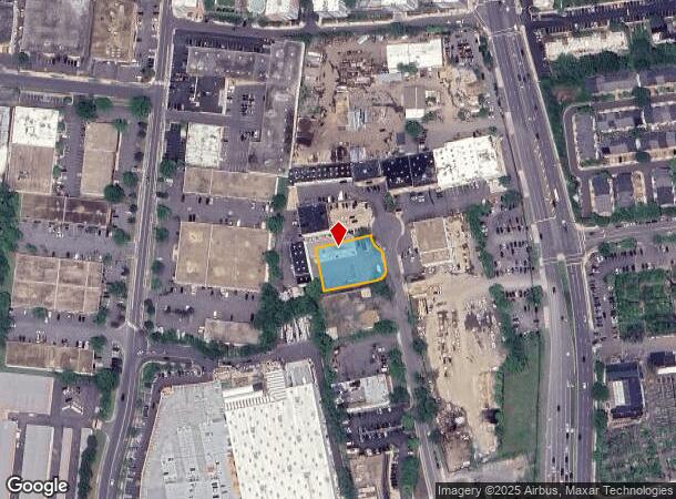
2814 Juniper St, Fairfax, VA 22031


NEARBY LISTINGS FOR SALE OR LEASE
Property Detail
2814 Juniper St
Washington-Arlington-Alexandria, DC-VA-MD-WV
Avondale
0492-05-0006
AVONDALE LT 6
Wholesaleoutletdiscountstore
Fairfax
X
Virginia
5100540015D
6
2024
0.53 AC
2025
Merrifield
461605
Washington, DC
4,800 SF
DEMOGRAPHICS near 2814 Juniper St
1 Mile
3 Mile
5 Mile
2024 Total Population
17,383
142,561
356,642
2029 Population
17,053
140,666
353,208
Pop Growth 2024-2029
(1.90%)
(1.33%)
(0.96%)
Average Age
36
39
40
2024 Total Households
7,812
52,548
128,601
HH Growth 2024-2029
(2.15%)
(1.47%)
(0.99%)
Median Household Inc
$134,559
$142,330
$145,251
Avg Household Size
2.20
2.60
2.70
2024 Avg HH Vehicles
1.00
2.00
2.00
Median Home Value
$696,820
$743,274
$764,760
Median Year Built
2002
1976
1974
Nearby Places
Map Layers
Map Styles
 Street
 Aerial
- Restaurants
- Banks
- Shops
- Fitness
- Groceries
PUBLIC TRANSPORTATION
TRANSIT/SUBWAY
Dunn Loring-Merrifield (Orange Line - Washington Metropolitan Area Transit Authority Metrorail (Metrorail))
DRIVE
WALK
Distance
Dunn Loring-Merrifield (Orange Line - Washington Metropolitan Area Transit Authority Metrorail (Metrorail))
9 min
13 min
0.7 mi
COMMUTER RAIL
Backlick Road (Manassas Line - Virginia Railway Express)
DRIVE
WALK
Distance
Backlick Road (Manassas Line - Virginia Railway Express)
17 min
8.4 mi
Rolling Road (Manassas Line - Virginia Railway Express)
DRIVE
WALK
Distance
Rolling Road (Manassas Line - Virginia Railway Express)
17 min
8.6 mi
AIRPORT
Ronald Reagan Washington Ntl
DRIVE
WALK
Distance
Ronald Reagan Washington Ntl
27 min
12.5 mi
Washington Dulles International
DRIVE
WALK
Distance
Washington Dulles International
33 min
18.0 mi
Baltimore/Washington International Thurgood Marshall
DRIVE
WALK
Distance
Baltimore/Washington International Thurgood Marshall
68 min
48.7 mi
Freight Ports
Port of Baltimore
DRIVE
WALK
Distance
Port of Baltimore
71 min
51.3 mi
Nearby Properties
Address
Land Use
TOTAL SIZE
Lot Size
Zoning
Address
Land Use
TOTAL SIZE
Lot Size
Zoning
2,385,458 SF
62.90 AC
403
Address
Land Use
TOTAL SIZE
Lot Size
Zoning
1,434,346 SF
29.59 AC
430
Address
Land Use
TOTAL SIZE
Lot Size
Zoning
829,629 SF
21.30 AC
430
Address
Land Use
TOTAL SIZE
Lot Size
Zoning
1,464,969 SF
39.52 AC
403
Address
Land Use
TOTAL SIZE
Lot Size
Zoning
553,360 SF
1.99 AC
403
Address
Land Use
TOTAL SIZE
Lot Size
Zoning
538,794 SF
3.44 AC
400
Address
Land Use
TOTAL SIZE
Lot Size
Zoning
819,540 SF
8.81 AC
COMMERCIAL
Address
Land Use
TOTAL SIZE
Lot Size
Zoning
505,415 SF
1.95 AC
403
Address
Land Use
TOTAL SIZE
Lot Size
Zoning
B-1 LTD.BU
Address
Land Use
TOTAL SIZE
Lot Size
Zoning
584,872 SF
10.58 AC
470
Address
Land Use
TOTAL SIZE
Lot Size
Zoning
290,749 SF
1.49 AC
403
Address
Land Use
TOTAL SIZE
Lot Size
Zoning
425,118 SF
16.99 AC
320
Address
Land Use
TOTAL SIZE
Lot Size
Zoning
B-2 CENTRA
Address
Land Use
TOTAL SIZE
Lot Size
Zoning
327,430 SF
4.24 AC
350
Address
Land Use
TOTAL SIZE
Lot Size
Zoning
775,934 SF
13.98 AC
312
Address
Land Use
TOTAL SIZE
Lot Size
Zoning
382,776 SF
11.02 AC
400
Address
Land Use
TOTAL SIZE
Lot Size
Zoning
440,979 SF
20 AC
530
Address
Land Use
TOTAL SIZE
Lot Size
Zoning
322,514 SF
4.81 AC
330
Address
Land Use
TOTAL SIZE
Lot Size
Zoning
305,250 SF
2.93 AC
403
Address
Land Use
TOTAL SIZE
Lot Size
Zoning
225,058 SF
596
Address
Land Use
TOTAL SIZE
Lot Size
Zoning
300,730 SF
9.60 AC
400
Address
Land Use
TOTAL SIZE
Lot Size
Zoning
401,218 SF
13.78 AC
403
Address
Land Use
TOTAL SIZE
Lot Size
Zoning
335,096 SF
18.40 AC
220
Address
Land Use
TOTAL SIZE
Lot Size
Zoning
817,044 SF
10.97 AC
960
Address
Land Use
TOTAL SIZE
Lot Size
Zoning
3,518 SF
2.11 AC
B-3 GENERA
Address
Land Use
TOTAL SIZE
Lot Size
Zoning
358,898 SF
6.44 AC
403
Address
Land Use
TOTAL SIZE
Lot Size
Zoning
230,346 SF
25.18 AC
460
Address
Land Use
TOTAL SIZE
Lot Size
Zoning
245,351 SF
16.83 AC
960
Address
Land Use
TOTAL SIZE
Lot Size
Zoning
3,000 SF
9.26 AC
497
Address
Land Use
TOTAL SIZE
Lot Size
Zoning
779,512 SF
22.66 AC
550
The World's #1 Commercial Real Estate Marketplace
Connect with us
© 2025 CoStar Group
The information above has been obtained from sources believed reliable. While we do not doubt its accuracy we have not verified it and make no guarantee, warranty or representation about it. It is your responsibility to independently confirm its accuracy and completeness. Any projections, opinions, assumptions, or estimates used are for example only and do not represent the current or future performance of the property. The value of this transaction to you depends on tax and other factors which should be evaluated by your tax, financial, and legal advisors. You and your advisors should conduct a careful, independent investigation of the property to determine to your satisfaction the suitability of the property for your needs.