Property Record
28149 Hwy 27, Dundee, FL 33838


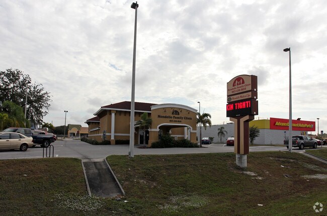
Property Detail
28149 Hwy 27
27-28-29-000000-021110
COMM NW COR OF NE1/4 OF SE1/4 OF SEC S0-00-52W 50 FT TO SLY R/W LINE OF SR 542 N89-23-46E 274.6 FT S0-26-35W 216.26 FT TO POB S0-26-35W 280.03 FT S89-23-50W 175.91 FT TO ELY R/W LINE OF US HWY 27 NWLY ALONG CURVE 106.46 FT N11-45-00W 199.22 FT N89-23
Medicalbuilding
POLK
XX
Florida
B and X Area of moderate flood hazard, usually the area between the limits of the 100-year and 500-year floods.
0.74 AC
2024
Polk County
2025
Tampa/St Petersburg
014131
Lakeland-Winter Haven, FL
6,080 SF
NEARBY LISTINGS FOR SALE OR LEASE
DEMOGRAPHICS near 28149 Hwy 27
1 mile
3 mile
5 mile
2025 Total Population
4,001
22,000
68,801
2030 Population
4,581
25,055
78,751
Pop Growth 2025-2030
+ 14.50%
+ 13.89%
+ 14.46%
Average Age
44
43
43
2025 Total Households
1,610
8,761
27,246
HH Growth 2025-2030
+ 14.66%
+ 14.09%
+ 14.68%
Median Household Inc
$56,677
$67,831
$68,882
Avg Household Size
2.50
2.50
2.50
2025 Avg HH Vehicles
2.00
2.00
2.00
Median Home Value
$261,724
$295,545
$311,898
Median Year Built
1991
1989
1995
Nearby Places
Map Layers
Map Styles
 Street
 Aerial
Layers
 Traffic
 Biking
Places
Listings with unknown addresses are not visible on the map
- Restaurants
- Banks
- Shops
- Fitness
- Groceries
PUBLIC TRANSPORTATION
COMMUTER RAIL
Drive
Walk
Distance
16 min
7.9 mi
AIRPORT
Orlando International
Drive
Walk
Distance
Orlando International
61 min
44.2 mi
Nearby Properties
Address
Land Use
TOTAL SIZE
Lot Size
Zoning
Address
Land Use
TOTAL SIZE
Lot Size
Zoning
432,251 SF
57.14 AC
RC
Address
Land Use
TOTAL SIZE
Lot Size
Zoning
215,470 SF
16.16 AC
Address
Land Use
TOTAL SIZE
Lot Size
Zoning
138,111 SF
40.01 AC
RC
Address
Land Use
TOTAL SIZE
Lot Size
Zoning
114,089 SF
6.62 AC
Address
Land Use
TOTAL SIZE
Lot Size
Zoning
96,322 SF
8.45 AC
XX
Address
Land Use
TOTAL SIZE
Lot Size
Zoning
104,120 SF
19.25 AC
Address
Land Use
TOTAL SIZE
Lot Size
Zoning
240,920 SF
15.33 AC
AG
Address
Land Use
TOTAL SIZE
Lot Size
Zoning
37,408 SF
4.23 AC
Address
Land Use
TOTAL SIZE
Lot Size
Zoning
147,825 SF
10.23 AC
Address
Land Use
TOTAL SIZE
Lot Size
Zoning
61,769 SF
3.91 AC
C3
Address
Land Use
TOTAL SIZE
Lot Size
Zoning
72,928 SF
4.73 AC
Address
Land Use
TOTAL SIZE
Lot Size
Zoning
85,890 SF
7.75 AC
C1
Address
Land Use
TOTAL SIZE
Lot Size
Zoning
35,632 SF
29.34 AC
RC
Address
Land Use
TOTAL SIZE
Lot Size
Zoning
100,177 SF
12.39 AC
XX
Address
Land Use
TOTAL SIZE
Lot Size
Zoning
74,292 SF
14.62 AC
Address
Land Use
TOTAL SIZE
Lot Size
Zoning
17,441 SF
119.40 AC
RC
Address
Land Use
TOTAL SIZE
Lot Size
Zoning
1,260 SF
473 AC
Address
Land Use
TOTAL SIZE
Lot Size
Zoning
91,964 SF
14.02 AC
XX
Address
Land Use
TOTAL SIZE
Lot Size
Zoning
31,565 SF
2.19 AC
Address
Land Use
TOTAL SIZE
Lot Size
Zoning
42.51 AC
Address
Land Use
TOTAL SIZE
Lot Size
Zoning
33,300 SF
8.94 AC
RC
Address
Land Use
TOTAL SIZE
Lot Size
Zoning
109,214 SF
14.64 AC
XX
Address
Land Use
TOTAL SIZE
Lot Size
Zoning
22,069 SF
7.74 AC
R1A
Address
Land Use
TOTAL SIZE
Lot Size
Zoning
189,241 SF
3.59 AC
C3
Address
Land Use
TOTAL SIZE
Lot Size
Zoning
70,000 SF
8.06 AC
C4
Address
Land Use
TOTAL SIZE
Lot Size
Zoning
33,962 SF
6.88 AC
C4
Address
Land Use
TOTAL SIZE
Lot Size
Zoning
15,400 SF
15.61 AC
Address
Land Use
TOTAL SIZE
Lot Size
Zoning
24.30 AC
Address
Land Use
TOTAL SIZE
Lot Size
Zoning
60,560 SF
9.33 AC
RC
Address
Land Use
TOTAL SIZE
Lot Size
Zoning
60,220 SF
12.05 AC
AG
The World's #1 Commercial Real Estate Marketplace
Connect with us
© 2026 CoStar Group
The information above has been obtained from sources believed reliable. While we do not doubt its accuracy we have not verified it and make no guarantee, warranty or representation about it. It is your responsibility to independently confirm its accuracy and completeness. Any projections, opinions, assumptions, or estimates used are for example only and do not represent the current or future performance of the property. The value of this transaction to you depends on tax and other factors which should be evaluated by your tax, financial, and legal advisors. You and your advisors should conduct a careful, independent investigation of the property to determine to your satisfaction the suitability of the property for your needs.