Property Record
2815 N Loop 1604 E, San Antonio, TX 78232
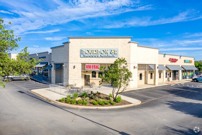

Property Detail
2815 N Loop 1604 E
San Antonio-New Braunfels, TX
NCB 18981 BLK 1 LOT 207 (REDLAND RETAIL SUBD) PLAT 9564/220
18981-001-2070
BEXAR
Regionalshoppingcenterormallwithanchorstore
Texas
B and X Area of moderate flood hazard, usually the area between the limits of the 100-year and 500-year floods.
35
2024
3.71 AC
2025
Far North Central
121906
San Antonio
29,301 SF
NEARBY LISTINGS FOR SALE OR LEASE
DEMOGRAPHICS near 2815 N Loop 1604 E
1 mile
3 mile
5 mile
2025 Total Population
8,613
85,840
227,413
2030 Population
9,092
90,121
238,378
Pop Growth 2025-2030
+ 5.56%
+ 4.99%
+ 4.82%
Average Age
40
40
39
2025 Total Households
3,491
34,580
88,559
HH Growth 2025-2030
+ 5.67%
+ 5.09%
+ 4.94%
Median Household Inc
$84,761
$91,701
$92,277
Avg Household Size
2.40
2.40
2.50
2025 Avg HH Vehicles
2.00
2.00
2.00
Median Home Value
$374,723
$346,013
$352,539
Median Year Built
1994
1994
1995
Nearby Places
Map Layers
Map Styles
 Street
 Aerial
Transit
 Traffic
 Biking
Places
Listings with unknown addresses are not visible on the map
- Restaurants
- Banks
- Shops
- Fitness
- Groceries
PUBLIC TRANSPORTATION
AIRPORT
San Antonio International
Drive
Walk
Distance
San Antonio International
12 min
8.3 mi
Freight Ports
Calhoun Port
Drive
Walk
Distance
Calhoun Port
184 min
154.0 mi
SALE & LEASE HISTORY
LISTING DATE
SALE/LEASE

Sep 25, 2016
For Lease
Oct 03, 2017
For Lease
Feb 15, 2019
For Lease
Dec 13, 2018
For Lease
Apr 29, 2025
For Lease
Nearby Properties
Address
Land Use
TOTAL SIZE
Lot Size
Zoning
Address
Land Use
TOTAL SIZE
Lot Size
Zoning
621,591 SF
15.25 AC
Address
Land Use
TOTAL SIZE
Lot Size
Zoning
427,456 SF
37.12 AC
Address
Land Use
TOTAL SIZE
Lot Size
Zoning
387,893 SF
11.97 AC
Address
Land Use
TOTAL SIZE
Lot Size
Zoning
435,882 SF
27.85 AC
Address
Land Use
TOTAL SIZE
Lot Size
Zoning
391,871 SF
17.94 AC
Address
Land Use
TOTAL SIZE
Lot Size
Zoning
311,728 SF
7.47 AC
Address
Land Use
TOTAL SIZE
Lot Size
Zoning
383,541 SF
12.41 AC
Address
Land Use
TOTAL SIZE
Lot Size
Zoning
298,710 SF
11.36 AC
Address
Land Use
TOTAL SIZE
Lot Size
Zoning
292,126 SF
12.86 AC
Address
Land Use
TOTAL SIZE
Lot Size
Zoning
307,210 SF
14.26 AC
Address
Land Use
TOTAL SIZE
Lot Size
Zoning
315,719 SF
13.91 AC
Address
Land Use
TOTAL SIZE
Lot Size
Zoning
280,330 SF
20.99 AC
Address
Land Use
TOTAL SIZE
Lot Size
Zoning
441,676 SF
19.99 AC
Address
Land Use
TOTAL SIZE
Lot Size
Zoning
306,523 SF
16.29 AC
Address
Land Use
TOTAL SIZE
Lot Size
Zoning
209,715 SF
22.91 AC
Address
Land Use
TOTAL SIZE
Lot Size
Zoning
317,041 SF
26.69 AC
Address
Land Use
TOTAL SIZE
Lot Size
Zoning
289,271 SF
16.87 AC
Address
Land Use
TOTAL SIZE
Lot Size
Zoning
290,188 SF
14.60 AC
Address
Land Use
TOTAL SIZE
Lot Size
Zoning
269,525 SF
17.75 AC
Address
Land Use
TOTAL SIZE
Lot Size
Zoning
341,841 SF
22 AC
Address
Land Use
TOTAL SIZE
Lot Size
Zoning
249,562 SF
9.65 AC
Address
Land Use
TOTAL SIZE
Lot Size
Zoning
340,570 SF
19.15 AC
Address
Land Use
TOTAL SIZE
Lot Size
Zoning
907.40 AC
Address
Land Use
TOTAL SIZE
Lot Size
Zoning
240,644 SF
16.35 AC
Address
Land Use
TOTAL SIZE
Lot Size
Zoning
281,805 SF
14.52 AC
Address
Land Use
TOTAL SIZE
Lot Size
Zoning
297,882 SF
17.16 AC
Address
Land Use
TOTAL SIZE
Lot Size
Zoning
256,048 SF
15.45 AC
Address
Land Use
TOTAL SIZE
Lot Size
Zoning
158,818 SF
4.33 AC
Address
Land Use
TOTAL SIZE
Lot Size
Zoning
146,700 SF
56.18 AC
Address
Land Use
TOTAL SIZE
Lot Size
Zoning
257,288 SF
10.57 AC
The World's #1 Commercial Real Estate Marketplace
Connect with us
© 2026 CoStar Group
The information above has been obtained from sources believed reliable. While we do not doubt its accuracy we have not verified it and make no guarantee, warranty or representation about it. It is your responsibility to independently confirm its accuracy and completeness. Any projections, opinions, assumptions, or estimates used are for example only and do not represent the current or future performance of the property. The value of this transaction to you depends on tax and other factors which should be evaluated by your tax, financial, and legal advisors. You and your advisors should conduct a careful, independent investigation of the property to determine to your satisfaction the suitability of the property for your needs.