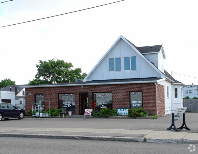
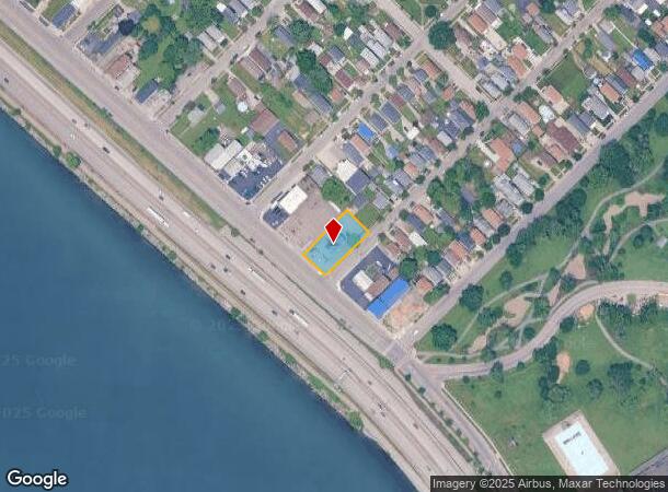
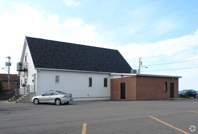
Property Record
2815 Niagara St, Buffalo, NY 14207
NEARBY LISTINGS FOR SALE OR LEASE
Property Detail
2815 Niagara St
146489-077-390-0002-015-000
COR N HUETTER AVE 449 96-98 80.10 X 163.30
Commercialofficeresidentialmixeduse
Erie
X
New York
36029C0183J
15.000
2025
0.30 AC
2024
North
008400
Buffalo/Niagara Falls
2,825 SF
Buffalo-Cheektowaga-Niagara Falls, NY
DEMOGRAPHICS near 2815 Niagara St
1 Mile
3 Mile
5 Mile
2024 Total Population
11,454
78,153
236,054
2029 Population
10,966
75,948
231,624
Pop Growth 2024-2029
(4.26%)
(2.82%)
(1.88%)
Average Age
34
38
39
2024 Total Households
4,279
33,927
104,988
HH Growth 2024-2029
(4.30%)
(2.89%)
(1.88%)
Median Household Inc
$32,623
$50,869
$53,953
Avg Household Size
2.50
2.20
2.10
2024 Avg HH Vehicles
1.00
1.00
1.00
Median Home Value
$76,499
$168,027
$177,088
Median Year Built
1946
1947
1948
Nearby Places
- Restaurants
- Banks
- Shops
- Fitness
- Groceries
PUBLIC TRANSPORTATION
COMMUTER RAIL
Buffalo (Exchange) (Empire Service - Amtrak, Maple Leaf - Amtrak, Toronto - New York - Amtrak)
DRIVE
WALK
Distance
Buffalo (Exchange) (Empire Service - Amtrak, Maple Leaf - Amtrak, Toronto - New York - Amtrak)
12 min
7.0 mi
AIRPORT
Buffalo Niagara International
DRIVE
WALK
Distance
Buffalo Niagara International
25 min
12.8 mi
Niagara Falls International
DRIVE
WALK
Distance
Niagara Falls International
23 min
14.3 mi
Freight Ports
Port of Toledo
DRIVE
WALK
Distance
Port of Toledo
368 min
309.5 mi
Nearby Properties
Address
Land Use
TOTAL SIZE
Lot Size
Zoning
Address
Land Use
TOTAL SIZE
Lot Size
Zoning
6,120 SF
87.10 AC
D-IL
Address
Land Use
TOTAL SIZE
Lot Size
Zoning
139,224 SF
13.72 AC
WID
Address
Land Use
TOTAL SIZE
Lot Size
Zoning
8,317 SF
39.03 AC
SPLIT ZONE
Address
Land Use
TOTAL SIZE
Lot Size
Zoning
80,927 SF
28.20 AC
WID
Address
Land Use
TOTAL SIZE
Lot Size
Zoning
121,015 SF
92.60 AC
D-E
Address
Land Use
TOTAL SIZE
Lot Size
Zoning
21,200 SF
20.94 AC
D-IL
Address
Land Use
TOTAL SIZE
Lot Size
Zoning
239,735 SF
17.73 AC
TND
Address
Land Use
TOTAL SIZE
Lot Size
Zoning
59,670 SF
911.28 AC
OS
Address
Land Use
TOTAL SIZE
Lot Size
Zoning
650,000 SF
42.15 AC
G-1
Address
Land Use
TOTAL SIZE
Lot Size
Zoning
61,327 SF
175 AC
D-OG
Address
Land Use
TOTAL SIZE
Lot Size
Zoning
67,666 SF
17.43 AC
G-1
Address
Land Use
TOTAL SIZE
Lot Size
Zoning
3.20 AC
G-1
Address
Land Use
TOTAL SIZE
Lot Size
Zoning
11,808 SF
11.93 AC
N-3R
Address
Land Use
TOTAL SIZE
Lot Size
Zoning
120,954 SF
9.74 AC
D-S
Address
Land Use
TOTAL SIZE
Lot Size
Zoning
16 AC
G-1
Address
Land Use
TOTAL SIZE
Lot Size
Zoning
151,641 SF
1.53 AC
N-1S
Address
Land Use
TOTAL SIZE
Lot Size
Zoning
41,752 SF
8.95 AC
SPLIT ZONE
Address
Land Use
TOTAL SIZE
Lot Size
Zoning
138,000 SF
7.30 AC
P-S
Address
Land Use
TOTAL SIZE
Lot Size
Zoning
97,298 SF
15.28 AC
D-S
Address
Land Use
TOTAL SIZE
Lot Size
Zoning
36,504 SF
D-OG
Address
Land Use
TOTAL SIZE
Lot Size
Zoning
3,840 SF
11.80 AC
D-R
Address
Land Use
TOTAL SIZE
Lot Size
Zoning
13,836 SF
7.70 AC
D-R
Address
Land Use
TOTAL SIZE
Lot Size
Zoning
265,850 SF
19.35 AC
Address
Land Use
TOTAL SIZE
Lot Size
Zoning
3,650 SF
0.13 AC
N-2R
Address
Land Use
TOTAL SIZE
Lot Size
Zoning
259,454 SF
7.66 AC
N-3R
Address
Land Use
TOTAL SIZE
Lot Size
Zoning
122,248 SF
9.15 AC
D-S
Address
Land Use
TOTAL SIZE
Lot Size
Zoning
2,797 SF
0.16 AC
N-1S
Address
Land Use
TOTAL SIZE
Lot Size
Zoning
4,384 SF
6.20 AC
D-R
Address
Land Use
TOTAL SIZE
Lot Size
Zoning
86,974 SF
2.57 AC
N-1S
Address
Land Use
TOTAL SIZE
Lot Size
Zoning
170,035 SF
1.94 AC
N-2R
The World's #1 Commercial Real Estate Marketplace
Connect with us
© 2025 CoStar Group
The information above has been obtained from sources believed reliable. While we do not doubt its accuracy we have not verified it and make no guarantee, warranty or representation about it. It is your responsibility to independently confirm its accuracy and completeness. Any projections, opinions, assumptions, or estimates used are for example only and do not represent the current or future performance of the property. The value of this transaction to you depends on tax and other factors which should be evaluated by your tax, financial, and legal advisors. You and your advisors should conduct a careful, independent investigation of the property to determine to your satisfaction the suitability of the property for your needs.