Property Record
2815 Ridge Rd, Cheyenne, WY 82001


NEARBY LISTINGS FOR SALE OR LEASE
Property Detail
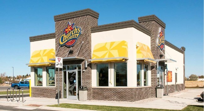
2815 Ridge Rd
Cheyenne, WY
Holmes Corner
1-4685-0001-0002-0
HOLMES CORNER: LOT 2, BLOCK 1. PLUS AN UNDIVIDED INTEREST IN LOT 6
Commercialnec
Laramie
X
Wyoming
56021C1094F
2
2024
1.31 AC
2025
I-80 Corridor/Cheyenne
001502
Other Market Areas
1,923 SF
DEMOGRAPHICS near 2815 Ridge Rd
1 Mile
3 Mile
5 Mile
2024 Total Population
10,871
49,781
82,720
2029 Population
11,057
50,775
84,272
Pop Growth 2024-2029
+ 1.71%
+ 2.00%
+ 1.88%
Average Age
41
39
40
2024 Total Households
4,804
21,331
34,892
HH Growth 2024-2029
+ 2.04%
+ 2.10%
+ 1.98%
Median Household Inc
$51,981
$59,463
$60,741
Avg Household Size
2.20
2.30
2.30
2024 Avg HH Vehicles
2.00
2.00
2.00
Median Home Value
$232,166
$262,431
$277,224
Median Year Built
1974
1975
1977
Nearby Places
Map Layers
Map Styles
 Street
 Aerial
- Restaurants
- Banks
- Shops
- Fitness
- Groceries
SALE & LEASE HISTORY
LISTING DATE
SALE/LEASE

Oct 24, 2019
For Sale
Aug 22, 2024
For Lease
Nearby Properties
Address
Land Use
TOTAL SIZE
Lot Size
Zoning
Address
Land Use
TOTAL SIZE
Lot Size
Zoning
240.51 AC
A2
Address
Land Use
TOTAL SIZE
Lot Size
Zoning
639,397 SF
67.52 AC
Address
Land Use
TOTAL SIZE
Lot Size
Zoning
243,960 SF
60.52 AC
Address
Land Use
TOTAL SIZE
Lot Size
Zoning
172,393 SF
12.16 AC
Address
Land Use
TOTAL SIZE
Lot Size
Zoning
91,021 SF
7.40 AC
Address
Land Use
TOTAL SIZE
Lot Size
Zoning
189,952 SF
11.15 AC
HR2
Address
Land Use
TOTAL SIZE
Lot Size
Zoning
148,018 SF
Address
Land Use
TOTAL SIZE
Lot Size
Zoning
210,717 SF
18.28 AC
Address
Land Use
TOTAL SIZE
Lot Size
Zoning
156,244 SF
4.75 AC
Address
Land Use
TOTAL SIZE
Lot Size
Zoning
180,600 SF
13.72 AC
HI
Address
Land Use
TOTAL SIZE
Lot Size
Zoning
136,488 SF
13.38 AC
CB
Address
Land Use
TOTAL SIZE
Lot Size
Zoning
114,342 SF
59.95 AC
HI
Address
Land Use
TOTAL SIZE
Lot Size
Zoning
219,227 SF
21.97 AC
CB
Address
Land Use
TOTAL SIZE
Lot Size
Zoning
69,726 SF
0.80 AC
CBD
Address
Land Use
TOTAL SIZE
Lot Size
Zoning
323,835 SF
Address
Land Use
TOTAL SIZE
Lot Size
Zoning
135,427 SF
6.61 AC
Address
Land Use
TOTAL SIZE
Lot Size
Zoning
109,096 SF
4.03 AC
MR2
Address
Land Use
TOTAL SIZE
Lot Size
Zoning
193,881 SF
21.36 AC
CB
Address
Land Use
TOTAL SIZE
Lot Size
Zoning
109,744 SF
7.04 AC
Address
Land Use
TOTAL SIZE
Lot Size
Zoning
81,948 SF
9.39 AC
CB
Address
Land Use
TOTAL SIZE
Lot Size
Zoning
142,588 SF
3.54 AC
PUD
Address
Land Use
TOTAL SIZE
Lot Size
Zoning
37,714 SF
4.29 AC
Address
Land Use
TOTAL SIZE
Lot Size
Zoning
69,941 SF
4.31 AC
LI
Address
Land Use
TOTAL SIZE
Lot Size
Zoning
88,107 SF
10.73 AC
Address
Land Use
TOTAL SIZE
Lot Size
Zoning
86,860 SF
1.70 AC
CB
Address
Land Use
TOTAL SIZE
Lot Size
Zoning
59,325 SF
0.85 AC
CBD
Address
Land Use
TOTAL SIZE
Lot Size
Zoning
96,088 SF
8.34 AC
Address
Land Use
TOTAL SIZE
Lot Size
Zoning
69,103 SF
17.34 AC
Address
Land Use
TOTAL SIZE
Lot Size
Zoning
79,186 SF
3.09 AC
Address
Land Use
TOTAL SIZE
Lot Size
Zoning
108,332 SF
0.80 AC
MUB
The World's #1 Commercial Real Estate Marketplace
Connect with us
© 2025 CoStar Group
The information above has been obtained from sources believed reliable. While we do not doubt its accuracy we have not verified it and make no guarantee, warranty or representation about it. It is your responsibility to independently confirm its accuracy and completeness. Any projections, opinions, assumptions, or estimates used are for example only and do not represent the current or future performance of the property. The value of this transaction to you depends on tax and other factors which should be evaluated by your tax, financial, and legal advisors. You and your advisors should conduct a careful, independent investigation of the property to determine to your satisfaction the suitability of the property for your needs.