Property Record
2815 W 41St St, Sioux Falls, SD 57105
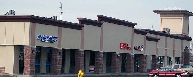

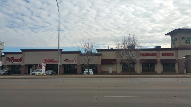
Property Detail
2815 W 41St St
Sioux Falls, SD-MN
TRACT A LOT 7 & N390.94 (EX W123.55 N160) BLOCK 2 BROWN ADDN TO CITY OF SIOUX FALLS
27689
MINNEHAHA
Stripcommercialcenter
South Dakota
B and X Area of moderate flood hazard, usually the area between the limits of the 100-year and 500-year floods.
7
2024
6.68 AC
2024
Sioux Falls
001109
Other Market Areas
67,645 SF
NEARBY LISTINGS FOR SALE OR LEASE
DEMOGRAPHICS near 2815 W 41St St
1 mile
3 mile
5 mile
2025 Total Population
8,443
93,780
188,540
2030 Population
8,792
99,760
200,980
Pop Growth 2025-2030
+ 4.13%
+ 6.38%
+ 6.60%
Average Age
41
39
38
2025 Total Households
4,046
40,668
77,791
HH Growth 2025-2030
+ 4.57%
+ 6.72%
+ 7.04%
Median Household Inc
$50,275
$68,593
$70,813
Avg Household Size
2.00
2.20
2.30
2025 Avg HH Vehicles
2.00
2.00
2.00
Median Home Value
$254,301
$288,483
$296,869
Median Year Built
1972
1985
1994
Nearby Places
Map Layers
Map Styles
 Street
 Aerial
Layers
 Traffic
 Biking
Places
Listings with unknown addresses are not visible on the map
- Restaurants
- Banks
- Shops
- Fitness
- Groceries
PUBLIC TRANSPORTATION
AIRPORT
Joe Foss Field
Drive
Walk
Distance
Joe Foss Field
25 min
6.7 mi
Freight Ports
Port Milwaukee
Drive
Walk
Distance
Port Milwaukee
551 min
508.0 mi
SALE & LEASE HISTORY
LISTING DATE
SALE/LEASE

Sep 25, 2016
For Lease
Sep 25, 2016
For Lease
May 15, 2019
For Lease
Nearby Properties
Address
Land Use
TOTAL SIZE
Lot Size
Zoning
Address
Land Use
TOTAL SIZE
Lot Size
Zoning
14.81 AC
MUNICIPALI
Address
Land Use
TOTAL SIZE
Lot Size
Zoning
80,415 SF
13.13 AC
Address
Land Use
TOTAL SIZE
Lot Size
Zoning
8.89 AC
MUNICIPALI
Address
Land Use
TOTAL SIZE
Lot Size
Zoning
639,393 SF
53.46 AC
FP;FP
Address
Land Use
TOTAL SIZE
Lot Size
Zoning
8.90 AC
C1;NEIGHBO
Address
Land Use
TOTAL SIZE
Lot Size
Zoning
Address
Land Use
TOTAL SIZE
Lot Size
Zoning
8.80 AC
MUNICIPALI
Address
Land Use
TOTAL SIZE
Lot Size
Zoning
184,821 SF
1.83 AC
NO;SPECIAL
Address
Land Use
TOTAL SIZE
Lot Size
Zoning
7,252 SF
12.07 AC
Address
Land Use
TOTAL SIZE
Lot Size
Zoning
9.41 AC
Address
Land Use
TOTAL SIZE
Lot Size
Zoning
360,262 SF
26 AC
Address
Land Use
TOTAL SIZE
Lot Size
Zoning
15,704 SF
5.13 AC
Address
Land Use
TOTAL SIZE
Lot Size
Zoning
3.07 AC
FP;FP
Address
Land Use
TOTAL SIZE
Lot Size
Zoning
55,998 SF
5.42 AC
FP;FP
Address
Land Use
TOTAL SIZE
Lot Size
Zoning
51,004 SF
3.99 AC
Address
Land Use
TOTAL SIZE
Lot Size
Zoning
72,553 SF
0.97 AC
Address
Land Use
TOTAL SIZE
Lot Size
Zoning
8.51 AC
MUNICIPALI
Address
Land Use
TOTAL SIZE
Lot Size
Zoning
15.40 AC
MUNICIPALI
Address
Land Use
TOTAL SIZE
Lot Size
Zoning
10.75 AC
MUNICIPALI
Address
Land Use
TOTAL SIZE
Lot Size
Zoning
9.45 AC
MUNICIPALI
Address
Land Use
TOTAL SIZE
Lot Size
Zoning
15.89 AC
Address
Land Use
TOTAL SIZE
Lot Size
Zoning
3,254 SF
2.13 AC
Address
Land Use
TOTAL SIZE
Lot Size
Zoning
99,834 SF
6.58 AC
Address
Land Use
TOTAL SIZE
Lot Size
Zoning
9.57 AC
MUNICIPALI
Address
Land Use
TOTAL SIZE
Lot Size
Zoning
8.57 AC
MUNICIPALI
Address
Land Use
TOTAL SIZE
Lot Size
Zoning
7.91 AC
MUNICIPALI
Address
Land Use
TOTAL SIZE
Lot Size
Zoning
11.13 AC
MUNICIPALI
Address
Land Use
TOTAL SIZE
Lot Size
Zoning
4.61 AC
MUNICIPALI
Address
Land Use
TOTAL SIZE
Lot Size
Zoning
100,053 SF
8.50 AC
FP;FP
Address
Land Use
TOTAL SIZE
Lot Size
Zoning
9.56 AC
MUNICIPALI
The World's #1 Commercial Real Estate Marketplace
Connect with us
© 2026 CoStar Group
The information above has been obtained from sources believed reliable. While we do not doubt its accuracy we have not verified it and make no guarantee, warranty or representation about it. It is your responsibility to independently confirm its accuracy and completeness. Any projections, opinions, assumptions, or estimates used are for example only and do not represent the current or future performance of the property. The value of this transaction to you depends on tax and other factors which should be evaluated by your tax, financial, and legal advisors. You and your advisors should conduct a careful, independent investigation of the property to determine to your satisfaction the suitability of the property for your needs.