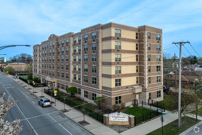
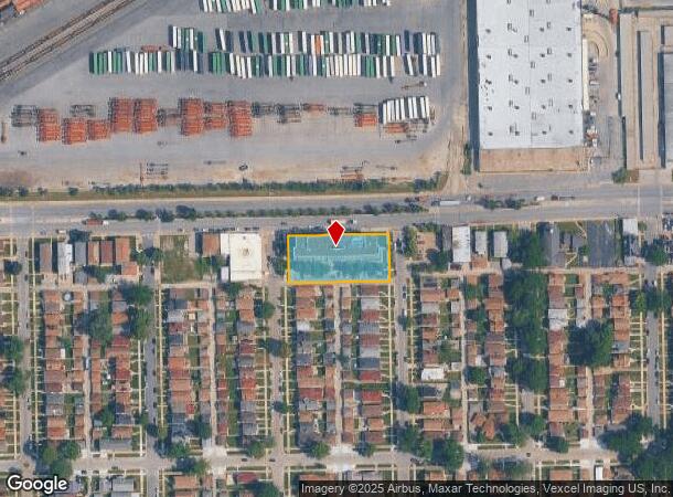
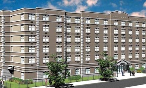
Property Record
2815 W 79Th St, Chicago, IL 60652
This Property Is For Sale
NEARBY LISTINGS FOR SALE OR LEASE
Property Detail
2815 W 79Th St
19-36-107-056-0000
Hinkamp & Cos Western Ave
Commercialnec
Cook
X
Illinois
17031C0630J
0.77 AC
2023
Wrightwood
2024
Chicago
700501
Chicago-Naperville-Elgin, IL-IN-WI
90,486 SF
DEMOGRAPHICS near 2815 W 79Th St
1 Mile
3 Mile
5 Mile
2024 Total Population
22,940
256,175
648,420
2029 Population
21,995
244,539
618,493
Pop Growth 2024-2029
(4.12%)
(4.54%)
(4.62%)
Average Age
41
38
39
2024 Total Households
7,671
85,440
225,810
HH Growth 2024-2029
(4.55%)
(4.83%)
(4.79%)
Median Household Inc
$68,048
$51,289
$50,734
Avg Household Size
2.80
2.90
2.80
2024 Avg HH Vehicles
2.00
1.00
1.00
Median Home Value
$200,990
$195,787
$213,318
Median Year Built
1955
1952
1952
Nearby Places
- Restaurants
- Banks
- Shops
- Fitness
- Groceries
PUBLIC TRANSPORTATION
TRANSIT/SUBWAY
Wrightwood Station (SouthWest Service - Northeast Illinois Regional Commuter Railroad (Metra))
DRIVE
WALK
Distance
Wrightwood Station (SouthWest Service - Northeast Illinois Regional Commuter Railroad (Metra))
2 min
12 min
0.6 mi
COMMUTER RAIL
Wrightwood Station (SouthWest Service - Northeast Illinois Regional Commuter Railroad (Metra))
DRIVE
WALK
Distance
Wrightwood Station (SouthWest Service - Northeast Illinois Regional Commuter Railroad (Metra))
2 min
12 min
0.6 mi
Ashburn Station (SouthWest Service - Northeast Illinois Regional Commuter Railroad (Metra))
DRIVE
WALK
Distance
Ashburn Station (SouthWest Service - Northeast Illinois Regional Commuter Railroad (Metra))
4 min
1.7 mi
AIRPORT
Chicago Midway International
DRIVE
WALK
Distance
Chicago Midway International
12 min
6.5 mi
Chicago O'Hare International
DRIVE
WALK
Distance
Chicago O'Hare International
45 min
26.9 mi
Nearby Properties
Address
Land Use
TOTAL SIZE
Lot Size
Zoning
Address
Land Use
TOTAL SIZE
Lot Size
Zoning
2,155,128 SF
63.23 AC
PMD13
Address
Land Use
TOTAL SIZE
Lot Size
Zoning
87,830 SF
0.76 AC
B1-1
Address
Land Use
TOTAL SIZE
Lot Size
Zoning
798,998 SF
B3-2
Address
Land Use
TOTAL SIZE
Lot Size
Zoning
240,300 SF
3.72 AC
Address
Land Use
TOTAL SIZE
Lot Size
Zoning
292,978 SF
22.31 AC
Address
Land Use
TOTAL SIZE
Lot Size
Zoning
796,454 SF
25.68 AC
PMD13
Address
Land Use
TOTAL SIZE
Lot Size
Zoning
157,787 SF
12.23 AC
Address
Land Use
TOTAL SIZE
Lot Size
Zoning
1,615,006 SF
41.91 AC
PMD13
Address
Land Use
TOTAL SIZE
Lot Size
Zoning
Address
Land Use
TOTAL SIZE
Lot Size
Zoning
139,493 SF
9.06 AC
PD 965
Address
Land Use
TOTAL SIZE
Lot Size
Zoning
134,078 SF
17.31 AC
Address
Land Use
TOTAL SIZE
Lot Size
Zoning
149,902 SF
3.62 AC
Address
Land Use
TOTAL SIZE
Lot Size
Zoning
223,310 SF
15.67 AC
Address
Land Use
TOTAL SIZE
Lot Size
Zoning
224,089 SF
Address
Land Use
TOTAL SIZE
Lot Size
Zoning
148,474 SF
17.68 AC
Address
Land Use
TOTAL SIZE
Lot Size
Zoning
82,000 SF
Address
Land Use
TOTAL SIZE
Lot Size
Zoning
127,197 SF
10.43 AC
Address
Land Use
TOTAL SIZE
Lot Size
Zoning
99,900 SF
12.45 AC
PD 1172
Address
Land Use
TOTAL SIZE
Lot Size
Zoning
166,292 SF
5.95 AC
PMD13
Address
Land Use
TOTAL SIZE
Lot Size
Zoning
876,321 SF
19.99 AC
PMD13
Address
Land Use
TOTAL SIZE
Lot Size
Zoning
13,700 SF
0.33 AC
B3-2
Address
Land Use
TOTAL SIZE
Lot Size
Zoning
48,192 SF
2.01 AC
Address
Land Use
TOTAL SIZE
Lot Size
Zoning
297,930 SF
9.79 AC
Address
Land Use
TOTAL SIZE
Lot Size
Zoning
285,672 SF
13.14 AC
Address
Land Use
TOTAL SIZE
Lot Size
Zoning
136,382 SF
10.53 AC
PD 965
Address
Land Use
TOTAL SIZE
Lot Size
Zoning
61,965 SF
3.66 AC
Address
Land Use
TOTAL SIZE
Lot Size
Zoning
0.54 AC
RS-3
Address
Land Use
TOTAL SIZE
Lot Size
Zoning
65,882 SF
1.23 AC
Address
Land Use
TOTAL SIZE
Lot Size
Zoning
310,815 SF
18.04 AC
Address
Land Use
TOTAL SIZE
Lot Size
Zoning
7.45 AC
The World's #1 Commercial Real Estate Marketplace
Connect with us
© 2025 CoStar Group
The information above has been obtained from sources believed reliable. While we do not doubt its accuracy we have not verified it and make no guarantee, warranty or representation about it. It is your responsibility to independently confirm its accuracy and completeness. Any projections, opinions, assumptions, or estimates used are for example only and do not represent the current or future performance of the property. The value of this transaction to you depends on tax and other factors which should be evaluated by your tax, financial, and legal advisors. You and your advisors should conduct a careful, independent investigation of the property to determine to your satisfaction the suitability of the property for your needs.