Property Record
2816 Windguard Cir, Wesley Chapel, FL 33544
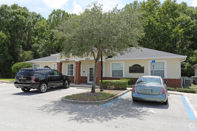

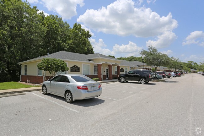
Property Detail
2816 Windguard Cir
25-26-19-0000-00100-1406
COM AT NE COR OF SEC 25 TH S00DEG 41 11W 2198.94 FT TH N89DEG 18 49W 603.49 FT FOR POB TH N89DEG 30 51W 50.00 FT TH N00DEG 29 09E 45.00 FT TH S89DEG 30 51E 50.00 FT TH S00DEG 29 09W 11.00 FT TH S89DEG 30 51E 5.00 FT TH S00DEG 29 09W 23.00 FT TH N89DE
Officebuilding
PASCO
MPUD
Florida
B and X Area of moderate flood hazard, usually the area between the limits of the 100-year and 500-year floods.
1406
2024
0.05 AC
2026
Pasco County
032106
Tampa/St Petersburg
2,250 SF
Tampa-St. Petersburg-Clearwater, FL
NEARBY LISTINGS FOR SALE OR LEASE
DEMOGRAPHICS near 2816 Windguard Cir
1 mile
3 mile
5 mile
2025 Total Population
8,057
59,390
150,479
2030 Population
9,214
66,864
168,701
Pop Growth 2025-2030
+ 14.36%
+ 12.58%
+ 12.11%
Average Age
36
38
39
2025 Total Households
2,851
20,828
53,389
HH Growth 2025-2030
+ 13.82%
+ 12.24%
+ 11.79%
Median Household Inc
$114,152
$118,834
$114,052
Avg Household Size
2.80
2.80
2.80
2025 Avg HH Vehicles
2.00
2.00
2.00
Median Home Value
$551,190
$462,421
$453,327
Median Year Built
2007
2006
2004
Nearby Places
Map Layers
Map Styles
 Street
 Aerial
Layers
 Traffic
 Biking
Places
Listings with unknown addresses are not visible on the map
- Restaurants
- Banks
- Shops
- Fitness
- Groceries
PUBLIC TRANSPORTATION
AIRPORT
Tampa International
Drive
Walk
Distance
Tampa International
39 min
28.7 mi
St Pete-Clearwater International
Drive
Walk
Distance
St Pete-Clearwater International
56 min
37.9 mi
Freight Ports
Port of Tampa Bay
Drive
Walk
Distance
Port of Tampa Bay
35 min
24.3 mi
Nearby Properties
Address
Land Use
TOTAL SIZE
Lot Size
Zoning
Address
Land Use
TOTAL SIZE
Lot Size
Zoning
455,090 SF
52.24 AC
MPUD
Address
Land Use
TOTAL SIZE
Lot Size
Zoning
548,616 SF
138.97 AC
PD-A
Address
Land Use
TOTAL SIZE
Lot Size
Zoning
603,350 SF
28.81 AC
MPUD
Address
Land Use
TOTAL SIZE
Lot Size
Zoning
425,346 SF
19.60 AC
MPUD
Address
Land Use
TOTAL SIZE
Lot Size
Zoning
380,937 SF
13.58 AC
MPUD
Address
Land Use
TOTAL SIZE
Lot Size
Zoning
306,559 SF
34.59 AC
MPUD
Address
Land Use
TOTAL SIZE
Lot Size
Zoning
293,253 SF
51.11 AC
MPUD
Address
Land Use
TOTAL SIZE
Lot Size
Zoning
38,091 SF
43.42 AC
MPUD
Address
Land Use
TOTAL SIZE
Lot Size
Zoning
425,129 SF
12.72 AC
MPUD
Address
Land Use
TOTAL SIZE
Lot Size
Zoning
347,708 SF
43.40 AC
MPUD
Address
Land Use
TOTAL SIZE
Lot Size
Zoning
346,880 SF
20.01 AC
MPUD
Address
Land Use
TOTAL SIZE
Lot Size
Zoning
324,184 SF
19.12 AC
MPUD
Address
Land Use
TOTAL SIZE
Lot Size
Zoning
263,289 SF
26.30 AC
MPUD
Address
Land Use
TOTAL SIZE
Lot Size
Zoning
267,326 SF
22.50 AC
MPUD
Address
Land Use
TOTAL SIZE
Lot Size
Zoning
299,792 SF
73.98 AC
AS-1
Address
Land Use
TOTAL SIZE
Lot Size
Zoning
279,167 SF
14.75 AC
MPUD
Address
Land Use
TOTAL SIZE
Lot Size
Zoning
275,549 SF
16.24 AC
C2
Address
Land Use
TOTAL SIZE
Lot Size
Zoning
199,740 SF
12.56 AC
PD
Address
Land Use
TOTAL SIZE
Lot Size
Zoning
175,877 SF
7.64 AC
PD
Address
Land Use
TOTAL SIZE
Lot Size
Zoning
192,698 SF
19.31 AC
MPUD
Address
Land Use
TOTAL SIZE
Lot Size
Zoning
50,016 SF
14.04 AC
MPUD
Address
Land Use
TOTAL SIZE
Lot Size
Zoning
138,613 SF
10.71 AC
PD
Address
Land Use
TOTAL SIZE
Lot Size
Zoning
113,513 SF
42.35 AC
PD-A
Address
Land Use
TOTAL SIZE
Lot Size
Zoning
198,276 SF
60.64 AC
AC
Address
Land Use
TOTAL SIZE
Lot Size
Zoning
153,412 SF
9.77 AC
MPUD
Address
Land Use
TOTAL SIZE
Lot Size
Zoning
175,978 SF
29.19 AC
AC
Address
Land Use
TOTAL SIZE
Lot Size
Zoning
153,330 SF
16.99 AC
PUD
Address
Land Use
TOTAL SIZE
Lot Size
Zoning
62,553 SF
43.31 AC
PD
Address
Land Use
TOTAL SIZE
Lot Size
Zoning
147,238 SF
13.89 AC
MPUD
Address
Land Use
TOTAL SIZE
Lot Size
Zoning
206,368 SF
27.78 AC
PD-A
The World's #1 Commercial Real Estate Marketplace
Connect with us
© 2026 CoStar Group
The information above has been obtained from sources believed reliable. While we do not doubt its accuracy we have not verified it and make no guarantee, warranty or representation about it. It is your responsibility to independently confirm its accuracy and completeness. Any projections, opinions, assumptions, or estimates used are for example only and do not represent the current or future performance of the property. The value of this transaction to you depends on tax and other factors which should be evaluated by your tax, financial, and legal advisors. You and your advisors should conduct a careful, independent investigation of the property to determine to your satisfaction the suitability of the property for your needs.