Property Record
2819 Whitney Ave, Hamden, CT 06518
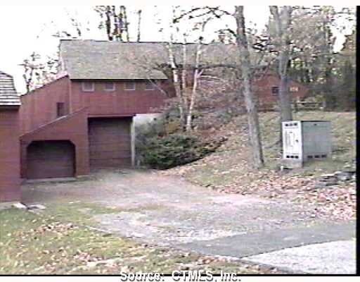

Property Detail
2819 Whitney Ave
HAMD-002831-000188
NEW HAVEN
Religious
Connecticut
R4T3
0000
B and X Area of moderate flood hazard, usually the area between the limits of the 100-year and 500-year floods.
4.43 AC
0
Hamden
2025
Westchester/So Connecticut
166002
New Haven, CT
NEARBY LISTINGS FOR SALE OR LEASE
DEMOGRAPHICS near 2819 Whitney Ave
1 mile
3 mile
5 mile
2025 Total Population
8,756
45,836
110,977
2030 Population
8,863
46,568
112,425
Pop Growth 2025-2030
+ 1.22%
+ 1.60%
+ 1.30%
Average Age
42
42
42
2025 Total Households
3,656
17,881
43,450
HH Growth 2025-2030
+ 1.07%
+ 1.61%
+ 1.33%
Median Household Inc
$90,530
$105,408
$94,678
Avg Household Size
2.10
2.30
2.40
2025 Avg HH Vehicles
2.00
2.00
2.00
Median Home Value
$277,944
$342,319
$338,248
Median Year Built
1981
1971
1966
Nearby Places
Map Layers
Map Styles
 Street
 Aerial
Layers
 Traffic
 Biking
Places
Listings with unknown addresses are not visible on the map
- Restaurants
- Banks
- Shops
- Fitness
- Groceries
PUBLIC TRANSPORTATION
COMMUTER RAIL
New Haven-State Street Station (New Haven Line - Metro-North Commuter Railroad Company (Metro-North))
Drive
Walk
Distance
New Haven-State Street Station (New Haven Line - Metro-North Commuter Railroad Company (Metro-North))
13 min
7.1 mi
Drive
Walk
Distance
12 min
8.1 mi
AIRPORT
Tweed/New Haven
Drive
Walk
Distance
Tweed/New Haven
21 min
12.0 mi
Nearby Properties
Address
Land Use
TOTAL SIZE
Lot Size
Zoning
Address
Land Use
TOTAL SIZE
Lot Size
Zoning
268,989 SF
22.59 AC
R20
Address
Land Use
TOTAL SIZE
Lot Size
Zoning
855,000 SF
142.06 AC
IL80
Address
Land Use
TOTAL SIZE
Lot Size
Zoning
33,122 SF
23.06 AC
T4
Address
Land Use
TOTAL SIZE
Lot Size
Zoning
28,824 SF
44.93 AC
T4
Address
Land Use
TOTAL SIZE
Lot Size
Zoning
15.32 AC
T4
Address
Land Use
TOTAL SIZE
Lot Size
Zoning
30.46 AC
T5
Address
Land Use
TOTAL SIZE
Lot Size
Zoning
36,520 SF
4.64 AC
IL30
Address
Land Use
TOTAL SIZE
Lot Size
Zoning
116.04 AC
R3
Address
Land Use
TOTAL SIZE
Lot Size
Zoning
18.85 AC
T5
Address
Land Use
TOTAL SIZE
Lot Size
Zoning
57,467 SF
3.72 AC
T4
Address
Land Use
TOTAL SIZE
Lot Size
Zoning
134,029 SF
27.54 AC
R20
Address
Land Use
TOTAL SIZE
Lot Size
Zoning
23.48 AC
T5
Address
Land Use
TOTAL SIZE
Lot Size
Zoning
97,898 SF
11.40 AC
R20
Address
Land Use
TOTAL SIZE
Lot Size
Zoning
10.91 AC
R5
Address
Land Use
TOTAL SIZE
Lot Size
Zoning
10.77 AC
R5
Address
Land Use
TOTAL SIZE
Lot Size
Zoning
23.40 AC
IG80
Address
Land Use
TOTAL SIZE
Lot Size
Zoning
30,272 SF
19.60 AC
R5
Address
Land Use
TOTAL SIZE
Lot Size
Zoning
8.61 AC
R5
Address
Land Use
TOTAL SIZE
Lot Size
Zoning
10.70 AC
IL30
Address
Land Use
TOTAL SIZE
Lot Size
Zoning
119,658 SF
7.48 AC
O12
Address
Land Use
TOTAL SIZE
Lot Size
Zoning
3 AC
T5
Address
Land Use
TOTAL SIZE
Lot Size
Zoning
2.86 AC
R5
Address
Land Use
TOTAL SIZE
Lot Size
Zoning
17,949 SF
8.02 AC
CB40
Address
Land Use
TOTAL SIZE
Lot Size
Zoning
318,092 SF
72.62 AC
I-2
Address
Land Use
TOTAL SIZE
Lot Size
Zoning
64,401 SF
19.16 AC
R3
Address
Land Use
TOTAL SIZE
Lot Size
Zoning
85,974 SF
7.05 AC
T-4
Address
Land Use
TOTAL SIZE
Lot Size
Zoning
123,853 SF
3.70 AC
R5
Address
Land Use
TOTAL SIZE
Lot Size
Zoning
9.80 AC
CA20
Address
Land Use
TOTAL SIZE
Lot Size
Zoning
7.04 AC
R5
Address
Land Use
TOTAL SIZE
Lot Size
Zoning
15,432 SF
5.67 AC
CB40
The World's #1 Commercial Real Estate Marketplace
Connect with us
© 2026 CoStar Group
The information above has been obtained from sources believed reliable. While we do not doubt its accuracy we have not verified it and make no guarantee, warranty or representation about it. It is your responsibility to independently confirm its accuracy and completeness. Any projections, opinions, assumptions, or estimates used are for example only and do not represent the current or future performance of the property. The value of this transaction to you depends on tax and other factors which should be evaluated by your tax, financial, and legal advisors. You and your advisors should conduct a careful, independent investigation of the property to determine to your satisfaction the suitability of the property for your needs.