Property Record
282 Central St, Hudson, MA 01749
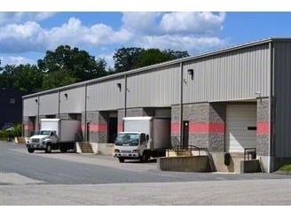

Property Detail
282 Central St
HUDS-000017-000000-000507
MIDDLESEX
Industrialcondominium
Massachusetts
CND
507
A Areas with a 1% annual chance of flooding and a 26% chance of flooding over the life of a 30-year mortgage.
7.43 AC
2025
Concord/Maynard
2025
Boston
322300
Boston-Cambridge-Newton, MA-NH
1,825 SF
NEARBY LISTINGS FOR SALE OR LEASE
DEMOGRAPHICS near 282 Central St
1 mile
3 mile
5 mile
2025 Total Population
3,418
24,886
82,101
2030 Population
3,529
25,789
84,825
Pop Growth 2025-2030
+ 3.25%
+ 3.63%
+ 3.32%
Average Age
42
43
42
2025 Total Households
1,407
9,951
32,410
HH Growth 2025-2030
+ 3.27%
+ 3.71%
+ 3.40%
Median Household Inc
$74,682
$114,006
$112,454
Avg Household Size
2.40
2.50
2.50
2025 Avg HH Vehicles
2.00
2.00
2.00
Median Home Value
$502,463
$570,532
$564,933
Median Year Built
1973
1975
1970
Nearby Places
Map Layers
Map Styles
 Street
 Aerial
Transit
 Traffic
 Biking
Places
Listings with unknown addresses are not visible on the map
- Restaurants
- Banks
- Shops
- Fitness
- Groceries
PUBLIC TRANSPORTATION
AIRPORT
Worcester Regional
Drive
Walk
Distance
Worcester Regional
34 min
21.9 mi
General Edward Lawrence Logan International
Drive
Walk
Distance
General Edward Lawrence Logan International
57 min
42.7 mi
SALE & LEASE HISTORY
LISTING DATE
SALE/LEASE

May 29, 2025
For Lease
Jul 10, 2025
For Sale
Feb 11, 2022
For Sale
Aug 16, 2021
For Lease
Nearby Properties
Address
Land Use
TOTAL SIZE
Lot Size
Zoning
Address
Land Use
TOTAL SIZE
Lot Size
Zoning
71.70 AC
LI
Address
Land Use
TOTAL SIZE
Lot Size
Zoning
13.86 AC
SB
Address
Land Use
TOTAL SIZE
Lot Size
Zoning
54.67 AC
LI
Address
Land Use
TOTAL SIZE
Lot Size
Zoning
14.80 AC
M6
Address
Land Use
TOTAL SIZE
Lot Size
Zoning
121,434 SF
21.35 AC
SA8
Address
Land Use
TOTAL SIZE
Lot Size
Zoning
91,722 SF
8.38 AC
A2
Address
Land Use
TOTAL SIZE
Lot Size
Zoning
12.42 AC
M1
Address
Land Use
TOTAL SIZE
Lot Size
Zoning
118,126 SF
82.89 AC
Address
Land Use
TOTAL SIZE
Lot Size
Zoning
283,750 SF
27.03 AC
LI
Address
Land Use
TOTAL SIZE
Lot Size
Zoning
119,850 SF
49.66 AC
LC1
Address
Land Use
TOTAL SIZE
Lot Size
Zoning
120,146 SF
7.33 AC
LI
Address
Land Use
TOTAL SIZE
Lot Size
Zoning
16.84 AC
M5
Address
Land Use
TOTAL SIZE
Lot Size
Zoning
182,509 SF
11.35 AC
A2
Address
Land Use
TOTAL SIZE
Lot Size
Zoning
9.90 AC
C12
Address
Land Use
TOTAL SIZE
Lot Size
Zoning
75,542 SF
3.23 AC
SB
Address
Land Use
TOTAL SIZE
Lot Size
Zoning
80,722 SF
27.01 AC
SA8
Address
Land Use
TOTAL SIZE
Lot Size
Zoning
10 AC
SA8
Address
Land Use
TOTAL SIZE
Lot Size
Zoning
148.66 AC
M6
Address
Land Use
TOTAL SIZE
Lot Size
Zoning
16.51 AC
SA7
Address
Land Use
TOTAL SIZE
Lot Size
Zoning
104,752 SF
7.54 AC
C11
Address
Land Use
TOTAL SIZE
Lot Size
Zoning
138,734 SF
16.03 AC
LCI1
Address
Land Use
TOTAL SIZE
Lot Size
Zoning
136,650 SF
21.06 AC
M6
Address
Land Use
TOTAL SIZE
Lot Size
Zoning
112,672 SF
16.50 AC
LI
Address
Land Use
TOTAL SIZE
Lot Size
Zoning
134,550 SF
19.76 AC
R1
Address
Land Use
TOTAL SIZE
Lot Size
Zoning
124,137 SF
12.90 AC
LI
Address
Land Use
TOTAL SIZE
Lot Size
Zoning
40,445 SF
36.81 AC
Address
Land Use
TOTAL SIZE
Lot Size
Zoning
82,602 SF
4 AC
LI
Address
Land Use
TOTAL SIZE
Lot Size
Zoning
8.14 AC
C6
Address
Land Use
TOTAL SIZE
Lot Size
Zoning
100,683 SF
6.57 AC
A2
Address
Land Use
TOTAL SIZE
Lot Size
Zoning
92,701 SF
6.41 AC
LI
The World's #1 Commercial Real Estate Marketplace
Connect with us
© 2026 CoStar Group
The information above has been obtained from sources believed reliable. While we do not doubt its accuracy we have not verified it and make no guarantee, warranty or representation about it. It is your responsibility to independently confirm its accuracy and completeness. Any projections, opinions, assumptions, or estimates used are for example only and do not represent the current or future performance of the property. The value of this transaction to you depends on tax and other factors which should be evaluated by your tax, financial, and legal advisors. You and your advisors should conduct a careful, independent investigation of the property to determine to your satisfaction the suitability of the property for your needs.