Property Record
282 Chapel Rd, South Windsor, CT 06074
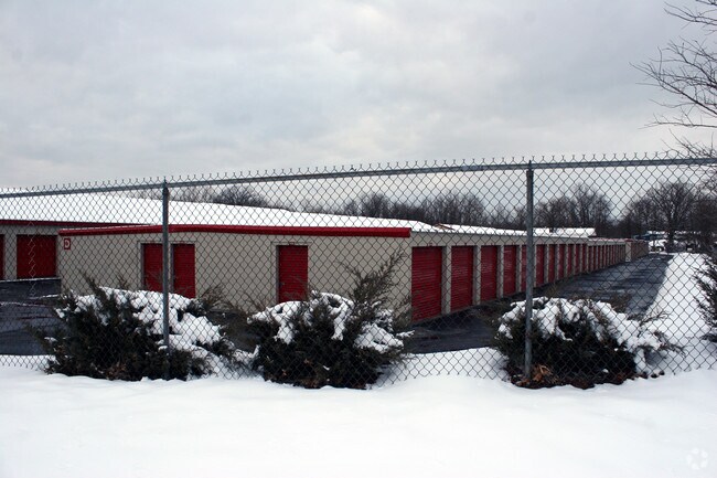

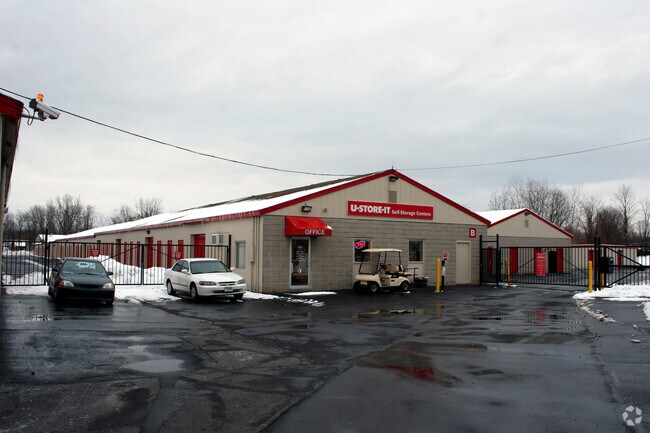
Property Detail
282 Chapel Rd
SWIN-000022-000000-000012
Capitol
Industrialgeneral
Connecticut
I
4.29 AC
B and X Area of moderate flood hazard, usually the area between the limits of the 100-year and 500-year floods.
South Windsor
2024
Hartford
2025
Hartford-West Hartford-East Hartford, CT
487400
NEARBY LISTINGS FOR SALE OR LEASE
-
-
View all South Windsor listings for sale on LoopNet.com
DEMOGRAPHICS near 282 Chapel Rd
1 mile
3 mile
5 mile
2025 Total Population
2,473
38,987
159,267
2030 Population
2,580
39,682
162,395
Pop Growth 2025-2030
+ 4.33%
+ 1.78%
+ 1.96%
Average Age
41
39
39
2025 Total Households
980
15,244
63,849
HH Growth 2025-2030
+ 4.39%
+ 1.80%
+ 2.07%
Median Household Inc
$153,968
$81,173
$74,154
Avg Household Size
2.50
2.50
2.40
2025 Avg HH Vehicles
2.00
2.00
2.00
Median Home Value
$359,714
$274,624
$260,187
Median Year Built
1981
1964
1964
Nearby Places
Map Layers
Map Styles
 Street
 Aerial
Layers
 Traffic
 Biking
Places
Listings with unknown addresses are not visible on the map
- Restaurants
- Banks
- Shops
- Fitness
- Groceries
PUBLIC TRANSPORTATION
COMMUTER RAIL
Windsor (Hartford Line - CONN DOT)
Drive
Walk
Distance
Windsor (Hartford Line - CONN DOT)
11 min
5.5 mi
Hartford Amtrak Station (Amtrak Hartford Line - Amtrak, Northeast Regional - Amtrak, Valley Flyer - Amtrak, Vermonter - Amtrak)
Drive
Walk
Distance
Hartford Amtrak Station (Amtrak Hartford Line - Amtrak, Northeast Regional - Amtrak, Valley Flyer - Amtrak, Vermonter - Amtrak)
9 min
5.7 mi
AIRPORT
Bradley International
Drive
Walk
Distance
Bradley International
31 min
15.5 mi
Freight Ports
Port of New Haven
Drive
Walk
Distance
Port of New Haven
57 min
42.9 mi
Nearby Properties
Address
Land Use
TOTAL SIZE
Lot Size
Zoning
Address
Land Use
TOTAL SIZE
Lot Size
Zoning
13,680 SF
240.83 AC
Address
Land Use
TOTAL SIZE
Lot Size
Zoning
194,971 SF
162.43 AC
IND
Address
Land Use
TOTAL SIZE
Lot Size
Zoning
10.74 AC
ID-1
Address
Land Use
TOTAL SIZE
Lot Size
Zoning
238.11 AC
GD
Address
Land Use
TOTAL SIZE
Lot Size
Zoning
58,778 SF
9.26 AC
R-4
Address
Land Use
TOTAL SIZE
Lot Size
Zoning
10.59 AC
GD
Address
Land Use
TOTAL SIZE
Lot Size
Zoning
175,936 SF
18.28 AC
GD
Address
Land Use
TOTAL SIZE
Lot Size
Zoning
26.65 AC
GB
Address
Land Use
TOTAL SIZE
Lot Size
Zoning
421,152 SF
45.95 AC
CD
Address
Land Use
TOTAL SIZE
Lot Size
Zoning
35.05 AC
FP
Address
Land Use
TOTAL SIZE
Lot Size
Zoning
38.80 AC
R-3
Address
Land Use
TOTAL SIZE
Lot Size
Zoning
66.09 AC
CX-2
Address
Land Use
TOTAL SIZE
Lot Size
Zoning
498,105 SF
29.55 AC
IND
Address
Land Use
TOTAL SIZE
Lot Size
Zoning
101,317 SF
24.91 AC
RR
Address
Land Use
TOTAL SIZE
Lot Size
Zoning
209,744 SF
25.67 AC
CD
Address
Land Use
TOTAL SIZE
Lot Size
Zoning
259,600 SF
25.58 AC
CD
Address
Land Use
TOTAL SIZE
Lot Size
Zoning
122.44 AC
OS
Address
Land Use
TOTAL SIZE
Lot Size
Zoning
111,800 SF
5.80 AC
GD
Address
Land Use
TOTAL SIZE
Lot Size
Zoning
182,628 SF
15.94 AC
CD
Address
Land Use
TOTAL SIZE
Lot Size
Zoning
156,929 SF
43 AC
GD
Address
Land Use
TOTAL SIZE
Lot Size
Zoning
416,640 SF
30 AC
I
Address
Land Use
TOTAL SIZE
Lot Size
Zoning
424,627 SF
26 AC
ID-1
Address
Land Use
TOTAL SIZE
Lot Size
Zoning
13,056 SF
17.43 AC
RB
Address
Land Use
TOTAL SIZE
Lot Size
Zoning
62,487 SF
14.35 AC
CD
Address
Land Use
TOTAL SIZE
Lot Size
Zoning
153,247 SF
19.85 AC
I
Address
Land Use
TOTAL SIZE
Lot Size
Zoning
11.14 AC
CD
Address
Land Use
TOTAL SIZE
Lot Size
Zoning
80,688 SF
5.40 AC
ID-2
Address
Land Use
TOTAL SIZE
Lot Size
Zoning
106,380 SF
12.55 AC
CUD
Address
Land Use
TOTAL SIZE
Lot Size
Zoning
11,212 SF
15.54 AC
Address
Land Use
TOTAL SIZE
Lot Size
Zoning
513,264 SF
34.88 AC
I-2
The World's #1 Commercial Real Estate Marketplace
Connect with us
© 2026 CoStar Group
The information above has been obtained from sources believed reliable. While we do not doubt its accuracy we have not verified it and make no guarantee, warranty or representation about it. It is your responsibility to independently confirm its accuracy and completeness. Any projections, opinions, assumptions, or estimates used are for example only and do not represent the current or future performance of the property. The value of this transaction to you depends on tax and other factors which should be evaluated by your tax, financial, and legal advisors. You and your advisors should conduct a careful, independent investigation of the property to determine to your satisfaction the suitability of the property for your needs.