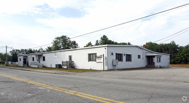
Property Record
282 River St, Springvale, ME 04083

Property Detail
282 River St
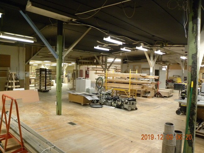
Commercialbuilding
YORK
IB
Maine
B and X Area of moderate flood hazard, usually the area between the limits of the 100-year and 500-year floods.
2.84 AC
2025
York County
2025
Portland/South Portland
030102
Portland-South Portland, ME
17,176 SF
SANF-000001-I000020
NEARBY LISTINGS FOR SALE OR LEASE
-
-
View all Springvale listings for lease on LoopNet.com
DEMOGRAPHICS near 282 River St
1 mile
3 mile
5 mile
2025 Total Population
3,877
17,132
24,577
2030 Population
3,955
17,468
25,052
Pop Growth 2025-2030
+ 2.01%
+ 1.96%
+ 1.93%
Average Age
42
41
42
2025 Total Households
1,664
7,027
10,137
HH Growth 2025-2030
+ 1.92%
+ 1.89%
+ 1.86%
Median Household Inc
$71,562
$69,788
$76,411
Avg Household Size
2.30
2.30
2.30
2025 Avg HH Vehicles
2.00
2.00
2.00
Median Home Value
$267,182
$276,483
$298,325
Median Year Built
1965
1969
1974
Nearby Places
Map Layers
Map Styles
 Street
 Aerial
Transit
 Traffic
 Biking
Places
Listings with unknown addresses are not visible on the map
- Restaurants
- Banks
- Shops
- Fitness
- Groceries
PUBLIC TRANSPORTATION
AIRPORT
Portland International Jetport
Drive
Walk
Distance
Portland International Jetport
45 min
31.2 mi
Freight Ports
Portland, ME
Drive
Walk
Distance
Portland, ME
46 min
33.8 mi
SALE & LEASE HISTORY
LISTING DATE
SALE/LEASE

Feb 05, 2020
For Lease
Dec 11, 2019
For Sale
Nearby Properties
Address
Land Use
TOTAL SIZE
Lot Size
Zoning
Address
Land Use
TOTAL SIZE
Lot Size
Zoning
61,542 SF
11.50 AC
Address
Land Use
TOTAL SIZE
Lot Size
Zoning
94,234 SF
17.65 AC
OR
Address
Land Use
TOTAL SIZE
Lot Size
Zoning
Address
Land Use
TOTAL SIZE
Lot Size
Zoning
18.86 AC
SFR
Address
Land Use
TOTAL SIZE
Lot Size
Zoning
55,418 SF
1.54 AC
DB
Address
Land Use
TOTAL SIZE
Lot Size
Zoning
83,505 SF
17 AC
RD
Address
Land Use
TOTAL SIZE
Lot Size
Zoning
81.92 AC
SFR
Address
Land Use
TOTAL SIZE
Lot Size
Zoning
61,457 SF
0.87 AC
IR
Address
Land Use
TOTAL SIZE
Lot Size
Zoning
Address
Land Use
TOTAL SIZE
Lot Size
Zoning
16,708 SF
3 AC
DB
Address
Land Use
TOTAL SIZE
Lot Size
Zoning
8.60 AC
ORBP
Address
Land Use
TOTAL SIZE
Lot Size
Zoning
19,019 SF
19.41 AC
SFR
Address
Land Use
TOTAL SIZE
Lot Size
Zoning
71,566 SF
12 AC
UB
Address
Land Use
TOTAL SIZE
Lot Size
Zoning
1,080 SF
3.50 AC
GR
Address
Land Use
TOTAL SIZE
Lot Size
Zoning
78,259 SF
8.29 AC
SFR
Address
Land Use
TOTAL SIZE
Lot Size
Zoning
2.25 AC
GR
Address
Land Use
TOTAL SIZE
Lot Size
Zoning
4.72 AC
SFR
Address
Land Use
TOTAL SIZE
Lot Size
Zoning
3.64 AC
UB
Address
Land Use
TOTAL SIZE
Lot Size
Zoning
4 AC
GR
Address
Land Use
TOTAL SIZE
Lot Size
Zoning
28.15 AC
Address
Land Use
TOTAL SIZE
Lot Size
Zoning
Address
Land Use
TOTAL SIZE
Lot Size
Zoning
4.40 AC
GR
Address
Land Use
TOTAL SIZE
Lot Size
Zoning
43,747 SF
1.12 AC
DB
Address
Land Use
TOTAL SIZE
Lot Size
Zoning
24,060 SF
0.92 AC
DB
Address
Land Use
TOTAL SIZE
Lot Size
Zoning
278,108 SF
2.78 AC
IR
Address
Land Use
TOTAL SIZE
Lot Size
Zoning
17,090 SF
0.63 AC
DB
Address
Land Use
TOTAL SIZE
Lot Size
Zoning
1.30 AC
DB
Address
Land Use
TOTAL SIZE
Lot Size
Zoning
44,460 SF
4.13 AC
UB
Address
Land Use
TOTAL SIZE
Lot Size
Zoning
1,080 SF
1.21 AC
GR
The World's #1 Commercial Real Estate Marketplace
Connect with us
© 2026 CoStar Group
The information above has been obtained from sources believed reliable. While we do not doubt its accuracy we have not verified it and make no guarantee, warranty or representation about it. It is your responsibility to independently confirm its accuracy and completeness. Any projections, opinions, assumptions, or estimates used are for example only and do not represent the current or future performance of the property. The value of this transaction to you depends on tax and other factors which should be evaluated by your tax, financial, and legal advisors. You and your advisors should conduct a careful, independent investigation of the property to determine to your satisfaction the suitability of the property for your needs.