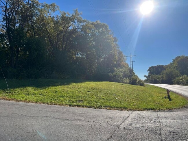
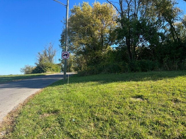
Property Record
0 Groveport Rd, Columbus, OH 43207

NEARBY LISTINGS FOR SALE OR LEASE
Property Detail
0 Groveport Rd
Columbus, OH
Baker Heights Add (Vacated)
010-115094
2820 GROVEPORT PK BAKER HTS LOT 119-20
Commercialacreage
Franklin
X
Ohio
39049C0336K
119-2
2024
0.41 AC
2024
Southeast
008811
Columbus
DEMOGRAPHICS near 0 Groveport Rd
1 Mile
3 Mile
5 Mile
2024 Total Population
6,297
66,123
198,090
2029 Population
6,327
66,750
200,478
Pop Growth 2024-2029
+ 0.48%
+ 0.95%
+ 1.21%
Average Age
41
39
38
2024 Total Households
2,412
27,588
85,360
HH Growth 2024-2029
+ 0.46%
+ 0.94%
+ 1.33%
Median Household Inc
$48,653
$53,693
$54,433
Avg Household Size
2.60
2.30
2.20
2024 Avg HH Vehicles
2.00
2.00
2.00
Median Home Value
$102,257
$163,130
$195,383
Median Year Built
1961
1959
1963
Nearby Places
Map Layers
Map Styles
 Street
 Aerial
- Restaurants
- Banks
- Shops
- Fitness
- Groceries
PUBLIC TRANSPORTATION
AIRPORT
Rickenbacker International
DRIVE
WALK
Distance
Rickenbacker International
14 min
7.1 mi
John Glenn Columbus International
DRIVE
WALK
Distance
John Glenn Columbus International
18 min
10.7 mi
Freight Ports
Port of Toledo
DRIVE
WALK
Distance
Port of Toledo
191 min
150.0 mi
SALE & LEASE HISTORY
LISTING DATE
SALE/LEASE

Nov 01, 2022
For Sale
Nearby Properties
Address
Land Use
TOTAL SIZE
Lot Size
Zoning
Address
Land Use
TOTAL SIZE
Lot Size
Zoning
382.42 AC
Address
Land Use
TOTAL SIZE
Lot Size
Zoning
859,800 SF
68.91 AC
Address
Land Use
TOTAL SIZE
Lot Size
Zoning
360,962 SF
33.91 AC
Address
Land Use
TOTAL SIZE
Lot Size
Zoning
462,840 SF
27.07 AC
Address
Land Use
TOTAL SIZE
Lot Size
Zoning
386,669 SF
32.15 AC
Address
Land Use
TOTAL SIZE
Lot Size
Zoning
163,629 SF
26.71 AC
Address
Land Use
TOTAL SIZE
Lot Size
Zoning
705,600 SF
43.41 AC
Address
Land Use
TOTAL SIZE
Lot Size
Zoning
604,078 SF
50.18 AC
Address
Land Use
TOTAL SIZE
Lot Size
Zoning
169,066 SF
11.72 AC
Address
Land Use
TOTAL SIZE
Lot Size
Zoning
761,098 SF
35.07 AC
Address
Land Use
TOTAL SIZE
Lot Size
Zoning
146,172 SF
26.42 AC
Address
Land Use
TOTAL SIZE
Lot Size
Zoning
600,255 SF
40.27 AC
Address
Land Use
TOTAL SIZE
Lot Size
Zoning
204,782 SF
20.82 AC
Address
Land Use
TOTAL SIZE
Lot Size
Zoning
73,908 SF
9 AC
Address
Land Use
TOTAL SIZE
Lot Size
Zoning
139,123 SF
24.67 AC
Address
Land Use
TOTAL SIZE
Lot Size
Zoning
736,660 SF
34.40 AC
Address
Land Use
TOTAL SIZE
Lot Size
Zoning
277,746 SF
24.13 AC
Address
Land Use
TOTAL SIZE
Lot Size
Zoning
54,209 SF
13.64 AC
Address
Land Use
TOTAL SIZE
Lot Size
Zoning
71,531 SF
28.15 AC
Address
Land Use
TOTAL SIZE
Lot Size
Zoning
231,838 SF
13.17 AC
Address
Land Use
TOTAL SIZE
Lot Size
Zoning
284,006 SF
16 AC
Address
Land Use
TOTAL SIZE
Lot Size
Zoning
236,000 SF
10.66 AC
Address
Land Use
TOTAL SIZE
Lot Size
Zoning
267,180 SF
13.72 AC
Address
Land Use
TOTAL SIZE
Lot Size
Zoning
77,183 SF
38.61 AC
Address
Land Use
TOTAL SIZE
Lot Size
Zoning
311,520 SF
17.59 AC
Address
Land Use
TOTAL SIZE
Lot Size
Zoning
441,747 SF
36.39 AC
Address
Land Use
TOTAL SIZE
Lot Size
Zoning
120,651 SF
25.12 AC
Address
Land Use
TOTAL SIZE
Lot Size
Zoning
406,364 SF
22.03 AC
Address
Land Use
TOTAL SIZE
Lot Size
Zoning
29,128 SF
24.45 AC
Address
Land Use
TOTAL SIZE
Lot Size
Zoning
1,316 SF
1.26 AC
The World's #1 Commercial Real Estate Marketplace
Connect with us
© 2026 CoStar Group
The information above has been obtained from sources believed reliable. While we do not doubt its accuracy we have not verified it and make no guarantee, warranty or representation about it. It is your responsibility to independently confirm its accuracy and completeness. Any projections, opinions, assumptions, or estimates used are for example only and do not represent the current or future performance of the property. The value of this transaction to you depends on tax and other factors which should be evaluated by your tax, financial, and legal advisors. You and your advisors should conduct a careful, independent investigation of the property to determine to your satisfaction the suitability of the property for your needs.