Property Record
2820 Main St, Elwood, IN 46036


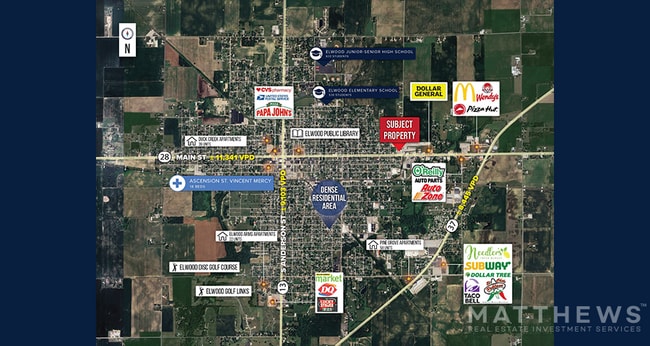
NEARBY LISTINGS FOR SALE OR LEASE
Property Detail
2820 Main St
Indianapolis-Carmel-Greenwood, IN
Rodefers Add
48-04-10-404-023.000-027
RODEFERS PTS LOTS 19-24 (0.633AC)
Restaurantbuilding
Madison
X
Indiana
18159C0200D
19-24
2024
0.63 AC
2025
Anderson/Madison Cnty
010200
Indianapolis
3,330 SF
DEMOGRAPHICS near 2820 Main St
1 Mile
3 Mile
5 Mile
2024 Total Population
4,553
10,933
13,445
2029 Population
4,705
11,312
13,794
Pop Growth 2024-2029
+ 3.34%
+ 3.47%
+ 2.60%
Average Age
41
42
42
2024 Total Households
1,870
4,589
5,632
HH Growth 2024-2029
+ 3.48%
+ 3.60%
+ 2.73%
Median Household Inc
$53,822
$54,828
$56,439
Avg Household Size
2.30
2.30
2.30
2024 Avg HH Vehicles
2.00
2.00
2.00
Median Home Value
$78,472
$92,751
$103,204
Median Year Built
1955
1957
1959
Nearby Places
Map Layers
Map Styles
 Street
 Aerial
- Restaurants
- Banks
- Shops
- Fitness
- Groceries
SALE & LEASE HISTORY
LISTING DATE
SALE/LEASE

May 29, 2024
For Sale
May 08, 2023
For Sale
Aug 07, 2024
For Sale
Nearby Properties
Address
Land Use
TOTAL SIZE
Lot Size
Zoning
Address
Land Use
TOTAL SIZE
Lot Size
Zoning
357,899 SF
26.60 AC
Address
Land Use
TOTAL SIZE
Lot Size
Zoning
30,588 SF
4.91 AC
Address
Land Use
TOTAL SIZE
Lot Size
Zoning
8,892 SF
5.95 AC
Address
Land Use
TOTAL SIZE
Lot Size
Zoning
40,662 SF
0.23 AC
Address
Land Use
TOTAL SIZE
Lot Size
Zoning
62,535 SF
30.38 AC
Address
Land Use
TOTAL SIZE
Lot Size
Zoning
12,828 SF
2.47 AC
Address
Land Use
TOTAL SIZE
Lot Size
Zoning
24,836 SF
0.47 AC
Address
Land Use
TOTAL SIZE
Lot Size
Zoning
76,100 SF
5.20 AC
Address
Land Use
TOTAL SIZE
Lot Size
Zoning
9,300 SF
8.28 AC
Address
Land Use
TOTAL SIZE
Lot Size
Zoning
10,968 SF
2.74 AC
Address
Land Use
TOTAL SIZE
Lot Size
Zoning
33,522 SF
0.24 AC
Address
Land Use
TOTAL SIZE
Lot Size
Zoning
4,608 SF
4.55 AC
Address
Land Use
TOTAL SIZE
Lot Size
Zoning
1,512 SF
4.18 AC
Address
Land Use
TOTAL SIZE
Lot Size
Zoning
52,577 SF
5.74 AC
Address
Land Use
TOTAL SIZE
Lot Size
Zoning
27,700 SF
3.79 AC
Address
Land Use
TOTAL SIZE
Lot Size
Zoning
8,870 SF
0.54 AC
Address
Land Use
TOTAL SIZE
Lot Size
Zoning
35,980 SF
0.33 AC
Address
Land Use
TOTAL SIZE
Lot Size
Zoning
10,080 SF
2.01 AC
Address
Land Use
TOTAL SIZE
Lot Size
Zoning
10,752 SF
2.39 AC
Address
Land Use
TOTAL SIZE
Lot Size
Zoning
4,296 SF
1.20 AC
Address
Land Use
TOTAL SIZE
Lot Size
Zoning
12,998 SF
1.86 AC
Address
Land Use
TOTAL SIZE
Lot Size
Zoning
9,100 SF
1.31 AC
Address
Land Use
TOTAL SIZE
Lot Size
Zoning
288 SF
0.39 AC
Address
Land Use
TOTAL SIZE
Lot Size
Zoning
19,663 SF
8.15 AC
Address
Land Use
TOTAL SIZE
Lot Size
Zoning
14,742 SF
0.34 AC
Address
Land Use
TOTAL SIZE
Lot Size
Zoning
14,742 SF
0.36 AC
Address
Land Use
TOTAL SIZE
Lot Size
Zoning
9,729 SF
7.29 AC
Address
Land Use
TOTAL SIZE
Lot Size
Zoning
1,250 SF
228.71 AC
Address
Land Use
TOTAL SIZE
Lot Size
Zoning
79,308 SF
19.04 AC
Address
Land Use
TOTAL SIZE
Lot Size
Zoning
13,200 SF
1.85 AC
The World's #1 Commercial Real Estate Marketplace
Connect with us
© 2026 CoStar Group
The information above has been obtained from sources believed reliable. While we do not doubt its accuracy we have not verified it and make no guarantee, warranty or representation about it. It is your responsibility to independently confirm its accuracy and completeness. Any projections, opinions, assumptions, or estimates used are for example only and do not represent the current or future performance of the property. The value of this transaction to you depends on tax and other factors which should be evaluated by your tax, financial, and legal advisors. You and your advisors should conduct a careful, independent investigation of the property to determine to your satisfaction the suitability of the property for your needs.