Property Record
2820 W Frey St, Stephenville, TX 76401
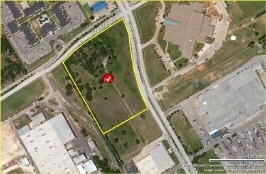

Property Detail
2820 W Frey St
Stephenville, TX
S9707 WASHINGTON SQUARE; BLOCK 2, LOT 1
R000022334
Erath
Multifamilydwelling
Texas
B and X Area of moderate flood hazard, usually the area between the limits of the 100-year and 500-year floods.
1
2025
11.16 AC
2025
Texas North Area
950402
Other Market Areas
205,581 SF
NEARBY LISTINGS FOR SALE OR LEASE
DEMOGRAPHICS near 2820 W Frey St
1 mile
3 mile
5 mile
2025 Total Population
3,442
21,590
26,600
2030 Population
3,411
22,069
27,294
Pop Growth 2025-2030
(0.90%)
+ 2.22%
+ 2.61%
Average Age
36
34
34
2025 Total Households
1,424
7,717
9,689
HH Growth 2025-2030
(0.98%)
+ 2.51%
+ 2.93%
Median Household Inc
$64,395
$55,604
$55,820
Avg Household Size
2.30
2.30
2.30
2025 Avg HH Vehicles
2.00
2.00
2.00
Median Home Value
$254,433
$247,419
$259,518
Median Year Built
1980
1981
1984
Nearby Places
Map Layers
Map Styles
 Street
 Aerial
Layers
 Traffic
 Biking
Places
Listings with unknown addresses are not visible on the map
- Restaurants
- Banks
- Shops
- Fitness
- Groceries
Nearby Properties
Address
Land Use
TOTAL SIZE
Lot Size
Zoning
Address
Land Use
TOTAL SIZE
Lot Size
Zoning
195,198 SF
70 AC
Address
Land Use
TOTAL SIZE
Lot Size
Zoning
6,877 SF
119.91 AC
Address
Land Use
TOTAL SIZE
Lot Size
Zoning
564,292 SF
40.36 AC
Address
Land Use
TOTAL SIZE
Lot Size
Zoning
233,750 SF
6.43 AC
Address
Land Use
TOTAL SIZE
Lot Size
Zoning
77,006 SF
55.67 AC
Address
Land Use
TOTAL SIZE
Lot Size
Zoning
70,658 SF
41.66 AC
Address
Land Use
TOTAL SIZE
Lot Size
Zoning
313,632 SF
38.47 AC
Address
Land Use
TOTAL SIZE
Lot Size
Zoning
177,941 SF
2.82 AC
Address
Land Use
TOTAL SIZE
Lot Size
Zoning
210,362 SF
12 AC
Address
Land Use
TOTAL SIZE
Lot Size
Zoning
288,884 SF
2.01 AC
Address
Land Use
TOTAL SIZE
Lot Size
Zoning
200,128 SF
1.98 AC
Address
Land Use
TOTAL SIZE
Lot Size
Zoning
233,398 SF
3.58 AC
Address
Land Use
TOTAL SIZE
Lot Size
Zoning
200,572 SF
7.72 AC
Address
Land Use
TOTAL SIZE
Lot Size
Zoning
109,066 SF
3.92 AC
Address
Land Use
TOTAL SIZE
Lot Size
Zoning
119,464 SF
46.95 AC
Address
Land Use
TOTAL SIZE
Lot Size
Zoning
137,800 SF
5.55 AC
Address
Land Use
TOTAL SIZE
Lot Size
Zoning
113,451 SF
4.40 AC
Address
Land Use
TOTAL SIZE
Lot Size
Zoning
91,058 SF
6.49 AC
Address
Land Use
TOTAL SIZE
Lot Size
Zoning
101,744 SF
12.66 AC
Address
Land Use
TOTAL SIZE
Lot Size
Zoning
225,611 SF
21.94 AC
Address
Land Use
TOTAL SIZE
Lot Size
Zoning
185,168 SF
26.77 AC
Address
Land Use
TOTAL SIZE
Lot Size
Zoning
13,130 SF
21.26 AC
Address
Land Use
TOTAL SIZE
Lot Size
Zoning
Address
Land Use
TOTAL SIZE
Lot Size
Zoning
72,205 SF
4.41 AC
Address
Land Use
TOTAL SIZE
Lot Size
Zoning
76,502 SF
4.93 AC
Address
Land Use
TOTAL SIZE
Lot Size
Zoning
94,715 SF
13.28 AC
Address
Land Use
TOTAL SIZE
Lot Size
Zoning
294,060 SF
39.39 AC
Address
Land Use
TOTAL SIZE
Lot Size
Zoning
195 SF
41.20 AC
Address
Land Use
TOTAL SIZE
Lot Size
Zoning
90,361 SF
7.73 AC
The World's #1 Commercial Real Estate Marketplace
Connect with us
© 2026 CoStar Group
The information above has been obtained from sources believed reliable. While we do not doubt its accuracy we have not verified it and make no guarantee, warranty or representation about it. It is your responsibility to independently confirm its accuracy and completeness. Any projections, opinions, assumptions, or estimates used are for example only and do not represent the current or future performance of the property. The value of this transaction to you depends on tax and other factors which should be evaluated by your tax, financial, and legal advisors. You and your advisors should conduct a careful, independent investigation of the property to determine to your satisfaction the suitability of the property for your needs.