Property Record
2821 N Naomi St, Burbank, CA 91504


NEARBY LISTINGS FOR SALE OR LEASE
Property Detail
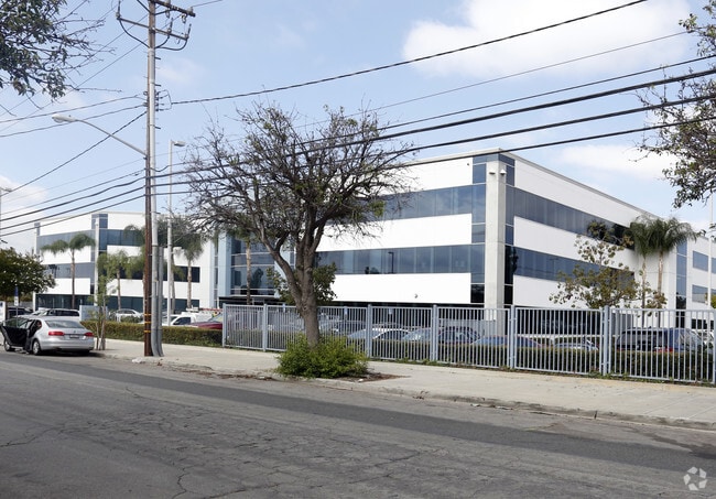
2821 N Naomi St
2473-013-007
LOT ON W LINE OF NAOMI ST PER RES 2124 COM S THEREON 240 FT FROM SW LINE OF GLENOAKS BLVD PER OR 3796-297 TH S ON SDW LINE 110 FT TH W ON S LINE OF LAND SEE ASSESSOR MAPBOOK FOR MISSING PORTIONLOT 5 IN NW 1/4 OF SEC 3 T 1N R 14W
Officebuilding
Los Angeles
X
California
06037C1329F
3
2024
2.61 AC
2025
Burbank
310400
Los Angeles
94,066 SF
Los Angeles-Long Beach-Glendale, CA
DEMOGRAPHICS near 2821 N Naomi St
1 Mile
3 Mile
5 Mile
2024 Total Population
17,614
171,548
443,258
2029 Population
16,959
166,232
429,987
Pop Growth 2024-2029
(3.72%)
(3.10%)
(2.99%)
Average Age
41
40
40
2024 Total Households
6,121
60,098
166,839
HH Growth 2024-2029
(4.05%)
(3.39%)
(3.19%)
Median Household Inc
$89,698
$72,764
$75,230
Avg Household Size
2.80
2.70
2.60
2024 Avg HH Vehicles
2.00
2.00
2.00
Median Home Value
$807,467
$802,399
$819,375
Median Year Built
1957
1960
1963
Nearby Places
Map Layers
Map Styles
 Street
 Aerial
- Restaurants
- Banks
- Shops
- Fitness
- Groceries
PUBLIC TRANSPORTATION
COMMUTER RAIL
Burbank Airport - North (Av Line) Metrolink Station (Metrolink Antelope Valley Line - Metrolink Trains)
DRIVE
WALK
Distance
Burbank Airport - North (Av Line) Metrolink Station (Metrolink Antelope Valley Line - Metrolink Trains)
3 min
19 min
1.0 mi
Burbank-Bob Hope Airport (Ventura County Line - Southern California Regional Rail Authority (Metrolink))
DRIVE
WALK
Distance
Burbank-Bob Hope Airport (Ventura County Line - Southern California Regional Rail Authority (Metrolink))
4 min
1.8 mi
AIRPORT
Bob Hope
DRIVE
WALK
Distance
Bob Hope
7 min
3.7 mi
Los Angeles International
DRIVE
WALK
Distance
Los Angeles International
42 min
27.9 mi
Long Beach (Daugherty Field)
DRIVE
WALK
Distance
Long Beach (Daugherty Field)
47 min
34.4 mi
Freight Ports
Port of Long Beach
DRIVE
WALK
Distance
Port of Long Beach
49 min
37.2 mi
SALE & LEASE HISTORY
LISTING DATE
SALE/LEASE

Sep 24, 2016
For Sale
Oct 29, 2018
For Lease
Nov 08, 2019
For Sale
Nov 08, 2019
For Lease
Jun 13, 2018
For Lease
Jan 30, 2017
For Lease
Apr 09, 2018
For Lease
Nearby Properties
Address
Land Use
TOTAL SIZE
Lot Size
Zoning
Address
Land Use
TOTAL SIZE
Lot Size
Zoning
849,801 SF
59.25 AC
BUM2
Address
Land Use
TOTAL SIZE
Lot Size
Zoning
452,048 SF
21.58 AC
BCCM
Address
Land Use
TOTAL SIZE
Lot Size
Zoning
1,328,547 SF
39.36 AC
BUPD
Address
Land Use
TOTAL SIZE
Lot Size
Zoning
432,232 SF
7.17 AC
BUM2
Address
Land Use
TOTAL SIZE
Lot Size
Zoning
362,863 SF
1.82 AC
BUMZ
Address
Land Use
TOTAL SIZE
Lot Size
Zoning
346,186 SF
11.72 AC
BUM2*
Address
Land Use
TOTAL SIZE
Lot Size
Zoning
558,532 SF
5.20 AC
BUC4*
Address
Land Use
TOTAL SIZE
Lot Size
Zoning
660,463 SF
6.88 AC
BUR4*
Address
Land Use
TOTAL SIZE
Lot Size
Zoning
612,976 SF
3.53 AC
BUC2*
Address
Land Use
TOTAL SIZE
Lot Size
Zoning
BURAILROAD
Address
Land Use
TOTAL SIZE
Lot Size
Zoning
279,574 SF
4.01 AC
BUM2*
Address
Land Use
TOTAL SIZE
Lot Size
Zoning
299,864 SF
1.29 AC
BUC3
Address
Land Use
TOTAL SIZE
Lot Size
Zoning
252,974 SF
2.86 AC
BUC4
Address
Land Use
TOTAL SIZE
Lot Size
Zoning
126,652 SF
0.93 AC
BUC3
Address
Land Use
TOTAL SIZE
Lot Size
Zoning
106,988 SF
1.45 AC
BUM2*
Address
Land Use
TOTAL SIZE
Lot Size
Zoning
BURAILROAD
Address
Land Use
TOTAL SIZE
Lot Size
Zoning
108,649 SF
3.33 AC
BUPD
Address
Land Use
TOTAL SIZE
Lot Size
Zoning
86,190 SF
3.07 AC
BUM2
Address
Land Use
TOTAL SIZE
Lot Size
Zoning
169,740 SF
1.74 AC
BUM2*
Address
Land Use
TOTAL SIZE
Lot Size
Zoning
119,895 SF
0.89 AC
03659
Address
Land Use
TOTAL SIZE
Lot Size
Zoning
474,155 SF
8.45 AC
LAM2
Address
Land Use
TOTAL SIZE
Lot Size
Zoning
229,983 SF
7.90 AC
BUM2YY*
Address
Land Use
TOTAL SIZE
Lot Size
Zoning
260,417 SF
2.35 AC
BUC4*
Address
Land Use
TOTAL SIZE
Lot Size
Zoning
214,664 SF
2.23 AC
BUM2*
Address
Land Use
TOTAL SIZE
Lot Size
Zoning
235,450 SF
1.48 AC
BUM1*
Address
Land Use
TOTAL SIZE
Lot Size
Zoning
371,907 SF
5.08 AC
BUM2*
Address
Land Use
TOTAL SIZE
Lot Size
Zoning
273,366 SF
13.46 AC
LAM2
Address
Land Use
TOTAL SIZE
Lot Size
Zoning
134,784 SF
0.77 AC
BUMZ
The World's #1 Commercial Real Estate Marketplace
Connect with us
© 2026 CoStar Group
The information above has been obtained from sources believed reliable. While we do not doubt its accuracy we have not verified it and make no guarantee, warranty or representation about it. It is your responsibility to independently confirm its accuracy and completeness. Any projections, opinions, assumptions, or estimates used are for example only and do not represent the current or future performance of the property. The value of this transaction to you depends on tax and other factors which should be evaluated by your tax, financial, and legal advisors. You and your advisors should conduct a careful, independent investigation of the property to determine to your satisfaction the suitability of the property for your needs.